

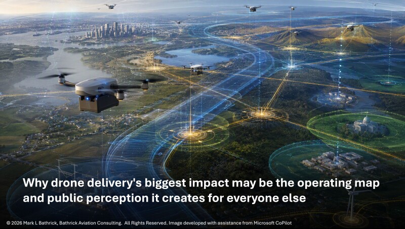
The FAA’s final environmental decision on Part 135 drone package delivery may appear to be about parcels, propellers, and noise footprints.1 It is really about precedent and about who will define the next routinely occupied layer of low-altitude airspace. The agency’s July 2026 Final Programmatic Environmental Assessment (PEA), Finding of No Significant Impact (FONSI), and Record of Decision (ROD) signals that recurring, revenue-generating low-altitude drone operations can be evaluated through a national programmatic framework rather than isolated, market-by-market accommodation.2 As delivery companies execute against that framework, they will increasingly determine where hubs are sited, routes concentrate, and repeated drone activity becomes part of the daily environment for everyone else.
The visible issue is package delivery. The real issue is whether the United States can build the environmental, operational, security, data, and public-trust architecture required for routine low-altitude density. In America’s Low-Altitude Awareness Gap, I argued that this gap is no longer theoretical; the FAA’s decision confirms it is now operational.3
Delivery operators get a clearer but more disciplined path to scale. Adjacent commercial UAS providers face route density, community exposure, and operational friction. Public safety, Drone as a First Responder (DAR), search and rescue (SAR), and wildland-fire programs see precedent and warning. Counter-UAS (C-UAS) and ADA teams face the classification challenge of distinguishing authorized activity from anomalous or threatening activity. Public agencies, communities, and investors see a low-altitude operating system beginning to take shape, with package delivery as the first visible test case.
What the FAA Actually Did
At the center of the action is a straightforward but consequential National Environmental Policy Act (NEPA) determination. The FAA evaluated the reasonably foreseeable environmental impacts of commercial drone package delivery operations conducted under 14 CFR Part 135 across the United States.4 It prepared the final PEA under NEPA, USDOT environmental procedures, and FAA environmental procedures, considered comments on the draft assessment, and concluded that with implementation of mitigation measures the proposed action would not result in significant impacts.5
That is the “ah-ha” moment. The PEA not only reduces uncertainty for drone delivery companies; it allows them to define the practical geography of routine low-altitude drone activity. Through hub siting, route design, operating tempo, aircraft selection, setbacks, and community practices, delivery operators will shape where repeated drone activity becomes normal. Other commercial operators and public safety programs may not be parties to a delivery company’s market-entry plan, but they may still inherit its consequences.
That does not mean every route, hub, operator, or community concern has been approved. Operators still need appropriate Part 135 certification, operating specifications, airspace compliance, safety cases, and site-specific discipline. FAA materials continue to describe package delivery as an advanced UAS operation involving NAS safety, operator certification, and NEPA compliance, with delivery flight paths below 400 feet and aircraft type, size, and quantity varying by operation.
The practical effect is a new baseline, not permission without responsibility. Recurring delivery can be assessed programmatically, but scale will be conditioned by measurable environmental assumptions. The next question is how public safety agencies, adjacent drone service providers, C-UAS planners, ADA integrators, communities, and investors adjust as delivery hubs and routes shape local airspace behavior.
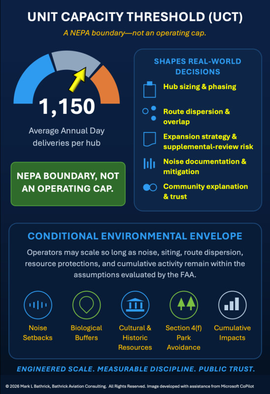
That distinction is especially important for the Unit Capacity Threshold (UCT). The UCT should not be misread as a direct operating cap or a free pass to fly up to a magic number. It is a NEPA boundary, a way of defining the activity level the FAA evaluated for environmental significance. Yet because it marks the boundary of that programmatic analysis, it will still shape hub sizing, route dispersion, expansion strategy, noise documentation, supplemental-review risk, and public explanation. That is why the PEA should be read not only as an approval pathway, but as an early signal of the system architecture routine drone density will require.
From Isolated Approvals to System Architecture
For years, the commercial drone sector has lived between validated capability and constrained permission. Operators could demonstrate technical feasibility, public agencies could show mission value, and communities could glimpse benefits in emergency response, infrastructure inspection, logistics, wildfire support, and data collection. Yet the pathway from promising demonstration to repeatable public value remained uneven. We proved drones could fly; we struggled to prove the system around them could scale.
This is the elephant in the airspace. In The Elephant in the Airspace, I argued that America’s aviation leadership is constrained less by aircraft capability than by outdated regulatory and operational paradigms that have not adapted to uncrewed and autonomous systems.6 Drone density requires machine-speed coordination, shared digital awareness, standardized data services, public-facing accountability, site-specific environmental discipline, and security procedures that can distinguish authorized activity from concerning activity in real time.
The Part 135 PEA does not solve that mismatch. It does, however, move one piece of the puzzle from custom treatment toward repeatable architecture that can support scaling to predictions of millions of drone deliveries a day that have recently been made by leading companies in this space.7 Its broader significance should be read alongside BVLOS rulemaking, Remote ID implementation, UTM development, and emerging C-UAS activity. As I argued in Lead Turning the Future, the emerging Part 108/146, Section 2209, Remote ID, DETER, telemetry, and ADSP/UTM environment marks a shift from pilot-centric operations toward organization-driven, telemetry-based aviation systems.8 Together, these developments show a sector moving from episodic permission toward managed density.
Why This Matters for Part 135 Drone Delivery Operators
For Part 135 drone delivery operators, the FAA’s action reduces one category of uncertainty while increasing the need for disciplined market entry. It provides a clearer environmental frame for scale, but operators still must design hubs, routes, schedules, maintenance practices, outreach, and complaint processes around real-world exposure. The operators most likely to scale are those that understand where repeated flight becomes a community experience.
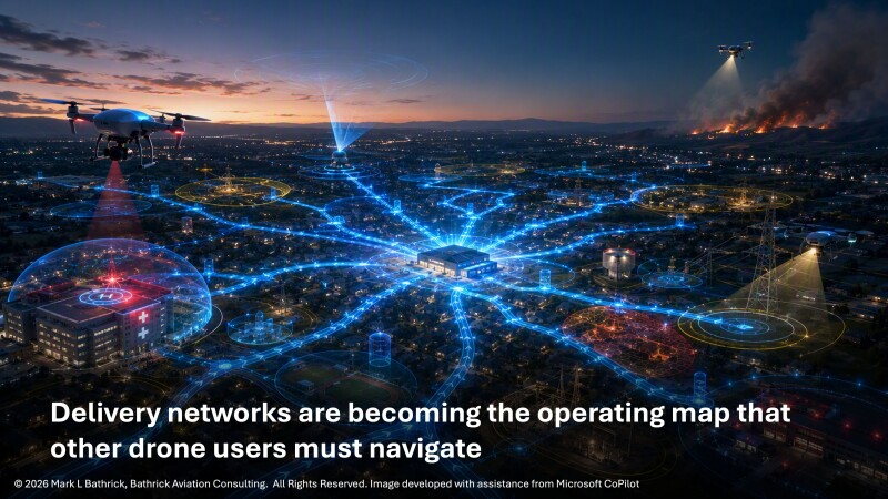
Hub placement, route design, sortie clustering, charging cycles, operating hours, emergency landing options, dispatch peaks, and distances from sensitive receptors will matter. The public will not experience delivery networks as FAA approvals. It will experience them as sound over a backyard, motion over a school, a repeated flight path near a park, or an unfamiliar aircraft crossing the same neighborhood each day.
That reality shifts the burden from regulatory compliance to operational trust. Certification may allow the aircraft to fly, but community acceptance determines whether the business can stay. In Earning the Right to Operate, I argued that programs too often confuse technical readiness with system readiness, neglecting privacy, transparency, accountability, and legitimacy until opposition hardens.9 The PEA should therefore become a siting tool, routing tool, community-engagement tool, and investor-diligence tool, not merely a document in a regulatory file.
Noise and visual exposure will be the first visible test of that operational trust.
Noise and Visual Effects Are the Community Acceptance Center of Gravity
The debate over drone delivery will not be won or lost only in decibels. It will be won or lost in how communities experience repetition. A single drone pass may be acceptable, even novel. Predictable flights over the same homes, parks, schools, or outdoor gathering spaces can become something different: not a technology demonstration, but a recurring feature of daily life. I experienced an early version during the first wave of consumer and commercial drones, when seeing a neighbor’s drone from my backyard moved quickly from interesting to intrusive because repetition changed the experience.
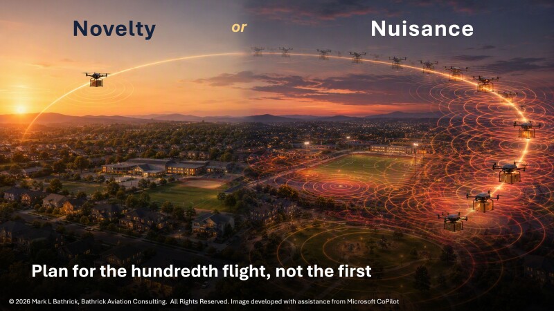
That is why sound character matters. Drone noise may be perceived differently from highway traffic, lawn equipment, helicopters, or conventional aircraft because it can include tonal, high-frequency, or fluctuating qualities that attract attention even when conventional metrics suggest limited impact. This point is reinforced by my work on how poorly chosen language and imagery can trigger fears around autonomy, surveillance, loss of control, and human replacement: the public responds not only to technical facts, but also to what a technology appears to represent.10
Visual effects create a related challenge. People respond not only to whether an aircraft is visible, but to where it appears, how often, whether it lingers, whether it passes over private outdoor space, and whether its purpose is understood. When people see a drone, the first question may be: what is it doing here, and who is accountable? In emerging aviation, perception often becomes policy pressure.
The most serious operators will manage noise and visual exposure as design constraints from day one. They will screen routes against sensitive receptors and community-sensitive locations, consider established public rights of way where appropriate, and use altitude, routing, schedule management, aircraft selection, maintenance discipline, and community reporting thresholds as operational mitigation, not rhetorical reassurance.11
A Practical Market-Entry Playbook
The first market should not necessarily be the market with the highest order density. It should be the market where operational need, public benefit, airspace feasibility, environmental fit, and community receptivity align. A dense market that produces immediate political resistance can become more expensive than a less dense market that builds durable trust.
Operators should build a pre-entry package before they build a press release. That package should include GIS screening, hub catchment assumptions, sortie forecasts, operating hours, sensitive-receptor overlays, preferred corridors, contingency landing options, emergency coordination points, plain-language community explanations, and post-launch monitoring for noise, visual exposure, wildlife concerns, and complaints.
The right playbook pairs commercial value with public value. Convenience alone is a shallow foundation for community acceptance. Delivery programs that show medical logistics value, improved access, reduced road congestion, lower emissions, emergency resilience, or service to underserved areas will have a stronger story. The “Drones for Good” 6-S framework remains useful because it tests whether an operation deserves public confidence rather than mere regulatory tolerance.12
Finally, operators should scale by evidence. Expanding sortie volume, operating hours, route coverage, or hub count should follow demonstrated performance. A mature delivery network will look less like a technology launch and more like a utility: measured, explainable, accountable, and boring in the best sense of the word.
Investor Implications: Environmental Durability Is Business Durability
Investors should not read the FAA’s decision as the removal of scaling risk. They should read it as the relocation of scaling risk from federal environmental uncertainty to repeatable market execution. The durable business question is whether an operator can apply the same disciplined playbook across communities, hubs, routes, operating conditions, public expectations, mitigation commitments, and complaint environments.
Due diligence should therefore test more than range, payload, autonomy stack, and unit economics. It should examine hub economics under weather downtime, maintenance cycles, route constraints, acoustic performance, battery life, staffing, outreach costs, complaint-response obligations, and mitigation commitments. In the next phase of drone delivery, noise risk and visual risk are business risks.
Investors should also test whether a company understands the second-order effects its network creates for DFR, SAR, wildfire response, infrastructure inspection, ADA integration, and local complaint dynamics. Companies that treat hub siting, acoustic performance, route dispersion, coordination, and transparency as core capabilities will be better positioned to scale under the PEA’s conditional national envelope.
The most resilient companies will prove not only that they can fly, but that they can repeatedly “earn the right to operate.” That is market discipline, not public-relations language.13 My Four Must-Have Competencies for Success in Drones framed aviation, privacy, security, and culture as pillars for sustainable operations; those pillars apply directly here.14
Beyond Delivery: What Adjacent Commercial UAS Sectors Should Learn
Package delivery may be the visible test case, but it will not be the only sector affected. Utilities, pipelines, railroads, ports, telecom providers, construction firms, energy companies, and infrastructure owners will all study the FAA’s approach. Some will rightly ask why recurring inspection missions that protect reliability, worker safety, environmental compliance, and public welfare should not receive comparable programmatic attention.
But they should be careful. The Part 135 package delivery record is not a universal permission slip. Inspection, imaging, façade work, construction monitoring, and other drone-enabled services create different public-facing issues, including closer operation near structures, stronger privacy perceptions, urban exposure, and lingering missions where delivery aircraft merely transit.
The wiser approach is to borrow the tools, not the conclusion. Adjacent commercial operators should use GIS screening, mission-specific impact analysis, route or work-zone explanation, public outreach, complaint intake, mitigation triggers, and operational transparency to build their own records. As I argued in Does Part 108 and Part 146 Signal a Gig Economy Breakout Opportunity for Commercial Drone Services?, scalable BVLOS opportunity will come with higher equipage, compliance, training, and subscription burdens that could reshape who participates in the drone economy.15 Package delivery may become the precedent, but infrastructure inspection may become the stronger public-interest case if it can show that it prevents outages, improves safety, reduces truck rolls, protects workers, and strengthens resilience.
The immediate takeaway is practical: adjacent operators should treat delivery hub maps, route corridors, noise setbacks, sensitive-resource buffers, and daily sortie density as mission-planning inputs. An area that looks open on an aeronautical chart may become crowded in practice because of community tolerance, complaint risk, route conflict, or the appearance that unrelated drone programs are converging over the same neighborhoods, schools, infrastructure corridors, or wildlife-sensitive areas.
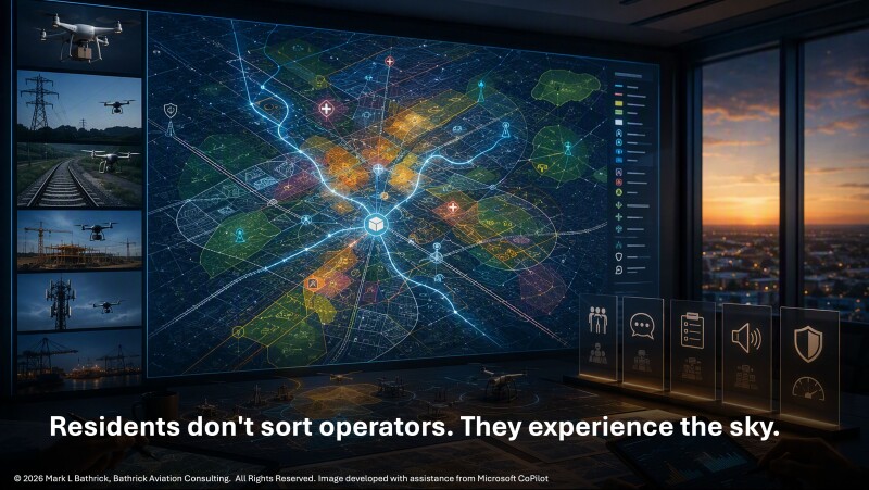
Commercial drone service providers should therefore build a “delivery-density watch” into business development and operations planning. Before entering a market, they should identify proposed hubs, likely corridors, sensitive receptors, emergency-service launch sites, and known community concerns and then decide which delivery-company practices should become part of their own operating model.
Consider a practical scenario. A delivery hub near a suburban retail center fits the operator’s demand model and the PEA’s assumptions. Its routes avoid sensitive areas but concentrate departures and returns along repeatable corridors. Nearby, a police department launches DFR missions, a utility contractor flies inspections, a critical infrastructure security team deploys C-UAS procedures, and an ADA integrator tries to explain what is happening overhead. No single operation may be improper. Yet residents may experience the combined effect as repeated sound, perceived surveillance, complaint confusion, and uncertainty about accountability. That is the delivery-density problem: lawful activity can still become politically fragile if it is not visible, coordinated, and explainable.
Those same density concerns become even more consequential when lifesaving public safety missions operate in that shared low-altitude environment.
Public Safety, DFR, and Wildland Fire: Public Value Still Requires Public Trust
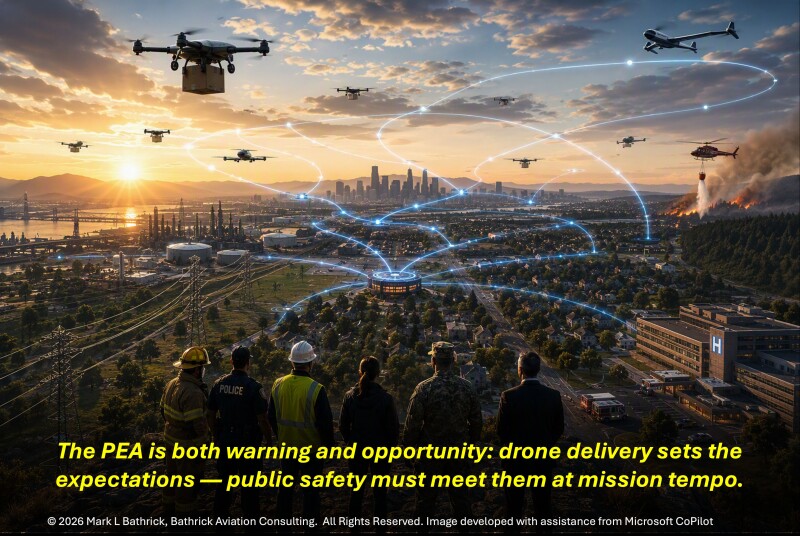
If commercial package delivery can be environmentally evaluated at scale, public safety agencies will reasonably ask why lifesaving drone missions remain trapped in fragmented pathways. DFR, SAR, disaster response, EMS support, and wildland fire often present a stronger public-value case than convenience delivery. My wildland fire work has made this point repeatedly, from From Detection to Action to The Final Spark and Defusing America’s Wildfire Time Bomb.16
That does not mean public safety agencies may skip the trust work. Routine launch patterns from police, fire, EMS, emergency-management, SAR, or wildland-fire facilities can create concentrated exposure, especially near high-tempo delivery hubs. Communities may support the mission and still have questions about privacy, data retention, flight frequency, noise, accountability, and coordination. Public safety credibility depends on transparency before the crisis, not explanation after complaints arrive.
C-UAS: The Density Paradox
That public safety distinction leads directly to a security problem: the more legitimate drones the country puts into low-altitude airspace, the harder it becomes to identify illegitimate ones. That is the density paradox. It echoes the argument I made in Small Drones, Big Opportunities and Beyond the Box: effective counter-drone capability depends less on any single sensor or device than on disciplined decision-making, lawful governance, interoperability, and system-level resilience.17 A sparse drone environment makes unusual activity easier to notice. A dense environment requires better classification.
This matters at stadiums, airports, ports, prisons, government facilities, energy sites, water systems, and large public gatherings. Detection alone will not be enough. Security teams will need authorization status, mission context, operator contacts, route intent, escalation procedures, and lawful response options.
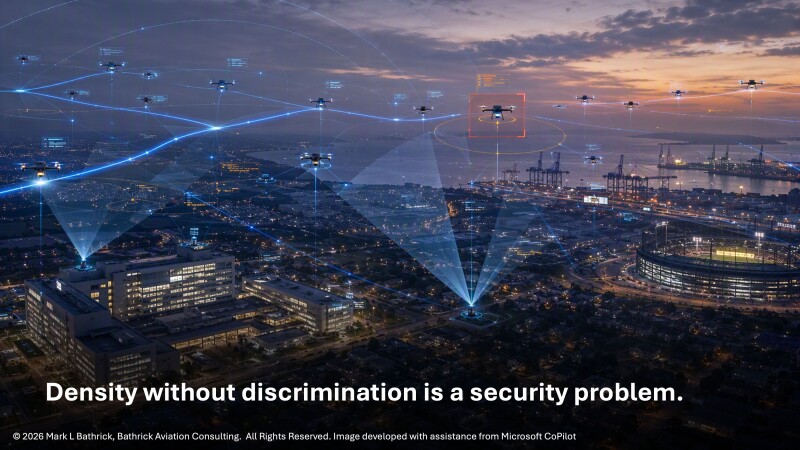
C-UAS and air-domain-awareness programs are two sides of the same operational problem. If delivery operators fly predictable, high-frequency routes near sensitive facilities, the question is whether a drone is expected, authorized, conforming, explainable, and distinguishable from a threat. C-UAS planning should incorporate delivery-route intelligence, hub operating windows, operator contact pathways, public safety exemptions, emergency-response overlays, ADA feeds, and lawful escalation rules. Without that context, dense legitimate activity can either mask real threats or trigger over-reaction to lawful operations.
Rules of engagement will have to mature from “detect and panic” to observe, identify, classify, coordinate, warn, restrict, interdict only where legally authorized, and document. In Drone Defense at Home and my work on why C-UAS rules of engagement are necessarily local, I argued that domestic drone defense requires lawful, proportionate, venue-specific decision frameworks rather than a one-size-fits-all technology response.18 Drone density without discrimination creates security risk. Drone density with shared awareness creates manageable airspace.
Air Domain Awareness: The Missing Connective Tissue
Scaled delivery, infrastructure inspection, DFR, wildfire support, emergency response, and C-UAS cannot mature if each community maintains a separate picture of the sky. Remote ID (RID) is an important baseline because it lets drones broadcast identifying and location information, but RID is the floor, not the ceiling. Reclaiming the Skies19 argued that universal electronic conspicuity is an executable framework for low-altitude safety, security, prosperity, and leadership, while Detect, Avoid, and Trust20 argued that legacy detect-and-avoid and cooperative surveillance models fall short in dense, mixed-equipage BVLOS airspace.
The broader requirement is air domain awareness: a shared, operationally useful picture of what is flying, where, why, whether it is conforming to expected behavior, and who is accountable. In America’s Low-Altitude Awareness Gap, I described ADA as interoperable infrastructure connecting electronic conspicuity, BVLOS trust, C-UAS authority, public transparency, and commercial scalability.21 UTM concepts point toward this future by describing services, roles, and information exchange necessary to manage UAS operations beyond traditional air traffic control methods.22
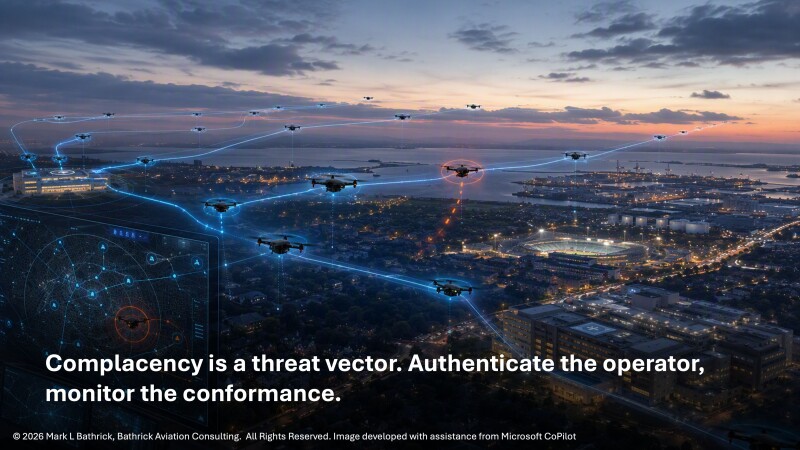
The public does not need a cockpit display. It needs confidence that someone knows what is happening overhead and can explain it. In a mature low-altitude system, awareness should include identity, position, mission context, route density, expected operating windows, hub activity, emergency deviations, and community-sensitive zones. Otherwise, even compliant operators may collectively create the impression of unmanaged proliferation.
For ADA integrators, the PEA creates a near-term product requirement: show users the operating context behind the dots. Communities, public safety agencies, security teams, and infrastructure owners will need to know whether a drone is part of a delivery route, DFR launch, utility inspection, wildfire mission, media operation, or anomalous flight. They will need tools that visualize route density, hub activity, sensitive-resource overlays, complaint hot spots, Remote ID, UTM/ADSP, C-UAS alerting, and emergency deviations before trust erodes.
The Cumulative Impacts Question
The most difficult question may not be whether one operator’s projected impacts are significant. It may be whether communities experience the accumulated effects of many separate operations as significant. Delivery flights, public safety launches, utility inspections, media drones, real estate imaging, construction monitoring, and security responses may each be defensible in isolation. Together, they can become a daily low-altitude environment that feels imposed rather than governed.
That is why programmatic environmental assessment must be paired with programmatic governance. Communities experience cumulative effects as noise repetition, visual saturation, perceived surveillance, complaint fatigue, and loss of control. Regulators may analyze these issues through formal categories; residents experience them as quality of life. As I argued in Earning the Right to Operate and in my work on language and imagery, public acceptance is shaped by transparency, cultural awareness, and the meanings communities attach to visible autonomous systems.23 24
The solution is not local veto over national airspace or treating local concerns as obstacles to innovation. It is making low-altitude governance visible, accountable, and adaptive enough that communities can see the difference between isolated disruption, unmanaged accumulation, and managed public value.
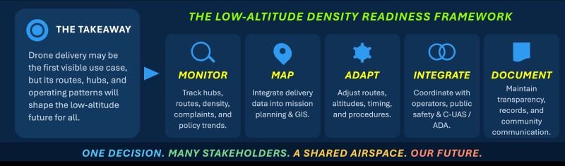
The Low-Altitude Density Readiness Framework is the practical takeaway from that governance challenge and should become part of every serious stakeholder’s planning process.
Winners, Losers, and Strategic Misreadings
The likely winners are not simply the companies with the fastest aircraft or the largest balance sheets. They are the organizations with practiced safety management systems (SMS), fleet standardization, operating discipline, environmental records, community engagement capacity, public-value narratives, and the data infrastructure to prove what they claim. They will understand that the PEA is not the end of public accountability. It is the beginning of a more sophisticated operating conversation.
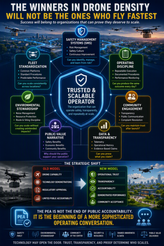
The likely losers are novelty-driven companies, undercapitalized operators that underestimate compliance cost, public agencies that rely on mission virtue without governance capacity, adjacent service providers that ignore delivery-density effects until complaints arrive, security programs that cannot distinguish authorized density from anomalous activity, and investors who believe market density automatically equals deployability. The most dangerous misreading is simple: “The FAA approved drone delivery.” The better reading is that the FAA demonstrated one possible pathway for assessing recurring low-altitude operations, and every adjacent mission community will now test how far that pathway can extend.
Package Delivery Is the Test Case, Not the End State
The FAA has moved package delivery materially forward, but its lasting importance will depend on what kind of precedent it becomes. The harder question is whether America can build the policy, data, environmental, security, and public-trust architecture needed for routine low-altitude density to deliver broader public value. That is the governance test now in front of us.
If the Part 135 PEA becomes only a delivery-sector shortcut, it may deepen UAS silos. Operators will point to approvals, communities to impacts, public safety to mission value, C-UAS stakeholders to risk, ADA providers to missing data, and investors to opportunity. Each will be partly right and collectively incomplete.
If, however, the FAA’s action becomes a template for disciplined, transparent, mission-aware governance, drone integration may mature from permission-based experimentation into a national operating system for the low-altitude sky. That conclusion is consistent with the through-line running from my 2022 call for a cross-domain digital strategy through later work on systems integration, public trust, drone dominance, airspace sovereignty, electronic conspicuity, Part 108 readiness, and low-altitude air domain awareness.25 Package delivery is not the end state. It is the test case for whether America can make routine low-altitude aviation safe, secure, trusted, understandable, and publicly valuable. What we do with that test will determine whether drones become another fragmented deployment or a safer, more secure, more prosperous layer of American infrastructure.

.jpg.small.400x400.jpg)






Comments