
2024: The Year America Woke Up to the Low-Altitude Blind Spot

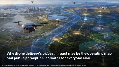
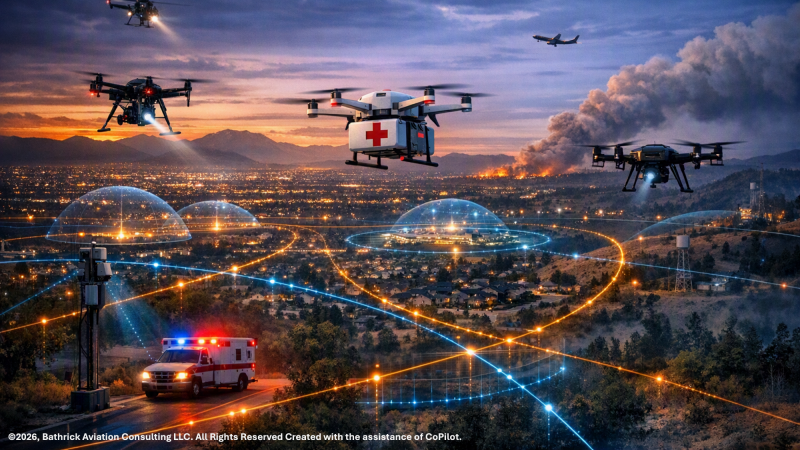
America’s low-altitude blind spot did not appear as one catastrophe. It arrived as a pattern: New Jersey’s late-2024 drone panic generated more than 5,000 public reports;1 World Cup security produced large-scale unauthorized-drone enforcement near stadiums and fan zones;2 3 4 a Los Angeles wildfire response was disrupted when an unauthorized drone collided with a Super Scooper;5 6 and at Fort Hancock, a Department of War (DoW) laser system shot down a Customs and Border Protection (CBP) drone after two federal entities failed to deconflict their operations.7 Meanwhile, drone delivery and drone-as-first-responder programs are transitioning from exceptions to routine use. At the July 31, 2026, American Drone Leadership Summit, CEOs of two prominent drone delivery companies reportedly claimed that each company already conducts more daily operations than United Airlines, despite serving only a limited portion of the United States.8 9 10  And on August 17, 2026, Zipline and Uber announced their target of one million drone deliveries a day by 2029.11 These are not separate stories. They are evidence of one national condition: the United States is entering the low-altitude economy without the low-altitude air domain awareness (ADA) required to govern it.

The failure is not simply that drones appeared where they were not expected. It is that authorities often could not authoritatively explain what was flying overhead, who controlled it, whether it was lawful, whether it was dangerous, or who had authority to act. America has sensors, agencies, statutes, aviation rules, and fast-growing commercial and public-safety drone programs. What it lacks is a unified low-altitude ADA architecture that connects detection, tracking, identification, notification, public communication, and lawful mitigation into a functioning system.

The Blind Spot Is Structural: What “Air Domain Awareness” Actually Means

Before the country can solve low-altitude “air domain awareness” (ADA), it must clarify the term. ADA means different things depending on where you sit: to FAA safety culture, it means position, vector, altitude, trajectory, intent, authorization, and conformance.12 To the public, it means: “what is that drone,” and “is it supposed to be there?” Remote ID answers part of that question by broadcasting identification and location information and helping authorities locate unsafe or unauthorized operations.13 To the security and C-UAS community, ADA means discrimination: separating cooperative traffic from errant-but-benign activity and both from nefarious threats.  To the flying public, ADA means making sure they don’t become an unintended “mitigation” target.

Those perspectives are incomplete views of one national capability. ADA is not a sensor, dashboard, or C-UAS tool; it is the layered capability that lets lawful drones scale, lets agencies distinguish known from unknown activity, lets security operators separate nuisance from threat, and lets regulators govern a fast-growing airspace without freezing its economic potential.14

The Evidence Is Overwhelming: America Is Flying Blind

The Elephant in the Airspace established the baseline: roughly 96 percent of low-altitude airspace has no mandated electronic conspicuity requirement for manned aircraft.15 Reclaiming the Skies argued that universal electronic conspicuity is the fastest way to separate cooperative traffic from unknown contacts.16 Detect, Avoid, and Trust moved the problem from visibility to operations: BVLOS cannot scale on waiver-by-waiver exceptions; it requires trusted ADA.17  Drone Defense at Home demonstrated that without the Air Defense Awareness (ADA) system, the rules of engagement become arbitrary, fragmented, and unpracticed, which has led to tragic outcomes across the history of air domain awareness and defense.18

From Silos to Systems showed that ADA is also a cross-domain digital infrastructure problem involving sensors, identity, communications, spectrum, cybersecurity, public safety, emergency management, and lawful command-and-control.19 Earning the Right to Operate made the legitimacy case,20 while Beyond the Box made the industry case for system-of-systems design.21 This article is the next chapter: ADA is the missing national capability connecting electronic conspicuity, BVLOS trust, C-UAS discrimination, economic scale, and industry interoperability. The United States is already using low-altitude airspace as if it were visible, coordinated, and governable. It is not.

The Policy Environment Has Shifted: ADA Is Now a National Requirement

The policy environment has shifted from aspiration to requirement. Across numerous federal drivers, the same premise appears: the country needs a trusted, interoperable, legally grounded way to know what is operating in low-altitude airspace, whether it is authorized, whether it is conforming, and what response is available when it is not.22 ADA is becoming the connective requirement underneath aviation safety, homeland security, spectrum governance, law enforcement authority, emergency response, commercial drone delivery, and economic scale.23

Taken together, these drivers are less a checklist than a convergence map.
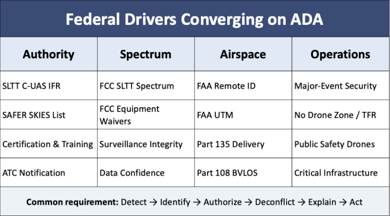
First, the SLTT C-UAS Interim Final Rule requires ADA. Certified SLTT law enforcement and correctional agencies may detect, track, identify, monitor, warn, disrupt, disable, seize control of, or destroy UAS in defined threat circumstances.24 But that authority depends on common operating pictures, authority records, ATC notification, interagency coordination, and defensible post-action documentation. Without ADA, permission to act does not make action safe, lawful, or explainable.

Second, FCC spectrum actions create a confidence problem that only ADA can manage. Authorized RF mitigation can raise noise floors, disrupt passive RF sensing, interfere with GPS timing, and corrupt surveillance data. FCC spectrum and equipment-authorization actions close an urgent legality gap, but they also make ADA a confidence problem: which signals can be trusted, what interference is acceptable, and which research sites must be protected for validation?25

Third, Part 135 and Part 108 create a scale problem that only ADA can govern. FAA’s Part 135 environmental framework contemplates delivery hubs at up to 1,150 average annual day deliveries from a single hub.26 Dense corridors below 400 feet AGL will require conformance monitoring, anomaly detection, corridor integrity, post-event reconstruction, and separation between authorized operations and unknown contacts.

Together, SLTT authority, FCC spectrum actions, and Part 135/Part 108 convert ADA from a useful concept into a national requirement. Low-altitude awareness can no longer be an optional overlay, pilot project, or vendor-defined feature set; it is a prerequisite for exercising authority, protecting the public, scaling commerce, and preserving spectrum integrity.

The ADA Stack: A Workable National Framework for Safety, Security, and Trust

ADA is often described as a five-level chain: detection, tracking, identification, warning/notification, and mitigation. That model captures the engagement sequence from sensing an object to possible lawful response, but it does not capture the full national capability required for routine low-altitude governance.27

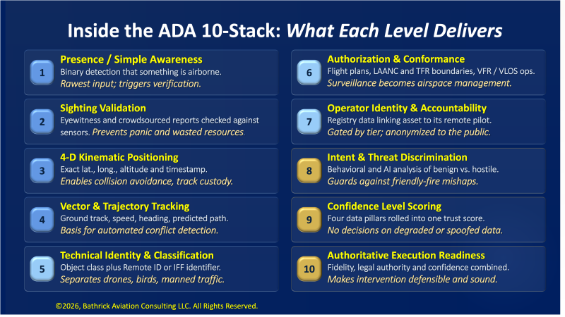
A workable ADA framework must serve FAA regulators, SLTT agencies, federal security users, BVLOS operators, wildfire commanders, airports, critical-infrastructure owners, event planners, spectrum managers, elected officials, and the public. They do not need the same screen or authority, but they do need a trusted operating picture. That requires a ten-level stack, depicted below, that moves from basic awareness to accountable execution, supporting both BVLOS trust and C-UAS discrimination.28
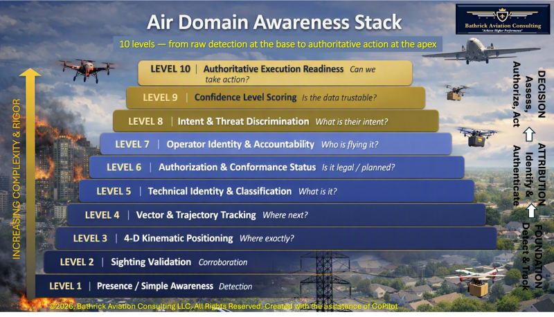
The five-level model explains how a contact moves toward possible mitigation. The ten-level ADA model specifically outlines how a nation governs a low-altitude ecosystem by connecting cooperative operations, non-cooperative detection, safety, security, authority, vendor systems, and national standards.
The Consequences of Inaction: Four Recent Case Studies in Air Domain Awareness Challenges

1. New Jersey 2024: Detection Without Authentication

What happened: During New Jersey’s late-2024 drone panic, the FBI received more than 5,000 tips and generated roughly 100 leads; federal agencies deployed detection technology and visual observers, then concluded that the sightings included lawful drones, manned aircraft, helicopters, and even stars.29 What failed: ADA failed at validation: authorities could observe and investigate activity, but they could not quickly provide a trusted explanation of what was overhead. Why it matters: Without validated identity and authorization status, even accurate government assessments can sound evasive, reinforcing DHS and FBI’s warning that the episode exposed “the insufficiency of current authorities.”30

2. Fort Hancock, February 2026: The Deconfliction Failure

What happened: At Fort Hancock, a DoD high-energy laser system shot down a CBP drone near the Texas border after treating it as a seemingly threatening UAS operating in military airspace.  What failed: ADA failed at deconfliction: the system moved to mitigation without a shared operating picture, agency notification protocol, and authority matrix sufficient to distinguish a federal partner aircraft from a threat.31 Why it matters: Domestic C-UAS systems may become necessary, but without integrated ADA they create potentially deadly “blue-on-blue” and “blue-on-white” engagement risks rather than reducing airspace risk.32

3. The 2026 FIFA World Cup: Coordinated ADA at Scale

What happened: During the 2026 FIFA World Cup, FAA TFRs prohibited unauthorized flight within three nautical miles and up to 3,000 feet AGL around match venues, while the DETER initiative accelerated enforcement and exposed violators to fines, seizure, and criminal charges.33 In North Texas, authorities seized 94 drones across AT&T Stadium and Fair Park and filed federal charges in selected cases. What succeeded: ADA partially succeeded because detection, C2, pre-established enforcement pathways, public “No Drone Zone” messaging, and coordinated operations were integrated before the event.34 Why it matters: The World Cup shows that major-event airspace can be made more governable when ADA functions are planned as a system rather than assembled during a crisis.35

4. Wildfire 2025: The Cost of Incomplete Authority

What happened: During the Palisades Fire, a privately owned drone collided with a Super Scooper firefighting aircraft, damaging the aircraft and removing it from service while aerial suppression resources were critically scarce. The broader pattern was worse: the U.S. Forest Service later reported 218 drone sightings over active wildfires in 2025, including 184 incursions inside restricted airspace around the Eaton and Palisades fires.36 What failed: ADA failed at the authority-to-action link: detection and operator location were possible, as a counter-UAS task force later demonstrated with 49 detections and intercepts in one day, but responders lacked a complete authority chain for timely, lawful mitigation.37 Why it matters: In wildfire operations, incomplete ADA does not merely create uncertainty; it can ground life-saving aircraft and delay suppression when minutes matter.

The Common Link: Sensors Without a System

Across these cases, the failure mode is consistent. New Jersey lacked validation. Fort Hancock lacked deconfliction. The World Cup succeeded because detection, C2, authority, messaging, and enforcement were integrated in advance. Wildfire operations showed that detection without timely authority can still ground critical aircraft. The same pattern now appears in regulation: SLTT authority, FCC spectrum actions, SAFER SKIES, and Part 135/Part 108 all depend on the missing capability to connect detection, identity, authority, communications, and accountable response.38 39 40

The ADA Industrial Base: Capabilities Required to Build the Stack

If the stack defines what ADA must do and the case studies show what happens when it is incomplete, the next question is who can build it. The ten-level ADA stack cannot be built by one sector or vendor class. It requires complementary capabilities: cooperative identification, non-cooperative sensing, sensor fusion, track custody, data-confidence scoring, command-and-control integration, legal-authority management, cybersecurity, and standards assurance. Remote ID and UTM providers offer identity, authorization, and intent data. Radar, RF, EO/IR, acoustic, and other sensing companies provide non-cooperative detection. AI and analytics firms support classification, anomaly detection, confidence scoring, and threat discrimination. Public-safety, emergency-management, logistics, and fleet-management platforms connect airspace awareness to real-world operations.
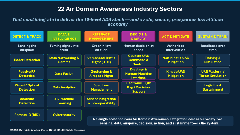
ADA is not a standalone product category; it is an ecosystem category. Radar, Remote ID receivers, UTM services, public-safety platforms, C-UAS integrators, sensor-data standards, cybersecurity controls, and liability frameworks must interoperate to produce national low-altitude awareness.

That matters for policy and procurement. Buying standalone tools will recreate silos; procuring ADA as a system-of-systems capability can reward interoperability, trusted data contribution, availability, and accountable performance. That is the difference between buying sensors and building infrastructure.

The Cross-Domain Future: ADA as National Digital Infrastructure

ADA cannot remain aviation-only. As From Silos to Systems argued, low-altitude airspace is becoming one layer of a broader autonomous environment: drones will move over smart intersections, freight corridors, emergency routes, critical-infrastructure sites, ports, rail yards, and dense neighborhoods. If ADA stays inside aviation stovepipes, it will reproduce the same failure pattern: strong tools, fragmented data, incompatible authorities, and no durable operating picture.

ADA must integrate with smart-city sensors, autonomous vehicles, logistics networks, emergency-response systems, and public-safety platforms. NIST emphasizes standards-based, scalable municipal IoT, cybersecurity, privacy, smart transportation, and data platforms,41 while DHS S&T applies IoT to public safety, critical-infrastructure resilience, emergency alerts, wildland-fire sensing, and responder situational awareness.42 Low-altitude awareness should become part of that sensor fabric, not a parallel stovepipe.

Connected and automated transportation points the same way. USDOT describes connected vehicles as exchanging safety-critical data about position, movement, hazards, and operational status,43 and FHWA frames emerging roadway operations around connectivity, digital infrastructure, cybersecurity, testing, and evaluation.44 Drone delivery, DFR launches, automated shuttles, and emergency vehicles will need shared assumptions about location, intent, priority, communications, and safety margins.

Logistics networks make ADA’s infrastructure role unavoidable. Drone-delivery corridors will connect fulfillment centers, healthcare facilities, campuses, neighborhoods, and roads, while UTM is built around flight planning, authorization, surveillance, conflict management, real-time airspace status, and automated data exchange.45 Without interoperability across ADA, fleet management, dispatch, geofencing, and permitting systems, the country risks automated opacity instead of governance by transparent processes.

That is why ADA should be treated as national digital infrastructure: interoperable enough to share trusted data, secure enough to protect sensitive missions and privacy, and flexible enough to support emergency response and commercial scale.46

The Governance Imperative: Public Trust as a Design Requirement

ADA will fail if it can see the airspace but cannot explain itself. As Earning the Right to Operate argued, public trust is as critical as safety, reliability, or technical performance.  Communities will not accept dense drone delivery, DFR, infrastructure patrols, or security deployments if every question is answered with “trust us.” Transparency and explainability must be designed in from the start.

That requires two ADA tiers: a public tier that answers basic legitimacy questions without exposing sensitive data, and a U.S. government tier that carries identity, authorization, conformance, threat discrimination, accountability, confidence scoring, and lawful response options. Remote ID already reflects this tiered logic by giving the public limited identification and location information while helping authorities locate unsafe or unauthorized operations.

The Capital Trap: ADA Must Be Commercially Viable

Any ADA framework must answer a hard question: who pays, and on what terms? A federated network of private radar, RF, optical, acoustic, Remote ID, and other surveillance nodes can feed a shared low-altitude picture for public safety, homeland security, aviation, and defense. But technical viability is not commercial viability. If private capital is expected to build “public-good” infrastructure, the business model must be designed in from the beginning.

UTM provides the warning. LAANC proved that federated public-private architecture can work technically by automating controlled-airspace approvals through FAA-approved UAS Service Suppliers.47 The FAA’s UTM model likewise relies on automated systems and APIs to coordinate operators, service providers, and FAA services.  Commercially, however, AirMap was acquired by DroneUp,48 Verizon shut down Skyward,49 Altitude Angel entered “administration” after mounting losses,50 and industry analysis warned that operator fees alone were unlikely to fund the infrastructure.51
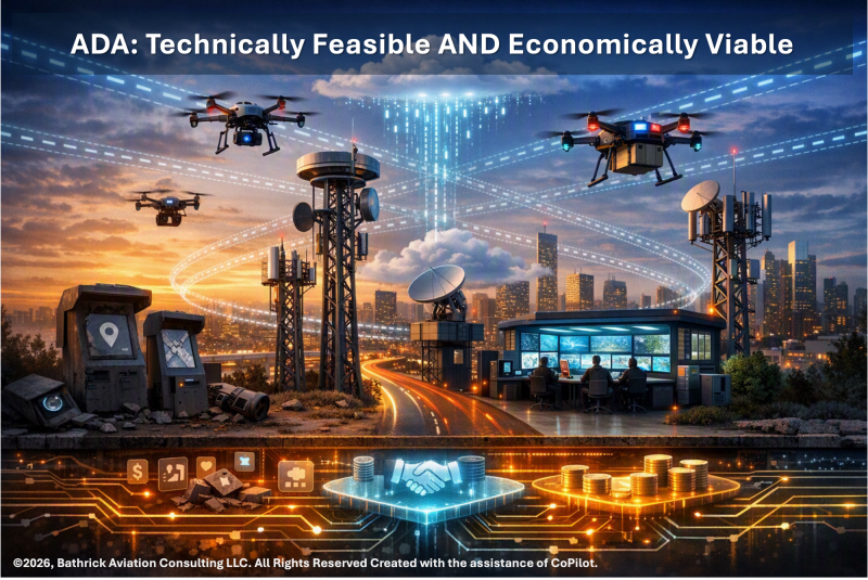
The ADA cannot repeat the monetization fallacy. Instead, it must reject unfunded mandates for public-safety and national-security surveillance.  It should pay private sensor operators through multi-year Data-as-a-Service procurements, availability payments, and service-level agreements.  Furthermore, it should harmonize manned, cooperative, and non-cooperative data through standardized gateways.  Finally, it should establish clear data ownership, liability, latency, confidence, and indemnification rules before investors fund wide-area networks.

ADA must be procured like infrastructure, not wished into existence like an app ecosystem. Without public-sector anchor tenants, open interfaces, performance standards, liability protections, and procurement pathways that reward trusted contribution, the federated approach will produce abandoned networks, stranded sensors, and capital trapped in the clouds.

Access, Affordability, and the Risk of a Toll-Road Airspace

The business-model problem has a mirror image: if providers cannot earn sustainable revenue, the system fails; if users cannot afford access, the system also fails. Transportation infrastructure has traditionally been built, managed, and maintained by public authorities because access is a public good. FAA’s move toward federated low-altitude services — LAANC, UTM, third-party service suppliers, automated data services, and surveillance-as-a-service — signals a possible departure from that model.52 Considering that the low-altitude economy is already accommodating more daily flights than the largest U.S. airline and is expected to expand substantially, it becomes imperative to establish an equitable and feasible business model.. The country should not create a low-altitude version of private toll roads, where safe, routine access depends on subscription tiers, transactional fees, or demand pricing that only the largest operators can absorb.
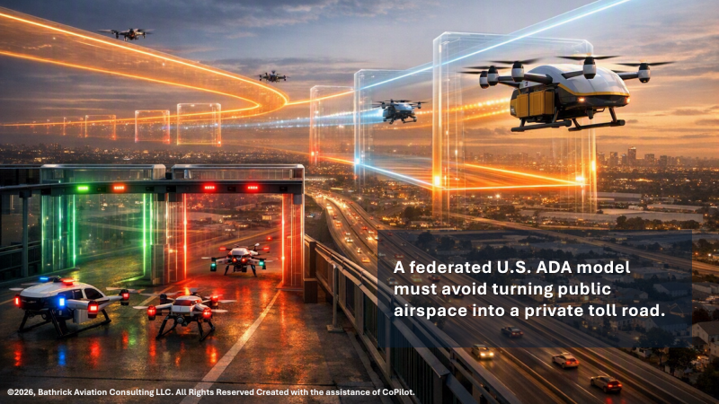
Large logistics platforms may be able to internalize low-altitude service costs, but smaller drone service providers, regional infrastructure inspectors, agricultural operators, news organizations, and state or local public-safety agencies operate on thinner margins and fixed budgets. DFR programs already require sustained funding for hardware, software, staffing, training, storage, compliance, insurance, vendor support, and long-term maintenance.53 54 If ADA, UTM, surveillance, conformance monitoring, or access-management charges are layered on top without public funding support or equitable pricing rules, the result could be a two-tier airspace: large commercial operators with full service access and smaller public-interest users priced into limited capability.

The better model is a mixed public-utility approach: government-funded baseline ADA services for safety, security, transparency, and public-safety operations; regulated or capped fees for required access services; and value-added commercial services priced separately for operators who need enhanced logistics, fleet optimization, or enterprise analytics. Companies must be able to earn a durable return but required safety and awareness services must remain affordable to the customers the system is meant to serve. If ADA is built as infrastructure, affordability is not a charitable add-on. It is a design requirement.

The Call to Action: Build the National ADA Infrastructure

America does not need another “pilot program” that proves the obvious. It needs national ADA infrastructure:

1. Mandate universal electronic conspicuity. Cooperative aircraft must be separated from unknown contacts at machine speed; Remote ID already lays part of that foundation but is incomplete.

2. Build the two-tier ADA model. The public tier should provide legitimacy and transparency; the U.S. government tier should support identity, conformance, threat discrimination, accountability, confidence scoring, and lawful response.

3. Establish and integrate confidence standards into decision support tools. No agency should act on degraded, spoofed, incomplete, or non-correlated data; FAA’s UTM model already depends on interoperable services, surveillance, authorization, conflict management, real-time status, and automated data exchange.

4. Integrate SLTT agencies. New C-UAS authority must be tied to common operating pictures, ATC notification, reporting, privacy protection, and federal oversight.55

5. Protect spectrum and surveillance integrity. Authorized RF mitigation changes the sensing environment and must be managed as part of ADA.56

6. Launch NASA–FAA prototypes. ADA feasibility models should test the full stack from public reporting and cooperative identity to confidence scoring and lawful response, building on NASA’s previous UTM work.

7. Proof-test the federated ADA business model. Government should validate that federated ADA can be economically viable for providers without turning low-altitude airspace into a toll road that only the largest operators and best-funded agencies can afford.
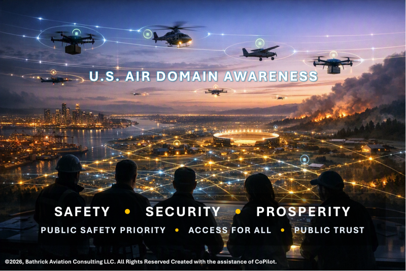
Finally, treat ADA as critical infrastructure: the trust layer that will determine whether America achieves safety, security, and prosperity in the low-altitude economy. The technology exists. The policy foundation is emerging. What remains is the commitment to build the system. The policy has shifted, the warning signs are visible, the opportunity is historic, and the decision is now national. 


References

1-  DHS, FBI, FAA & DoD, “Joint Statement on Ongoing Response to Reported Drone Sightings,” Dec. 17, 2024, reporting more than 5,000 tips, approximately 100 leads, deployment of advanced detection technology and visual observers, and an assessment that sightings included lawful drones, manned aircraft, helicopters, and stars, https://www.faa.gov/newsroom/dhs-fbi-faa-dod-joint-statement-ongoing-response-reported-drone-sightings.
2 - FAA, “FAA Establishes ‘No Drone Zones’ for FIFA World Cup 2026 Stadiums, Fan Events and Base Camps,” May 28, 2026, explaining that match-day TFRs prohibited drones within a 3-nautical-mile radius and up to 3,000 feet AGL around stadiums unless authorized, https://www.faa.gov/newsroom/faa-establishes-no-drone-zones-fifa-world-cup-2026-stadiums-fan-events-and-base-camps.
3 - U.S. Department of Justice, U.S. Attorney’s Office for the Northern District of Texas, “Northern District of Texas Elevates Airspace Security During FIFA World Cup 2026 – Sets Foundation for Future Events,” July 23, 2026, reporting 65 drone seizures at Dallas Stadium and 29 at Fair Park, for a total of 94 seizures, https://www.justice.gov/usao-ndtx/pr/northern-district-texas-elevates-airspace-security-during-fifa-world-cup-2026-sets.
4 - WFAA, “DOJ: 94 unauthorized drones seized during FIFA World Cup in North Texas, 3 operators charged,” July 29, 2026, reporting that federal authorities seized 94 unauthorized drones and charged three operators during World Cup security operations in North Texas, https://www.wfaa.com/article/sports/soccer/world-cup/doj-94-unauthorized-drones-seized-during-fifa-world-cup-in-north-texas-3-operators-charged/287-05b90c2c-6725-480c-b8ed-5e08a8d72425.
5 - U.S. Dep’t of Justice, U.S. Attorney’s Office, Central District of California, “Culver City Man Agrees to Plead Guilty to Recklessly Crashing Drone into Super Scooper Firefighting Aircraft During Palisades Fire,” Jan. 31, 2025, https://www.justice.gov/usao-cdca/pr/culver-city-man-agrees-plead-guilty-recklessly-crashing-drone-super-scooper.
6 - Bathrick Aviation Consulting, Context and Perspective on the Issue of Drone Incursions on Wildfires, January 16, 2025, https://media.licdn.com/dms/document/media/v2/D4E1FAQGpDTa5wur_mg/feedshare-document-pdf-analyzed/B4EZRwixNtHMAY-/0/1737054955568?e=1787788800&v=beta&t=HaD6k4tUMpVhhgQpB0Gx9k6tErepkxyyhFxbElXf27A.
7 - Reuters, “US military shoots down government drone in Texas accident, congressional aides say,” Feb. 26, 2026, quoting the Pentagon, FAA, and CBP statement that the military used a counter-unmanned aircraft system to mitigate a “seemingly threatening” UAS operating within military airspace and that agencies would improve cooperation and communication, https://www.reuters.com/business/aerospace-defense/faa-closes-airspace-fort-hancock-texas-after-reported-use-anti-drone-laser-2026-02-27/.
8 - U.S. Department of Transportation, “Driving the News: U.S. Transportation Secretary Sean P. Duffy Unleashes American Drone Dominance,” Aug. 7, 2025, quoting industry stakeholders that scalable BVLOS operations can enhance safety, transform commercial services, strengthen public safety, support infrastructure inspections, precision agriculture, package delivery, disaster response, economic growth, and high-quality jobs, https://www.transportation.gov/briefing-room/driving-news-us-transportation-secretary-sean-duffy-unleashes-american-drone.
9 - Police1, “What does a Drone as First Responder program really cost?,” Oct. 1, 2025, explaining that DFR budgeting must account for hardware, software, staffing, community transparency, vendor pricing complexity, and downstream expenses, https://www.police1.com/drones/what-does-a-drone-as-first-responder-program-really-cost.
10 - American Drone Leadership Summit LinkedIn post, July 31, 2026, stating that CEOs of two major drone delivery companies said their companies each fly more daily operations than United Airlines while serving only a small portion of the United States, https://www.linkedin.com/posts/droneleadership-aviationinnovation-cda-share-7490098123353272320-00Co/?utm_source=share&utm_medium=member_desktop&rcm=ACoAAAUz21UBbAE35E3e1SSmP44XxCoXXY29LpI.
11 - DRONELIFE, “Uber and Zipline Target One Million Drone Deliveries a Day by 2029,” Aug. 17, 2026, reporting that Uber and Zipline announced a target of one million drone deliveries per day by 2029, https://dronelife.com/2026/08/17/uber-and-zipline-target-one-million-drone-deliveries-a-day-by-2029/.
12 - FAA, “Unmanned Aircraft System Traffic Management (UTM),” describing UTM as a collaborative low-altitude ecosystem built on regulatory requirements, technical capabilities, interoperable services, flight planning, authorization, surveillance, conflict management, real-time airspace status, and automated data exchange, https://www.faa.gov/uas/advanced_operations/traffic_management.
13 - FAA, “Remote Identification of Drones,” explaining that Remote ID provides drone identification and location information and helps FAA, law enforcement, and other federal agencies locate a control station when a drone appears unsafe or is operating where it is not allowed, https://www.faa.gov/uas/getting_started/remote_id.
14 - NASA, “UTM: Air Traffic Management for Low-Altitude Drones,” explaining that NASA and FAA recognized the need for a system to safely manage UAS flying at low altitudes and identifying UTM functions such as dynamic geofencing, congestion management, terrain avoidance, route planning, separation management, sequencing, spacing, and contingency management, https://www.nasa.gov/wp-content/uploads/2024/04/utm-factsheet-09-06-16-508.pdf.
15 - Commercial UAV News, “The Elephant in the Airspace: How Outdated Approaches Ground America’s Aviation Leadership,” June 24, 2025, discussing the low-altitude airspace/electronic-conspicuity gap; see https://www.commercialuavnews.com/the-elephant-in-the-airspace-how-outdated-approaches-ground-america-s-aviation-leadership. See also 14 C.F.R. § 91.225, which defines ADS-B Out requirements by airspace, https://www.ecfr.gov/current/title-14/chapter-I/subchapter-F/part-91/subpart-C/section-91.225.
16 - Commercial UAV News, “Reclaiming the Skies: Accelerating Universal Electronic Conspicuity for America’s Low-Altitude Aviation Safety, Security, Prosperity, and Leadership,” July 17, 2025, https://www.commercialuavnews.com/reclaiming-the-skies-accelerating-universal-electronic-conspicuity-for-america-s-low-altitude-aviation-safety-security-prosperity-and-leadership.
17 - Commercial UAV News, “Detect, Avoid, and Trust: Why Legacy Models Fall Short in Low-Altitude BVLOS Airspace,” Feb. 23, 2026, https://www.commercialuavnews.com/low-altitude-air-domain-awareness-coordination-collision-avoidance.
18 - Commercial UAV News, “Drone Defense at Home: Closing the C-UAS Rules of Engagement (ROE) Gap,” Nov. 25, 2025, https://www.commercialuavnews.com/drone-defense-at-home-closing-the-cuas-rules-of-engagement-roe-gap.
19 - Commercial UAV News, “From Silos to Systems: Why America’s Transportation Future Demands a Cross Domain Digital Infrastructure Strategy,” Apr. 22, 2026. https://www.commercialuavnews.com/from-silos-to-systems-cross-domain-digital-infrastructure-transportation
20 - Commercial UAV News, “Earning the Right to Operate: Public Trust in Emerging Aviation and Autonomous Systems,” Mar. 23, 2026, https://www.commercialuavnews.com/earning-the-right-to-operate-public-trust-emerging-aviation-autonomous-systems.
21 - Commercial UAV News, “Beyond the Box: How C-UAS Companies Can Win in the Era of the ‘System of Systems,’” Dec. 22, 2025, https://www.commercialuavnews.com/beyond-the-box-how-c-uas-companies-can-win-in-the-era-of-the-system-of-systems.
22 - This synthesis is based on the combined effect of SAFER SKIES Act implementation, DHS/DOJ SLTT C-UAS certification rules, FCC temporary spectrum and equipment-authorization actions, FAA Remote ID, FAA UTM policy, FAA Part 135 drone delivery environmental review, and the anticipated Part 108 BVLOS operating framework. See, e.g., https://www.federalregister.gov/documents/2026/07/06/2026-13609/counter-uas-authority-for-state-local-tribal-and-territorial-law-enforcement-and-correctional;  https://www.fcc.gov/document/c-uas-spectrum-authority-sltts-under-safer-skies-act;   https://www.faa.gov/uas/getting_started/remote_id;   https://www.faa.gov/uas/advanced_operations/traffic_management; and https://www.federalregister.gov/documents/2025/08/07/2025-14992/normalizing-unmanned-aircraft-systems-beyond-visual-line-of-sight-operations.
23 - FAA Remote ID, FAA UTM, DHS/DOJ SLTT C-UAS IFR, FCC DA 26-656 and DA 26-657, and FAA Part 135 Final PEA collectively show that low-altitude awareness now operates across identity, traffic management, spectrum, public safety, law enforcement authority, and commercial operations. See https://www.faa.gov/uas/getting_started/remote_id;  https://www.faa.gov/uas/advanced_operations/traffic_management;  https://www.federalregister.gov/documents/2026/07/06/2026-13609/counter-uas-authority-for-state-local-tribal-and-territorial-law-enforcement-and-correctional; https://www.fcc.gov/document/c-uas-spectrum-authority-sltts-under-safer-skies-act; https://www.fcc.gov/document/oet-waives-certain-prohibitions-part-2-authorized-systems;  and https://www.faa.gov/uas/advanced_operations/nepa_and_drones/.
24 - DHS/DOJ, Counter-UAS Authority for State, Local, Tribal, and Territorial Law Enforcement and Correctional Agencies, Interim Final Rule, 91 Fed. Reg. 41,466 (July 6, 2026), establishing SLTT detection, tracking, warning, and mitigation authority subject to certification, operations planning, coordination, reporting, and authorized-system requirements, https://www.federalregister.gov/documents/2026/07/06/2026-13609/counter-uas-authority-for-state-local-tribal-and-territorial-law-enforcement-and-correctional.
25 - Federal Communications Commission, Orders DA 26-656 and DA 26-657 (July 2, 2026), granting temporary spectrum authority and waiving certain equipment authorization requirements for eligible SLTT C-UAS operations using systems on the SAFER SKIES Act Authorized Systems List, https://www.fcc.gov/document/c-uas-spectrum-authority-sltts-under-safer-skies-act and https://www.fcc.gov/document/oet-waives-certain-prohibitions-part-2-authorized-systems.
26 - FAA, Final Programmatic Environmental Assessment and Finding of No Significant Impact/Record of Decision for Drone Package Delivery Operations Conducted Under 14 C.F.R. Part 135, July 2026, establishing a delivery-hub operational baseline including a unit capacity threshold of 1,150 average annual day deliveries from a single hub and identifying current Part 135 operations as a bridge toward a future Part 108 BVLOS framework, https://www.faa.gov/uas/advanced_operations/nepa_and_drones/Part_135_Final_PEA_FONSI-ROD-NOA_Appendices_A-D_Final.pdf; see also https://www.federalregister.gov/documents/2026/07/30/2026-15417/notice-of-availability-of-the-final-programmatic-environmental-assessment-and-fonsirod.
27 - The five-level ADA chain reflects the operational progression commonly used in C-UAS and airspace-security discussions: detect, track, identify, notify/warn, and mitigate. The SAFER SKIES Act IFR reinforces the distinction between detection/warning activities and mitigation activities by separating operational functions and imposing heightened certification, planning, coordination, and reporting requirements for mitigation.
28 - The expanded ten-level stack draws from the requirements reflected in Remote ID, FAA UTM, Part 135 drone-delivery operations, the anticipated Part 108 BVLOS framework, FCC C-UAS spectrum actions, and DHS/DOJ SLTT C-UAS authorities, all of which require more than simple detection-to-mitigation sequencing.
29 - DHS, FBI, FAA & DoD, “Joint Statement on Ongoing Response to Reported Drone Sightings,” Dec. 17, 2024, reporting more than 5,000 tips, approximately 100 leads, deployment of advanced detection technology and visual observers, and an assessment that sightings included lawful drones, manned aircraft, helicopters, and stars, https://www.faa.gov/newsroom/dhs-fbi-faa-dod-joint-statement-ongoing-response-reported-drone-sightings.
30 - “Joint DHS/FBI Statement on Reports of Drones in New Jersey,” Dec. 12, 2024, stating that the New Jersey sightings highlighted “the insufficiency of current authorities,” https://www.fbi.gov/news/press-releases/joint-dhs-fbi-statement-on-reports-of-drones-in-new-jersey.
31 - Reuters, “US military shoots down government drone in Texas accident, congressional aides say,” Feb. 26, 2026, noting the use of the laser-based counter-drone system and reporting that the laser had not previously been deployed domestically, https://www.reuters.com/business/aerospace-defense/faa-closes-airspace-fort-hancock-texas-after-reported-use-anti-drone-laser-2026-02-27/.
32 - The Washington Post, “U.S. military used a laser to shoot down a Border Protection drone,” Feb. 27, 2026, reporting that the incident prompted the closure of airspace near Fort Hancock and followed earlier counter-drone laser activity that disrupted El Paso airspace, https://www.washingtonpost.com/national-security/2026/02/27/cbp-drone-us-military-faa-texas/.
33 - FAA, “FAA Establishes ‘No Drone Zones’ for FIFA World Cup 2026 Stadiums, Fan Events and Base Camps,” May 28, 2026, describing the Drone Expedited and Targeted Enforcement Response (DETER) initiative and penalties including fines, drone confiscation, and federal criminal charges, https://www.faa.gov/newsroom/faa-establishes-no-drone-zones-fifa-world-cup-2026-stadiums-fan-events-and-base-camps.
34 - FBI Dallas, “FBI Dallas Warns Drone Operators of Temporary Flight Restrictions During FIFA World Cup 2026,” May 28, 2026, describing coordinated public messaging, event-security planning, counter-UAS protection teams, and federal/state/local partner engagement around unauthorized drone activity during World Cup operations, https://www.fbi.gov/contact-us/field-offices/dallas/news/fbi-dallas-warns-drone-operators-of-temporary-flight-restrictions-during-fifa-world-cup-2026.
35 - DRONELIFE, “Counter-Drone Security at the 2026 FIFA World Cup,” Aug. 6, 2026, describing the World Cup as a multi-agency counter-drone deployment involving public-safety agencies across host cities and a layered security approach to unauthorized drone activity, https://dronelife.com/2026/08/06/2026-fifa-world-cup-counter-drone-security/.
36 - U.S. Forest Service, “Busy airspace,” Apr. 23, 2026, reporting 218 drone sightings over active wildfires in 2025, including 184 incursions within the restricted airspace around the Eaton and Palisades fires and noting that the total exceeded the prior seven-year national total of 125 reported incidents, https://www.fs.usda.gov/about-agency/features/busy-airspace.
37 - DVIDS / U.S. Forest Service, “Busy airspace: Record number of consumer drones are keeping firefighters grounded,” Apr. 23, 2026, reporting that after the Super Scooper collision, a counter-UAS task force with the FBI, Los Angeles County Fire Department, and Sheriff’s Department conducted 49 detections and intercepts during a one-day period on the Eaton and Palisades fires, https://www.dvidshub.net/news/563514/busy-airspace-record-number-consumer-drones-keeping-firefighters-grounded.
38 - DHS/DOJ, Counter-UAS Authority for State, Local, Tribal, and Territorial Law Enforcement and Correctional Agencies, Interim Final Rule, 91 Fed. Reg. 41,466 (July 6, 2026), summary and implementing provisions requiring airspace approval, real-time air traffic control notification, mitigation reporting, privacy protections, and compliance requirements for SLTT C-UAS operations, https://www.federalregister.gov/documents/2026/07/06/2026-13609/counter-uas-authority-for-state-local-tribal-and-territorial-law-enforcement-and-correctional.
39 - FCC, “C-UAS Spectrum Authority for SLTTs Under SAFER SKIES Act,” Order DA 26-656, July 2, 2026, granting temporary spectrum authority for eligible SLTT C-UAS operations under the SAFER SKIES Act, https://www.fcc.gov/document/c-uas-spectrum-authority-sltts-under-safer-skies-act.
40 - FAA, “Beyond Visual Line of Sight (BVLOS),” Aug. 6, 2025, describing the FAA’s proposed rule for safely normalizing BVLOS drone operations, including operations, aircraft manufacturing, separation from other aircraft, operational authorizations, responsibility, security, information reporting, and recordkeeping, https://www.faa.gov/newsroom/beyond-visual-line-sight-bvlos; see also Federal Register, “Normalizing Unmanned Aircraft Systems Beyond Visual Line of Sight Operations,” 90 Fed. Reg. 38,212 (Aug. 7, 2025), https://www.federalregister.gov/documents/2025/08/07/2025-14992/normalizing-unmanned-aircraft-systems-beyond-visual-line-of-sight-operations.
41 - NIST, “Smart Cities and Communities Framework Series,” explaining that smart-city frameworks address standards-based, replicable, scalable, and readily adoptable solutions, including cross-cutting issues such as data, platforms, municipal IoT, cybersecurity and privacy, and sector-specific areas such as smart transportation, https://www.nist.gov/ctl/smart-connected-systems-division/iot-devices-and-infrastructures-group/smart-americaglobal/nist.
42 - DHS Science & Technology Directorate, “Smart City Internet of Things Innovation (SCITI) Labs,” describing the use of smart-city and IoT technologies to enhance public safety, critical-infrastructure resilience, intelligent building sensors, wildland fire sensors, low-cost flood sensors, emergency alerts, and responder situational awareness, https://www.dhs.gov/science-and-technology/st-smart-city-internet-things-innovation-sciti-labs.
43 - U.S. Department of Transportation, “How Connected Vehicles Work,” explaining that vehicle-to-everything communications allow vehicles and infrastructure to exchange safety-critical information about position, heading, speed, movement, operational status, threats, and hazards, including information that may not be visible through line-of-sight sensors, https://www.transportation.gov/research-and-technology/how-connected-vehicles-work.
44 - Federal Highway Administration, “Connected/Automated Vehicles and Emerging Technologies,” identifying connectivity, automation, ITS architecture and system engineering, data, digital infrastructure, cybersecurity, testing, analysis, demonstration, and evaluation as activity areas for integrating emerging technologies into roadway operations, https://ops.fhwa.dot.gov/program_areas/ops-cavet.htm.
45 - FAA, “Unmanned Aircraft System Traffic Management (UTM),” explaining that UTM is a collaborative ecosystem for low-altitude drone operations built on regulatory requirements, technical capabilities, interoperable services, flight planning, authorization, surveillance, conflict management, real-time airspace status, and automated data exchange, https://www.faa.gov/uas/advanced_operations/traffic_management.
46 - DHS S&T / Open Geospatial Consortium, “Smart City Interoperability Reference Architecture (SCIRA),” describing an interoperable framework for integrating commercial IoT sensors for public-safety applications, including situational awareness, common operating picture, computer-aided dispatch, dynamic routing, route planning, workforce mobility, and emergency-response capabilities, https://www.ogc.org/initiatives/scira/.
47 - FAA, “UAS Data Exchange (LAANC),” explaining that LAANC is a collaboration between FAA and industry that provides drone pilots access to controlled airspace at or below 400 feet, gives air traffic professionals visibility into where and when drones will operate, and automates the application and approval process through FAA-approved UAS Service Suppliers, https://www.faa.gov/uas/getting_started/laanc.
48 - DroneUp, “DroneUp Announces Acquisition of AirMap,” Dec. 7, 2021, describing AirMap as a leading digital airspace and automation company and UTM provider acquired to support DroneUp’s network, fleet, and infrastructure, https://www.prnewswire.com/news-releases/droneup-announces-acquisition-of-airmap-301438731.html.
49 - Light Reading, “Verizon buries Skyward, its drone company,” May 6, 2022, reporting that Verizon shut down Skyward and shifted focus toward ground robotics, connectivity services, and solution development, https://www.lightreading.com/iot/verizon-buries-skyward-its-drone-company.
50 - Commercial UAV News, “Altitude Angel, the End of a Good Company and the Beginning of Uncertainty,” Oct. 17, 2025, reporting that UK-based Altitude Angel entered administration on Oct. 7, 2025 after mounting financial losses and that the uncertainty affected services including Drone Assist and the future of Project Skyway, https://www.commercialuavnews.com/drone-news-altitude-angel-administration-regulations.
51 - Unmanned Airspace, “UTM market fragments and service suppliers rethink business plans,” July 13, 2020, warning that tactical UTM service-supplier business models were fragmenting because operator service charges would only partly fund services and additional technical or commercial services would need to provide the bulk of USS revenue, https://www.unmannedairspace.info/utm-and-c-uas-market-analysis/utm-market-fragments-and-service-suppliers-rethink-business-plans-latest-unmanned-airspace-study/.
52 - FAA, “LAANC for Industry,” explaining that FAA-approved UAS Service Suppliers provide LAANC services and identifying the performance rules, concept of operations, memoranda of agreement, onboarding procedures, and other requirements USS providers must follow, https://www.faa.gov/uas/programs_partnerships/data_exchange.
53 - Police1, “What does a Drone as First Responder program really cost?,” Oct. 1, 2025, explaining that DFR budgeting must account for hardware, software, staffing, community transparency, vendor pricing complexity, and downstream expenses, https://www.police1.com/drones/what-does-a-drone-as-first-responder-program-really-cost.
54 - Axon, “Funding a scalable, sustainable DFR program,” explaining that DFR is not a one-time equipment purchase but a sustained public-safety program requiring total-cost-of-ownership planning for hardware, software, training, support, data security, insurance, maintenance, cloud storage, recurring compliance, and long-term sustainability, https://www.axon.com/resources/funding-a-dfr-program.
55 - U.S. Dept. of Homeland Security & U.S. Dept. of Justice, Counter-UAS Authority for State, Local, Tribal, and Territorial Law Enforcement and Correctional Agencies, Interim Final Rule, 91 Fed. Reg. 41,466 (July 6, 2026), establishing training, certification, authorized technologies, spectrum coordination, airspace approval, real-time ATC notification, mitigation reporting, privacy protections, and compliance requirements for SLTT agencies, https://www.federalregister.gov/documents/2026/07/06/2026-13609/counter-uas-authority-for-state-local-tribal-and-territorial-law-enforcement-and-correctional.
56 - Federal Communications Commission, Orders DA 26-656 and DA 26-657 (July 2, 2026), granting temporary spectrum authority and equipment-authorization relief for eligible SLTT C-UAS operations under the SAFER SKIES Act, https://www.fcc.gov/document/c-uas-spectrum-authority-sltts-under-safer-skies-act and https://www.fcc.gov/document/oet-waives-certain-prohibitions-part-2-authorized-systems.