

We’ve gone to great lengths to explain and explore why photogrammetry vs LiDAR conversations are not the most productive way to approach deciding which sensors makes the most sense for a given operator or organization. Surveying and mapping professionals who work with these tools on a daily basis understand that each has its strengths and limitations, which means it’s not about determining which is “best” in a general sense but instead, which is the “best fit” for a given project or workflow.
However, technology innovations with drones have made the simultaneous collection and combination of both imagery and LiDAR data attainable, introducing a whole new consideration around such decisions. Utilized with a drone or as part of a drone program, this combination of photogrammetry and LIDAR can yield the highest accuracy mapping solution. While doing so isn’t exactly a common practice, does this combination completely change what it means for someone to consider which tool is ultimately the “best fit” for them?
The answer to that question is complicated and will vary depending on accuracy needs, budget, resources and the existing capabilities of operators and entire organizations. Thankfully, they can rely on tools and insights from experts and solution providers that have worked through these challenges to create real value with both photogrammetry and LiDAR in multiple ways.
Accuracy, Adoption and Accessibility
When drones first became a viable option for surveying and mapping professionals, early-adopters experimented with UAVs to explore how they could support or augment existing processes. Those efforts laid a foundation that is being built upon today, since providers who offer surveying / mapping / GIS services make the most of any in the entire market.
However, that success has made expectations that much higher on all sides. Clients want better accuracy, good full-featured project planning software and an end-to-end solution that is supported. They won’t tolerate an “experiment” or “science project” approach with a drone that they might have in the past. This change in expectation has compelled operators to define exactly how the technology is being used and where it’s creating value. Thankfully, there are plenty of experts who are more than up to that task.
“Today, most modern drones are equipped with high-quality cameras and use GPS systems to provide accurate location data,” said Diego Barrera, Director of Professional Services for Skyward, A Verizon company. “These capabilities, paired with an aerial perspective, make drones ideal for photogrammetry surveys, and drone programs can recognize the benefits of photogrammetry right away. In many industries, aerial mapping and 3D modeling can be part of the value proposition when calculating the return on investment (ROI) in a drone program, but successful photogrammetry requires safe operation of the drone and effective collection of the imagery.”
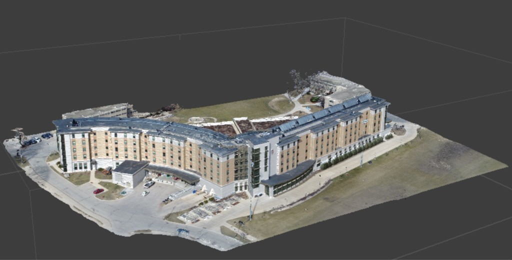
The practical differences the technology is making can also be seen in terms of how models produced by photogrammetry are being used in applications ranging from building information modeling (BIM) and stockpile calculations to terrain surveys and infrastructure inspection. Drones are being utilized to produce 2D maps and 3D models via photogrammetry, which includes creating renderings of buildings, job sites, infrastructure and more to capture more information, quicker and cheaper.
Given these distinctions and as the CEO of DroneView Technologies, you might think Michael Singer brings drones into the conversation with clients sooner rather than later, but that isn’t necessarily the case. His company is dedicated to bringing the right platform and sensors to a project and not forcing a UAV into a situation when other platforms such as manned aircraft and/or mobile LiDAR may be a better fit for the project. Drones are increasingly relevant when those conversations begin to explore sensor solutions, especially as all of that relates to cost, but the capture methodology is not where these conversations begin or end.
“Whatever your sensor platform, it has to be utilized enough to pay for itself,” said Singer. “There is a large divide today between a quality image sensor, which might be what comes with a prosumer drone at one end, and a high-quality LiDAR platform on the other. That high-quality LiDAR platform can be an extremely expensive way to acquire data, but with the demand to use it with great frequency, you could make a business case. The combination of imagery and LIDAR changes this paradigm, but it all comes down to accuracy, because if it’s not accurate, it's worthless, no matter what the cost is.”
Accuracy needs should define technology adoption plans, but those needs depend on numerous factors, with the environment being a major one. Situations with lots of vegetation, or with poor lighting conditions, means imaging is unlikely to provide an ideal result.
Additionally, if the alternative to utilizing the potential photogrammetry or LiDAR solution is that much more costly, an investment can make a great deal of sense. That one cost might be astronomically lower than the cost of putting together an army of people to traverse a field. Understanding how such potential applications can augment or change existing approaches is the key to creating value, with new options around the simultaneous capture of information introducing a whole new level of capability for stakeholders to consider.
Some of the best solutions that are available today seamlessly use the information provided by both photogrammetry and LiDAR are designed to generate accurate, robust deliverables at the lowest cost. Doing so is something the Phoenix LiDAR Systems team is focused on.
“The barrier to entry is lower now,” said Grayson Omans, CEO of Phoenix LiDAR Systems. “The fact that it doesn't take a million-dollar investment to enter the market means that it's no longer limited to big engineering firms with big overhead. Smaller companies can offer the service. This is driving the prices and increasing adoption/development.”
What’s also enabling this adoption is a better understanding of who needs to access what. A plant manager is going to need access to information related to a drone program that looks much different than the information that the accountant needs. Questions around who is consuming this data, how it’s being presented, and who needs access to what type of information, are all being considered in greater detail to further enable the value of the technology.
On a technical level though, those logistics and considerations have very little to do with what solution or sensor is being utilized. The existing and expanded capabilities and opportunities associated with photogrammetry and LiDAR further highlight how the topic has evolved.
Redefining What “Photogrammetry + LiDAR” Can Mean
Because photogrammetry and LiDAR are inherently doing different things, using them in combination is a concept that always made sense. However, logistics and budget often prevented attempts to make this connection. With many of those barriers removed thanks to drone platforms that are cheaper and more powerful, these connections can now be explored in a whole new way.
“They are absolutely complementary technologies,” Omans told Commercial UAV News, “LiDAR has traditionally been more expensive, so for many projects the first question people have is ‘can I do it with cameras only’. To answer that question, you need to have a good grasp on the area you are surveying and the deliverables you are going to generate.”
The benefits associated with a deliverable that can rely on both technologies is evident, as LiDAR could model a forest bed under tree canopy while photogrammetry could be utilized to create a 3D point cloud and photorealistic mesh of a structure near that canopy. The effort to utilize photogrammetry when you’re already set with a LiDAR sensor might seem unnecessary, but that isn’t necessarily the case.
“LiDAR is not, in all ways, superior to photogrammetry,” said Barrera. “LiDAR employs very precise active sensors that generate 3D point clouds by bouncing light beams off of all objects in a scanned area. The light rays can penetrate vegetation to model underlying elements that go unseen by passive, visible light sensors found in aerial cameras. However, equipment costs are generally higher, as is the cost in training employees to use the equipment competently and adapting workflows to accommodate LiDAR-generated point clouds.”
Photogrammetry can be a superior solution on account of its’ ease of use and ability to transition from non-modeling uses of drones. That’s why an end product that combines photogrammetry and LiDAR is typically more accurate. While LiDAR is more accurate than photogrammetry, oftentimes photogrammetry can be the best solution depending on the type of project and the mapping products required. These requirements should drive the ultimate approach, but these recent innovations allow users to explore what this combination of photogrammetry and LiDAR can look like in a whole new way.
“Combining both imagery and LiDAR may be the best (highest accuracy) solution in some cases, but it depends on the project specifications,” said Singer. “Simultaneous data acquisition allows sensors to operate and acquire data that can reduce errors that were introduced in the past by flying two separate sensor missions. Airborne GPS data, atmospheric conditions, site conditions and countless other factors can all vary over time and affect the quality of data acquisition.”
While the possibilities associated with the simultaneous collection and combination of images and LiDAR are more attainable than ever, it’s a combination that really needs to be thought through in terms of hardware, software and process. The combination of the two modeling technologies often costs more than employing one system or the other. Additionally, combining the two distinctly different model outputs (the LiDAR cloud and the photo mesh) requires more expensive post-flight processing to align the two.
In some cases a higher-end sensor or sensor type that cannot be co-mounted on the platform may be required, which means simultaneous data acquisition is not possible and two separate data missions are the preferred solution. Companies that are using drones for the first time or considering investing in them for aerial mapping and modeling likely need to start with a much simpler process.
Where operators and stakeholders are at in their adoption phase is also critical to consider, as it should further define the choices around photogrammetry and/or LiDAR solutions. An organization might not be ready to adopt or consider what a “photogrammetry + LiDAR” could look like for them today, but they can establish a framework to get there tomorrow. Regardless of what decisions are ultimately made, that kind of planning needs to simultaneously define what it will mean to provide an ROI in the short and long term, which means numerous factors and considerations beyond the technology itself need to be taken into account.
Begin at the End, and Ask the Right Questions
It wasn’t so long ago that surveyors were very wary when it came to adopting tools like drones. There were real questions about whether or not the claims related to accuracy would line up with reality. That made it essential for service providers to not just talk about what they were going to do, but to prove it. Their doing so in terms of the data and the ROI has eliminated much of this skepticism.
That said, not every surveyor has a drone in their truck, and while some organizations are upgrading their existing drone programs, others are just now beginning to take a serious look at adoption. How can someone define value with this technology, no matter where they are in the adoption process? And how should considerations around sensors and other innovations be considered as part of it?
Operators should begin at the end of their workflow or project by considering the final product or deliverable in terms of its’ accuracy requirements and how all of the stakeholders will need to utilize or interact with this final product. Stakeholders need to fully grasp exactly what kind of value adoption will create in terms of an ROI or more efficient process. There may be several ways to define a more efficient process that includes photogrammetry and/or LiDAR solutions, but the difference needs to be understood before anything with existing processes actually changes.
Some of the questions that people should be asking when they’re making decisions about utilizing photogrammetry and/or LiDAR for a project include the following. These are some of the questions that the teams at Droneview Technologies, Phoenix LiDAR Systems and Skyward utilize when discussing the merits and challenges that certain solutions might present for a given project.
- What level of accuracy is required?
- What are the deliverables I am generating?
- What is my budget?
- Can I reference some accuracy standards such as ASPRS or NSSDA?
- Is a photorealistic 3D mesh required?
- What technology is the best fit for the capability of my operators, data processors, end users and company?
- What are the characteristics of the project area? If it is open and flat - image only is an option. If there are wires, vegetation - LiDAR is a must.
- How big is the area?
- Is this solution a short term investment that will create a path to a long term approach or program?
- How is the ROI being measured in terms of our bottom line per project and an annual basis?
- What regulatory challenges or certifications that need to be addressed?
Anyone sorting out whether photogrammetry or LiDAR is right for them needs to ask the right questions and know what they’re getting into, but that advice is the same as it was years ago, and it will be the same years from now. What’s different is that today, these solutions have proven they can deliver the accuracy as promised, which means adoption is about understanding the applications and limitations of both.
What’s also different is the availability of resources like Skyward’s Program Start package, the services offered by companies like Droneview Technologies as well as the solutions from organizations Phoenix LiDAR Systems. These resources, services and products are enabling stakeholders to understand their photogrammetry and LiDAR options in a way that has seen many define brand new workflows that create value in the present while opening up countless opportunities for the future.
5 Things You Need to Know About Surveying with a Drone
LiDAR for Drones: Direct Georeferencing vs Traditional Aerial Triangulation Systems
Drones (Photogrammetry) vs Terrestrial LiDAR - What Kind of Accuracy Do You Need?


Comments