|
|---|
A four-part series exploring when and how drone technology can be considered and utilized in place of or in addition to other potential solutions. |
|
How accurate does the information you're gathering need to be? What does survey-grade accuracy really mean? Will gathering information that fits this description make a difference for your project?
These are just a few of the questions that professionals working in industries that range from construction to mining to oil & gas deal with when it comes to evaluating the merits of capturing 3D data using a drone equipped with only a camera (photogrammetry) versus using a terrestrial laser scanner. It's absolutely possible to mount a laser scanner on a drone, but for the purposes of this discussion, we're focused on what it means to compare photogrammetric data captured in the air via drone with LiDAR data captured via a ground-based laser scanner.
While survey professionals have historically relied on terrestrial lidar to gather actionable info, drone photogrammetry solutions are increasingly capable of gathering data that professionals require. Does that mean we'll soon see the death of laser scanning?
Traditionally, the main challenge with laser scanning adoption was cost. Those costs are a major discussion point in the
photogrammetry vs LiDAR argument, mostly because in this type of comparison, LiDAR is still more expensive, even though the technology is
now more affordable than ever. As people on both sides of that debate will tell you though, costs really shouldn't be driving the decision, because the limitations and strengths of each technology should be the essential focus. Those inherent strengths are just part of the reason we're nowhere near seeing the death of the laser scanner, and why most professionals talk about the importance of
defining the accuracy you need on a given project before discussing one solution over another.
Since the question remains whether survey-grade information is absolutely necessary, most professionals concede there's no
silver bullet solution. Just like comparisons of
drones with manned aircraft and satellite solutions, what makes sense is going to depend on what it will mean to serve the clients’ needs as well as possible, and the best answer can even be a combination of these technologies. That said—there are some good rules of thumb to keep in mind when it comes to decisions about staying on the ground or taking to the sky.
Choose Drone/Photogrammetry When…When the area to be surveyed is large and outdoor, it’s often best to use a drone for the job.
Drone technology can cover a large area with a single unit and a few batteries. That area can be exponentially expanded with a few units, but there are limitations in terms of scale. Such an application is good for an area that is hundreds of acres in size, but it's not going to be the best approach for an area that’s hundreds of miles in size.
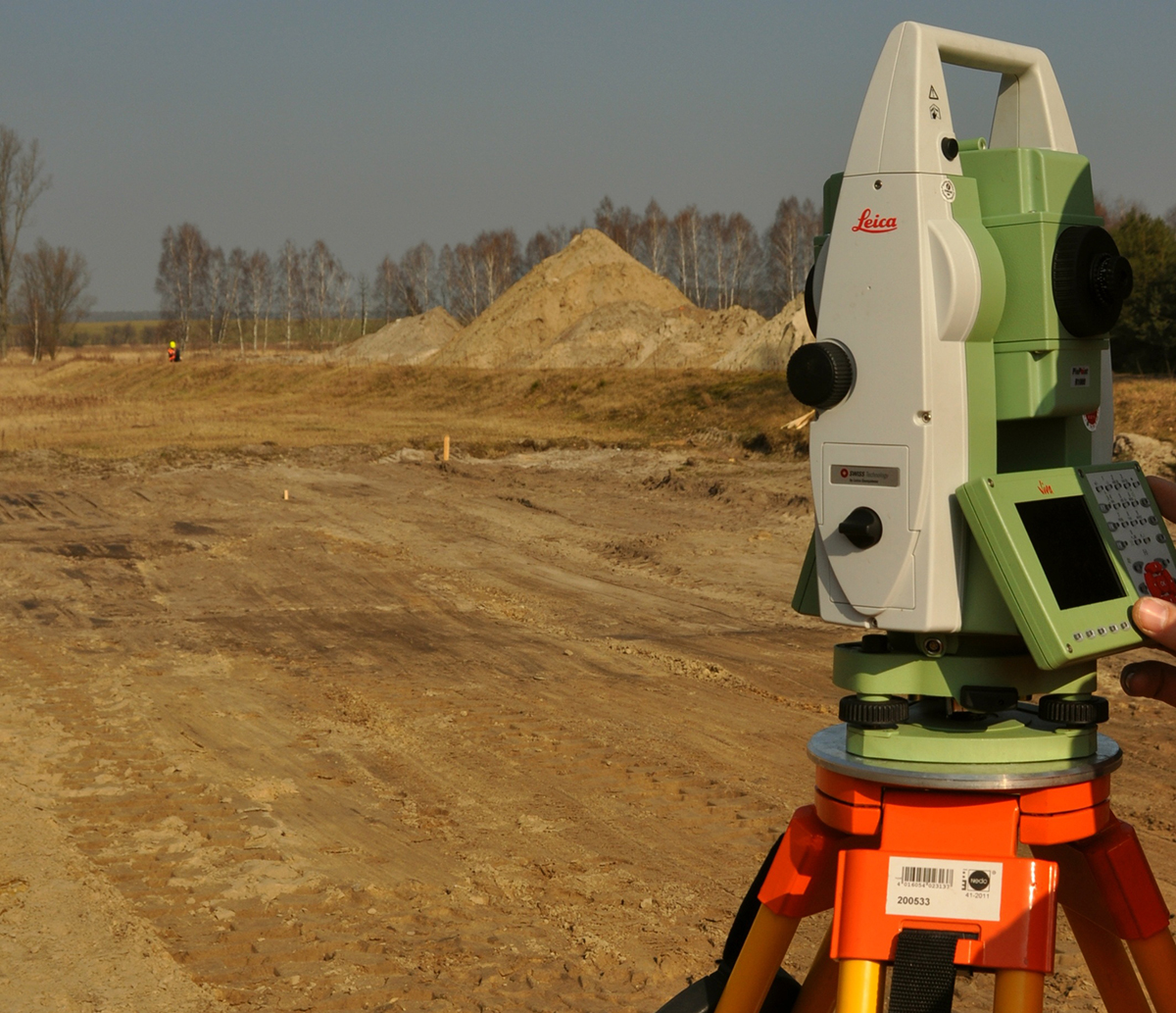
Choose Terrestrial LiDAR When…When a high degree of accuracy is important, terrestrial LiDAR is oftentimes the best choice.
As an example of this, consider the archeological survey of an area containing Mayan ruins, explains says
Dan Hubert, owner of
Modus Robotics. "They might take an approach of using LiDAR [attached to a plane] flying over the top of the ruins, to get through the vegetation, to see where that civilization’s remains are."
How does terrestrial LiDAR tie-in? They can be the right choice when you need a detailed look at this kind of site. After a LiDAR-equipped plane makes its flyover, professionals might want to get minute detail on a part of the topography surveyed. For that kind of detail, it can make sense to employ a terrestrial scanner, which will provide detail down to the 1 millimeter-level.
“Now you have a historical document that you can load into an archeological or GIS database,” Hubert says.
Choose Drone/Photogrammetry When…There are times when it makes more sense to add a drone to the process you already employ. That said, a firm must know whether it’s logical to use a drone or not for a given situation, otherwise trying to integrate one can create unnecessary confusion.
“Is drone data collection going to help?" Hubert asks prospective clients. "And how might data automation get you a competitive advantage?”
Much of this goes back to the question of how accurate the data being gathered needs to be, and it's one that needs to be asked and answered at the beginning of any project.
Choose Drone/Photogrammetry When…Drones meet or exceed expectations of delivery of data.
“People are using Part 107 to find savings that reduce walk time, and which allows skilled labor to go to an executable skilled labor job, rather than to an inspection job,” Hubert says.
Choose Terrestrial LiDAR When…The job calls for contour mapping. Some jobs require it, and a drone isn’t necessarily equipped to provide such detail.
Choose Drone/Photogrammetry When…Obstructions are in the way. If a job requires mapping around a power line or another obstruction, sometimes drones are just the right tool for the job. Ground-based laser scanners often can’t handle such tasks as efficiently as drones.
Choose Terrestrial LiDAR When…It is required by job specifications. However, consider how information gathered via drone could create a new value proposition.
Mapping below a tree canopy or another obstruction requires LiDAR, and clients will often mandate this approach. However, similar mandates might exist for a transmission line job, and there's an opportunity to utilize a drone in this circumstance. It’s all about the right tool for the right job, and more and more that means utilizing drones
and terrestrial laser scanners together.


Comments