

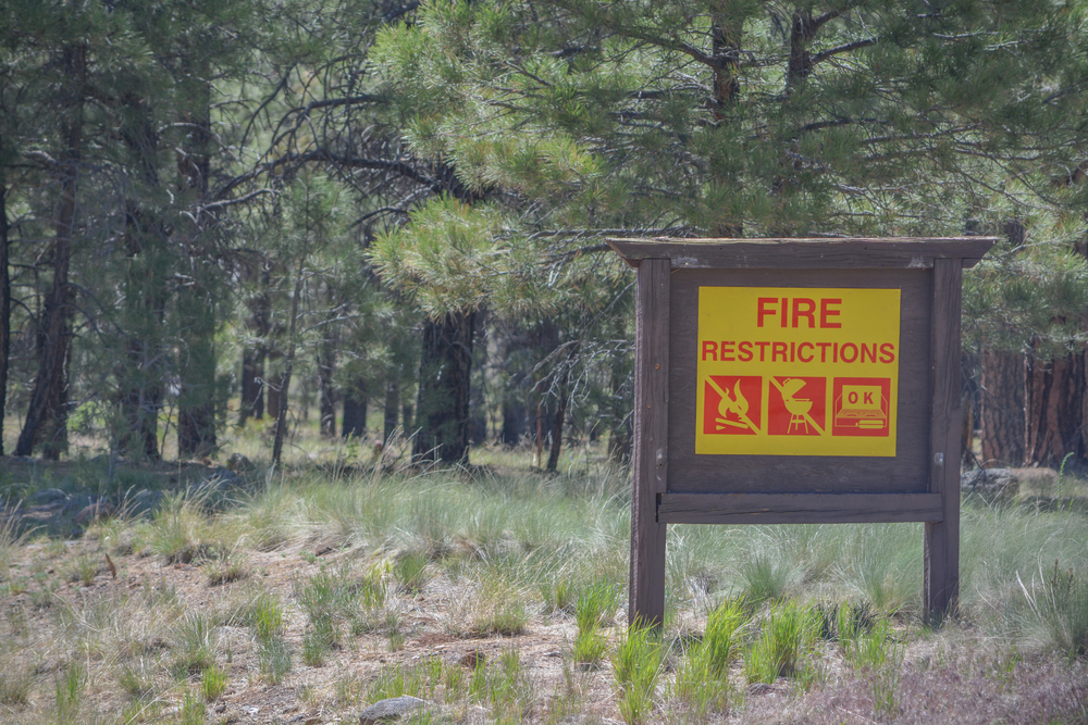
I recently spent some time in the wilderness of Arizona. While the desert setting was beautiful and the red rocks were mesmerizing, something felt off. Every trail head featured warning signs telling visitors that campfires were strictly prohibited, the drive through the desert featured scarred blackened trees, and the only natural source of water visible was at the end of eight-mile trail. Despite Smokey the Bear saying the fire danger that day was moderate, it was obvious that this area was taking no risks when it came to wildfire prevention.
The western United States has been badly burned by wildfires, which seem to become exponentially worse each year. According to the National Interagency Fire Center, 1,815,628 acres have burned this year already. That is above the 10-year average.
Thankfully, drone technology has made great advances to help aid the U.S. Forest Service in wildfire prevention, detection, and mitigation. In light of the start of wildfire season, now is a good time to look at few of the organizations that are lending a helping hand.
Detection and Surveillance
Wildfire prevention tactics are essential when it comes to reducing risk. Signage communicating that campfires are prohibited is a start, but campfires alone are not to blame. This is where drone technology has taken prevention along with early detection to a new level.
The use of drone imagery and GIS has proven to be a valuable source of information, specifically around utility infrastructure. Utility company EDM International combines aerial imagery with GIS to pinpoint towers that are at risk of malfunctioning and sparking brush at the base of them, causing a fire to start. With their drone data, they can quicky asses what towers are in high-risk zones and get them fixed quickly.
Monitoring fire behavior when they inevitably start is essential for effective surveillance. Understanding the direction and rate of spread enables responders to make informed suppression decisions and issue timely warnings to those in the path of the fire.
CAL FIRE is a perfect example of a drone surveillance use case. They receive support from the California Air National Guard, who provide military grade drones to gather that data. These rugged drones can fly above 30,000 feet and for over 27 hours, and are equipped with sensors that provide real-time intelligence and can operate at night and through dense smoke.
Another impressive case for early detection and mitigation is by Dryad Networks. This company uses a two-step approach with their technology to rapidly detect the fire and extinguish it within 12 minutes. Dryad's Silvanet sensor network (AI-powered gas sensors) detects the fire within three minutes of ignition. Then an observation drone autonomously launched to locate the fire using optical and infrared imaging, followed by a Silvaguard suppression drone that automatically extinguished it.
Mitigation
For nearly a century, airplanes have been fighting fires overhead, now it’s time for drones to join them.
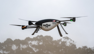
Seneca, a California-based startup, has developed an autonomous drone system designed to suppress wildfires in their earliest stages before they can grow catastrophic. A "strike team" consists of five drones and a launch station, with each drone carrying 100 lbs. of class A foam.
When a fire is detected through the local dispatch system, the drones launch automatically with the goal of reaching the fire within 3–10 minutes, using thermal imaging to pinpoint the fire's exact location and deliver a precise attack. The drones are particularly valuable in hard-to-reach terrain where ground crews would otherwise have to trek in on foot, getting there faster and without putting firefighters in harm's way.
Wildfire technology startup, FireSwarm, is launching with an “ultra heavy-lift” drone that carries about 105 gallons of water. Additionally, the company is working on an AI and machine learning algorithms and fire mission kits. They have tailored their products to perform in instances when traditional aircraft cannot and fill in the gaps for wildfire response with their drones being able to operate around the clock.
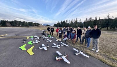
Lastly, the next generation of wildfire innovators is already in training. Students at Lane County Community College, in partnership with the Oregon Department of Aviation, are conducting experimental drone flights out of a local airport, researching the most effective ways to detect and extinguish wildfires in Oregon. The field is still young, but the emergence of dedicated coursework and hands-on research at the collegiate level speaks volumes about where wildfire prevention is headed.
From AI-powered sensor networks that detect fires within minutes of ignition, to autonomous drone strike teams that can reach remote terrain faster than any ground crew, to the next generation of researchers already training on the front lines of this problem. The technology isn't just promising; it's urgently necessary. Those no-campfire signs aren't just rules, they're a sign of how fragile the balance has become and why the technology in this article matters.


Comments