

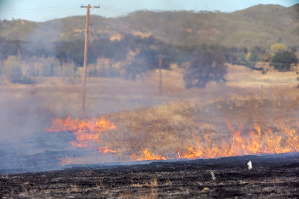
It has become increasingly clear over the last decade or so that wildfires are a growing concern around the United States and other parts of the world. Although these events have always been present in some form, more areas around the nation have to worry about these incidents, and areas like the Pacific coast are seeing their wildfire seasons continue to grow in length. For utility owners in particular, this concern is changing the way they work and many of their processes. Thanks to increasing demand and drier climates, monitoring vegetation around assets and other potential wildfire sparks is critical to safeguard not only their own assets, but most importantly, the surrounding communities.
The good news on this front is that new technologies are a significant boon toward these efforts. EDM International is a good example of this. A consultant company that works with utilities around the U.S., EDM International has recently started a new methodology for wildfire prevention that they say switches the focus from reactive measures to proactive ones by combining the power of drone imagery and GIS. Recently, Commercial UAV News spoke with Greg Benton, the company’s media manager and UAS program coordinator, as well as Taylor Barnes, a GIS analyst, about this wildfire mitigation process and how the two departments work together to help utilities proactively address wildfire risk.
In the conversation, Benton acknowledged this growing risk of wildfire around the country. He noted that areas like the west have always dealt with this, but due to drying vegetation, even urban areas in other parts of the country are having to worry more than ever about these risks.
“Wildfire concern is increasing across the U.S. in a huge way,” Benton said. “Areas that have high vegetation are drying out, and some of those urban areas are even at risk for just grass fires. That’s what is really driving so much need for this kind of [risk mitigation] work, because fire conditions are changing rapidly, and utilities are struggling to catch up.”
.jpg.small.400x400.jpg)
To help with this issue, EDM International has begun to roll out a new process for its customers that combines two critical pieces of technology – drone imagery and GIS, in this case powered by Esri’s ArcGIS – that takes real-world conditions and places them in an accurate geographical context. By taking what we know about how wildfires start, particularly in relation to utilities, pilots can go out and capture imagery, and EDM’s GIS team can place the imagery within ArcGIS and run analyses to both find potential defects and also discover areas of risk that can be addressed by field teams.
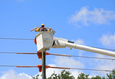
“The core of this issue,” Benton said, “is that a lot of these companies have millions of poles, and a lot of that was put up 30, 40, 50 years ago and is in poor condition. As it relates to what’s going to cause a wildfire, you start getting into: How are you building those wildfire risk zones? How are we starting to prioritize those millions of poles down to something that’s manageable and we can put onto a yearly schedule for inspection? The predictive nature of all this is that we know what’s likely to cause a fire. We have that data now after years and years of work. So, what sections of the pole can we start to tackle and look for those specific defects in advance?”
In terms of what specifically makes up that risk, Barnes tells Commercial UAV News that the GIS team takes the imagery and is looking for a number of different factors. That includes things like temperature, rainfall, and seasonal effects. From there, he says they can “assign weights to those different variables and bring them all to the same model to begin identifying where those high-risk zones are so we can preventively go out and get those areas fixed up.”
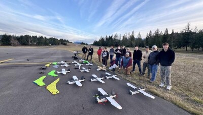
EDM International has evolved over time with regard to its use of drones in general, which, of course, are utilized for other purposes beyond this wildfire risk analysis. In the program’s inception, Barnes tells Commercial UAV News, the GIS team also made up somewhere between 50 and 75 percent of the drone pilots. As the use of these tools became more prominent, though, the team realized that they should bring a dedicated team of drone pilots aboard in order to scale their work and complete more projects, allowing the GIS team to focus on their work in the office.
Today, Benton leads the company’s UAS program, with the pilots making up a mix of those coming from a utility or GIS-based background and others coming from a photography background. Perhaps surprisingly, he told Commercial UAV News that he often has an easier time training the latter.
“What I’ve found in terms of training a lot of pilots is that I actually get a little more efficiency in production out of people that have not come from the utility or GIS space,” he said. “Some of the photographers that come in, as long as we’re doing the things we need to do from a safety perspective, they’re out there ready to take a thousand photos a day.”
Barnes also spoke to what the GIS team is asking of the drone pilots to make sure the entire process works smoothly and the in-office team has the data they need to run analysis. He noted that the pilots are savvy enough to know that if they see major issues, they should call it in right away. However, most of the time his team doesn’t expect or ask the pilots to go out of their way to identify specific issues, but rather to focus on the quality of imagery.
“Number one, we’re looking for clean imagery coming in, high-quality photos, correct exposures, things like that. But then we also give our pilots criteria on a lot of our projects. So, for instance, we need to look at both sides of the structure. The nadir image is really important for us, too. So we don’t necessarily tell them to be on the lookout for certain types of defects, or to zoom in on certain photos, because the drones themselves are so close to the poles that we can see everything without getting more specific requirements from the pilots.”
This use case for EDM International is enabled, according to Barnes and Benton, by the company not being a utility owner itself but rather a consultancy that is smaller and able to be “more nimble and agile,” trying out new methodologies. These kinds of solutions are necessary for a changing world with evolving problems, and for wildfire risk in particular, they are showing that the combination of drone imagery and GIS analysis can help shift the approach to this problem from being reactive to proactive.


Comments