

As veterans in the UAV industry will know, we are long past the point where being able to simply fly your drone is enough to sustain a successful business in today’s world. It certainly helps, but the most successful pilots in the industry will also bring in other knowledge from whatever industry with which they are working, as the UAV market continues to grow and competition for services may be saturating. While it’s generally not required to be an expert in a given field, be it agriculture, mining, utilities, or any other sector, having at least a baseline knowledge to know what customers need for deliverables and be able to speak their language is a way to separate yourself from the competition.
While there are, of course, a number of sectors for which UAV pilots can find work, many of them will in some way involve geographic context and mapping, with Geographic Information Systems (GIS) playing a major role. This presents one of those opportunities for a pilot to separate themselves from potential competition. As noted above, it’s not about becoming an expert in GIS – something that would take years to truly accomplish – but just having the base knowledge can make offerings that much more appealing for those across many sectors.
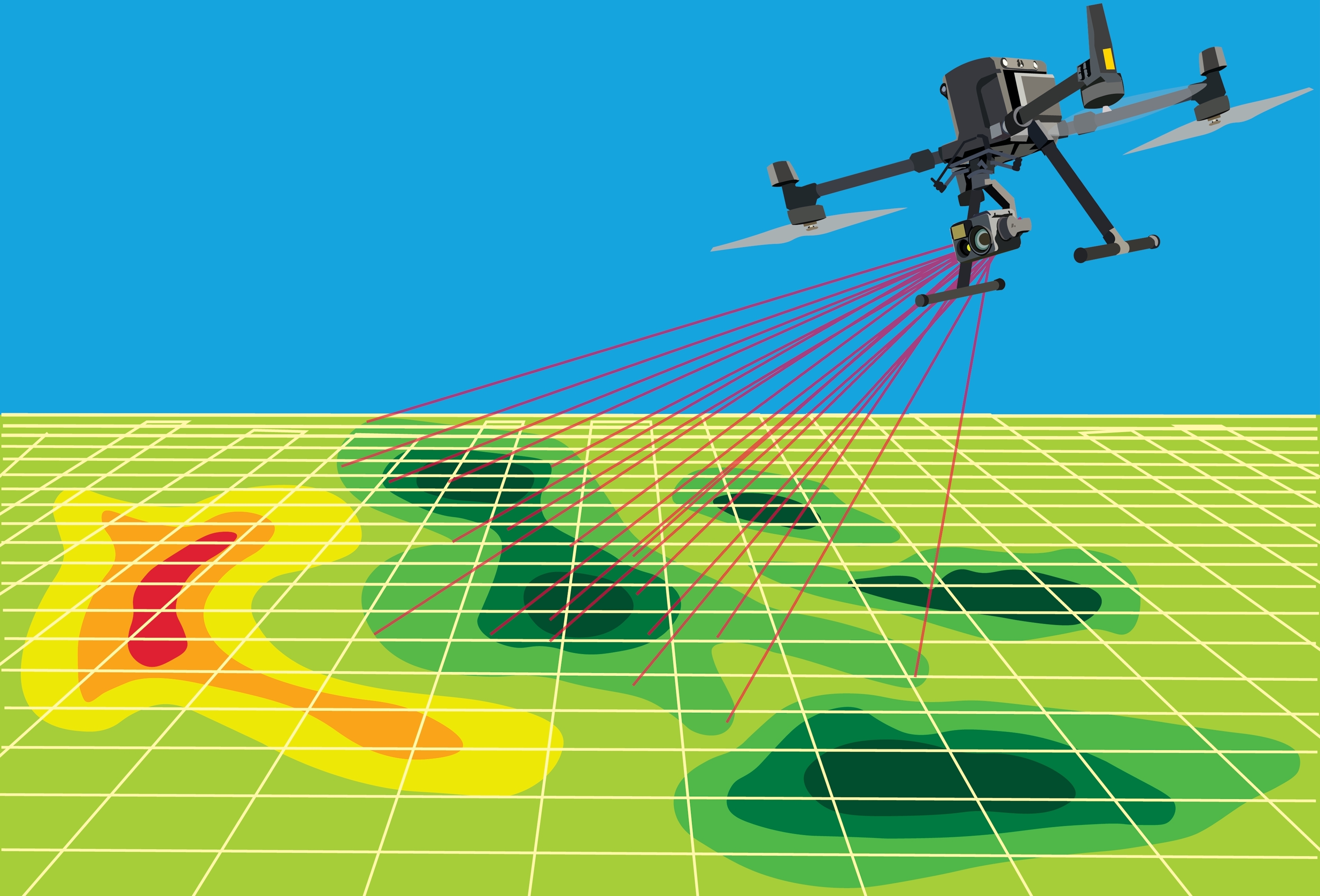
Earlier this month, I spent the week in San Diego attending the Esri User Conference, bringing together geospatial professionals across the world, with Esri being the leader in GIS tools by a significant margin. Conversations and presentations throughout the event varied, but drone data was being utilized within GIS systems in many of the examples showcased by users. As the technology becomes more sophisticated and remote sensing data more accessible, those in fields like utility management, environmental monitoring, and public safety, among others, are using drone data to enhance their GIS workflows to tie high-quality imagery to precise geographic locations. Being able to serve this market and know what the end user is looking for in their deliverable goes a long way in today’s drone services market.
So, what do pilots really need to know about GIS? To start, it helps to understand what GIS actually is. At its core, a Geographic Information System is a framework for gathering, managing, and analyzing spatial data. It connects various data points to specific locations, allowing users to visualize patterns, track changes over time, and make informed decisions based on geography. For UAV pilots, that means the imagery, point clouds, and models you capture aren’t just standalone files, but rather part of a larger spatial dataset that informs real-world decisions.
One of the biggest things that can trip up drone data once it reaches a GIS workflow is how it’s georeferenced, or how it’s not. Coordinate systems and map projections are critical pieces of the puzzle, dictating where data appears on Earth and how accurately it lines up with other spatial layers. If your orthomosaic or point cloud is in the wrong projection, it won’t match up with site plans, infrastructure maps, or survey data, even if it looks fine on its own. This is where accuracy becomes a real factor, especially for work in construction, surveying, or environmental monitoring. Ground control points (GCPs) or RTK/PPK workflows can drastically improve the positional accuracy of drone outputs, making them more reliable when integrated into GIS platforms. Without that level of control, even high-resolution imagery can fall short when precision is needed.
Just as important as where your data sits on the map is how it’s structured, which is where file formats and metadata come into play. Deliverables like GeoTIFFs, shapefiles, or LAS point clouds are standard in GIS workflows because they carry the spatial reference information that software platforms need to place them accurately. But even if you export the right file type, stripping out or failing to include the metadata adds more layers of complication for the end user. Details like the coordinate system, timestamp, altitude, and camera specifications help GIS professionals assess data quality and consistency, especially in long-term projects with repeat flights. Simply put, the more context your data provides, the more valuable it becomes once it enters a spatial analysis environment.
This basic level of GIS knowledge can go a long way in making drone service providers more effective and marketable across a wide range of industries. In construction, understanding how to align orthomosaics with site plans allows for accurate progress tracking and quantity measurements over time. In utilities and infrastructure, it helps ensure that asset inspections or corridor surveys integrate cleanly into existing GIS databases, speeding up analysis and reporting. Environmental consultants rely on georeferenced imagery and elevation data to assess erosion, vegetation health, or flood risks, all of which depend on accurate spatial context. Even in real estate, insurance, or agriculture, clients increasingly expect deliverables that can be dropped into a map or dashboard and immediately make sense.
In short, while GIS might feel like a separate world from flying drones, the two are becoming increasingly connected, and that connection is only going to strengthen as more industries adopt geospatial tools. For pilots, having a foundational understanding of GIS isn’t about replacing analysts or diving deep into software. It’s about being able to provide data that integrates smoothly into the workflows your clients already use, and to understand enough of their expectations to deliver value beyond the flight itself. As the market continues to mature, that kind of awareness can be the difference between being just another drone service provider and being a go-to partner for long-term, high-value projects.


Comments