

The exhibit hall at XPONENTIAL features solutions that define every aspect of the drone industry. While drone hardware systems grab many of the headlines, the practical value being created by innovations that can be connected to and supplement these systems is just as notable. The drone traffic management and airspace awareness solutions on display from Dronetag highlight what this value can look like.
Recognizing Remote ID requirements that require all aircraft to be digitally visible, Dronetag has created products that are designed to both manage a fleet and keep teams and security personnel informed about other drones in the airspace. At XPONENTIAL 2025, they showcased two solutions that are set to impact exactly what that looks like for public safety, mass events, and critical infrastructure monitoring.
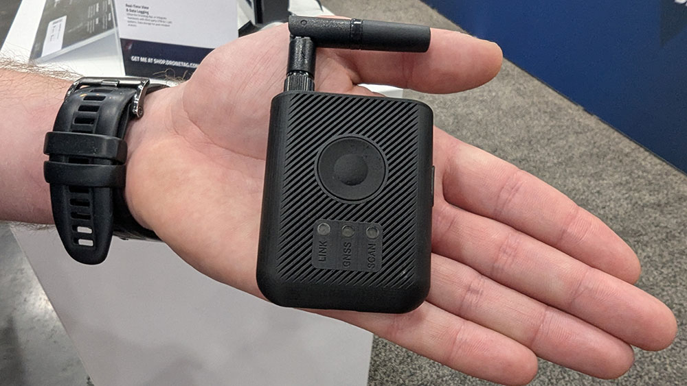
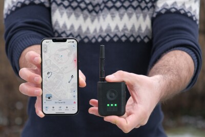
The Dronetag RIDER is a compact, wireless, and battery-powered Remote ID receiver that has been designed to enhance airspace situational awareness. It is drone-agnostic, capable of detecting Broadcast/Direct Remote ID data from various drone manufacturers, with a range of up to 5 km that can be expanded to 10 km with an antenna.
The RIDER provides real-time alerts via an integrated buzzer and LED indicators, transmitting collected data to the Dronetag App (available on iOS, Android, and Web) for visualization and historical tracking. It offers versatile data transmission options, including integrated LTE, Bluetooth, and USB-C, allowing for both online and offline operations. It also boasts a robust design with an IP54 rating and a 6-10 hour battery life for reliable performance in diverse environments
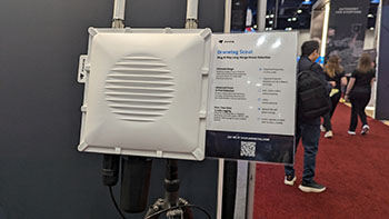 With a detection range of up to 10km (6 miles), Dronetag Scout represents an expansion of these drone monitoring capabilities. Additionally, multiple Scouts can be interconnected to expand coverage even further.
That practical difference that RIDER has made was mentioned by users during the Enhancing Public Safety at Mass Gatherings and Special Events session that took place at XPONENTIAL. Officials from the Florida Highway Patrol and Arlington Police Aviation mentioned how they’ve deployed the technology during special events and highlighted how the product improved situational awareness for their ground teams, enabling better resource allocation and response.
It’s a difference that stems from a realization that public safety officials and others cannot fully rely on their existing systems or connected apps for this type of awareness in the airspace. These tools possess inherent limitations, which have exposed security vulnerabilities and reinforced the need for more specialized capabilities for airspace awareness.
“Departments originally thought they could get everything they need natively from their phones, but certain operating systems don’t allow you to have the kind of access you need to see most drones,” said Jakub Kabat, Head of Business Development at Dronetag. “Our purpose-built solutions go above and beyond the limitations of consumer-grade mobile devices, giving users a true understanding of the drone traffic in their operational area.”


Comments