

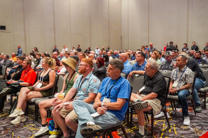
As has become tradition at Commercial UAV Expo, the opening day’s conference track kicked off with the Exhibitor Showcases, during which 13 of the leading companies from across the commercial drone industry presented on their latest offerings and releases. The companies ran the gamut in terms of product offerings, with drone manufacturers, payload suppliers, software companies, and more representing the industry during the session. Below, you can find the second part of our recap of the presentations, covering companies offering positioning and other products. You can also check out parts one and three.
Skyline Nav AI
GPS jamming has been coming up in the news more and more in recent years, and these tactics can be extremely impactful for drone platforms. As Kanwar Singh, CEO of Skyline Nav AI, put it in his presentation, this GPS jamming will bring drones down. He shared his passion for the topic of GPS and how important it is for organizations and governments to have alternative plans for lacking this data, something Skyline’s Pathfinder solution addresses directly. The solution seamlessly switches between GPS, IMU, and imagery data from cameras and leverages machine learning from satellite imagery data to provide precise location data, even in GPS-denied environments. The system has been tested in a variety of locations, including mountainous regions and urban areas, and Singh even shared that the company is working with NASA to apply the technology to missions for landing on the moon.
SYNEREX Inc.
Increasingly, precise positioning is a vital part of how our society works as technology continues to evolve and improve. SYNEREX provides exactly that technology to provide positioning for a variety of use cases with their GNSS RTK technologies. Their customers span a wide range of industries, including autonomous vehicles, precision farming, and robotics. Additionally, as CEO J.D. Park explained in his presentation, there are plenty of drone-specific applications for this technology. Specifically, he called out drone delivery services, which need precise positioning for takeoff and landing, as well as drone training education programs. Their newest solution, the SYN-3000 series, includes dual GNSS RTK, LTE connectivity, a GNSS base station, network RID, remote control, and monitoring.
CHC Navigation USA Corporation
CHC NAVIGATION USA CORPORATION, a geospatial solutions company that creates solutions for survey and mapping, showcased its new drone, the X500. This drone has been through rigorous testing to ensure its durability to support operations across a variety of sectors including construction, public safety, energy and utilities, mining, surveying, and infrastructure.
With the ability to withstand conditions like high altitudes, drastic temperature fluctuations, salt fog, and a IP55 waterproof rating, the X500 is a rugged drone. This drone’s versatility is further enhanced by its capacity to carry up to three payloads simultaneously and its capability to land on moving vehicles. As Tristen D, technical support engineer put it, this is a perfect example of finding higher efficiency without having higher costs.
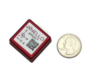
ANELLO Photonics
Dr. Mario Paniccia, CEO of ANELLO Photonics, took the stage to discuss his company’s Silicon Photonics Optical Gyroscope or “SiPhOG.” A small optical gyroscope technology that enables uncrewed vehicles to operate in GPS-denied environments, SiPhOG, Paniccia explained, offers UAV operators “a high-precision, cost-effective solution that can work in any environment.” He presented real-world use cases to demonstrate how SiPhOG can be deployed to help professionals in fields such as agriculture, automotive, trucking, surveying, and defense.
“We have systems now that we’re selling across land, air, and sea,” Paniccia asserted. “I think we’ve changed the mindset in GPS-denied environments with our technology.”


Comments