

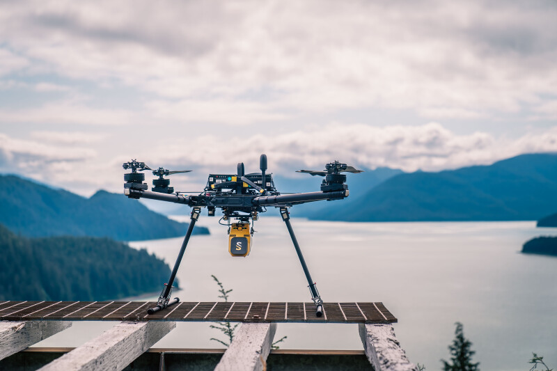
Today, drones are utilized for a variety of functions across myriad industries, with sectors like public safety and delivery representing some of the fastest-growing sectors. The geospatial industry, however, was one of the earliest adopters of technology, and lidar systems for drones remain one of the most important payloads on the market for today’s environment. More pilots are knowledgeable about the technology, too, which was one of the most evident takeaways from this year’s Commercial UAV Expo.
As this industry becomes more interested in lidar technology, and the systems become more accessible for different use cases, it’s important to stay up-to-date with the latest developments. To that end, next week Commercial UAV News will be hosting a webinar sponsored by Frontier Precision to highlight the YellowScan Voyager lidar system. The 60-minute webinar, which will take place on October 22 at 1:00 PM Eastern Time, will feature insights from Keegan Schaefer, a sales and services specialist with Frontier Precision Unmanned, and Nathan Stephenson, a business development manager with YellowScan. Registration is free at the link below.
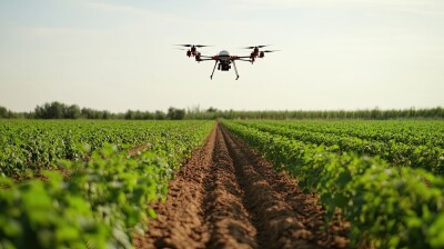
In a conversation with Commercial UAV News, Schaefer noted that one of the big goals for this webinar is to educate attendees about the value that can be provided by lidar in surveying and mapping workflows. The webinar, he notes, will provide value to those just getting into the lidar space and veterans, detailing some of the basics of how the technology works, how it compares to other data-capturing methodologies like photogrammetry, and the evolution of the technology over time. The pair will also detail some of the many use cases for airborne lidar, including but not limited to surveying, construction, and utility inspection.
After some high-level overview of lidar in general, the bulk of the webinar will focus on the aforementioned YellowScan Voyager. The webinar will cover some of the important details around this lidar system, which includes a laser scanner from RIEGL and boasts high point densities with fast data acquisition. Schaefer noted that among the most important themes they will cover with respect to the Voyager will be the operational and cost flexibility, specifically talking about the ability to use the system not only with drones but also easily switching to crewed aircraft like helicopters.
In addition to talking about the specs and capabilities for Voyager, the pair plans to also dive into specific use cases they have seen for the system across a number of industries. Additionally, Schaefer says they will talk about how lidar in general, and Voyager specifically, plays into BVLOS operations. This is, of course, one of the major talking points for the industry right now as the FAA released its Notice of Proposed Rulemaking for BVLOS drone operations. Crucially, he also noted that there will be time at the end for questions from those watching, giving attendees a chance for live interaction with the presenters for questions that arise from the conversation.
Overall, Schaefer said that he wants people to come away from this webinar with a greater understanding of lidar technology and how it can help their workflows, whether they are ready to enter this area today or in the future.
“My ultimate goal for this webinar is that even those without the budget for Voyager come away understanding how lidar can enhance dense vegetation projects or provide valuable historical data. I want attendees to know where lidar really shines compared to photogrammetry.”
Be sure to fill out the form at the link below for free registration to this webinar.


Comments