

Drones can carry numerous cameras and sensors to capture data that makes a difference on projects of all types, but the details associated with what data is being captured and how that information is being utilized makes all the difference in the world. Drone technology is being used to save time and simplify workflows in various places across the United States and Europe, but what can doing so look like in South Africa? UAV Technologies PTY Ltd. utilized drones and lidaretto to find out.
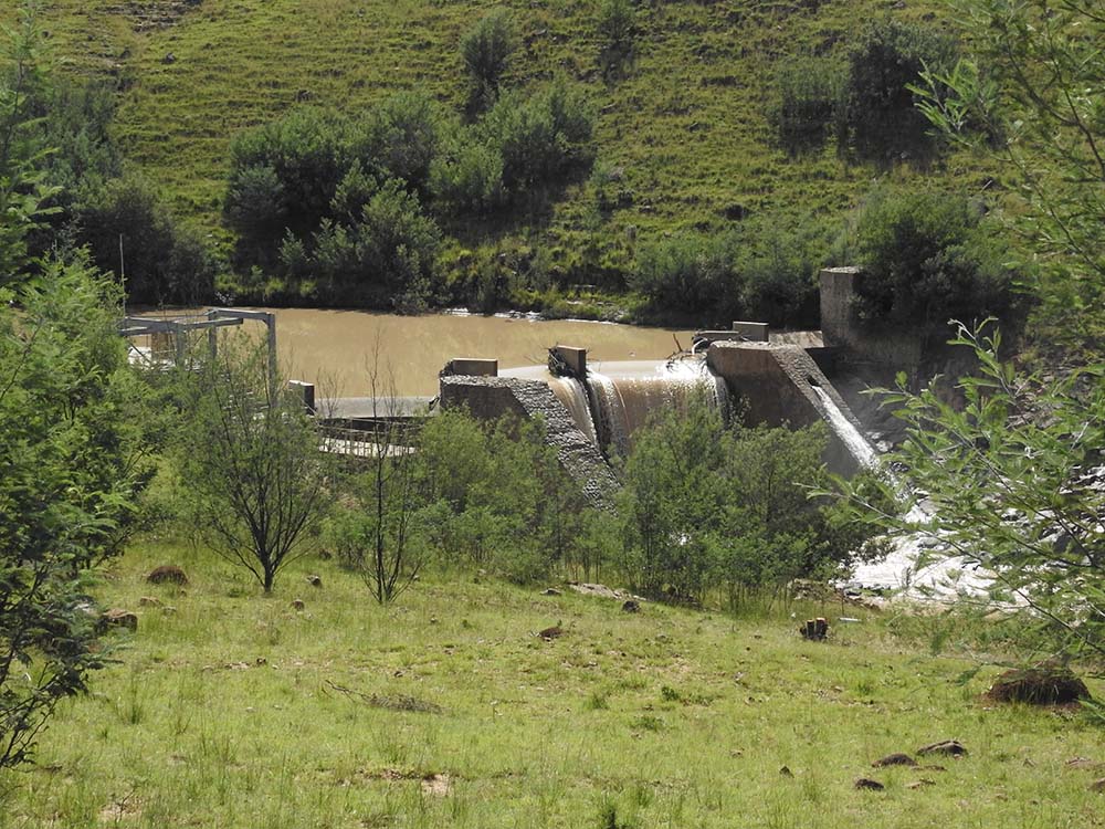
Lidaretto is a mobile 3D scanning system for capturing reality suitable to use either to fly, drive or just walk. The solution produces highly accurate point clouds for various professional applications, which made it the perfect choice for a municipality in the Eastern Cape Province of South Africa that needed to assess water damage. This municipality has had problems with erosion caused by flooding and rain which is why UAV Technologies PTY was hired to utilize lidar to map out exactly where water build up and see the direction of flow caused by years of stormwater damage.
One of the current constraints to UAV monitoring in South Africa is the required South African Civil Aviation Authority (SACAA) regulations which make it very difficult for researchers and small companies to get approval. In order to be issued with this approval, a company must demonstrate all aspects of the business to the SACAA and must have the following numerous roles within their management structure. Mr. Henke Beyers from UAV Technologies PTY Ltd. has utilized lidaretto and drones to demonstrate these elements for approval that makes a bottom-line difference for his clients.
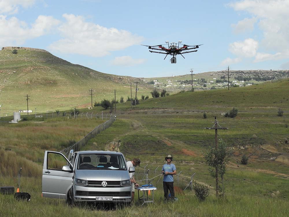
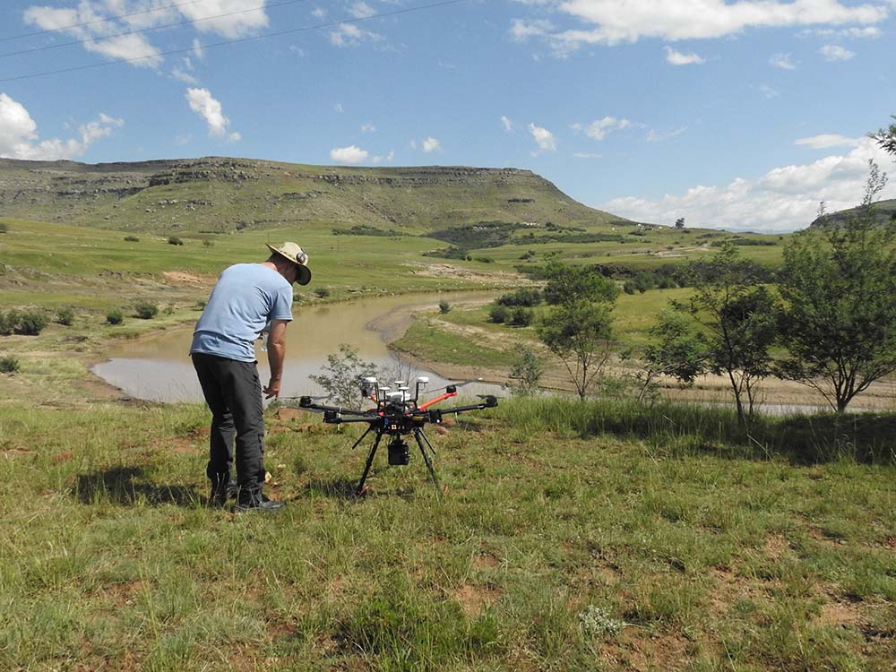
Using manned aircraft over an area that was 20ha would have been feasible but too expensive for this water damage assessment project. They wanted to finalize the whole project in a day, which is why they used lidaretto along with a DJI matrice 600 pro with RTK platform and Geomax GNSS base station. These tools provided Beyers with the mobility needed to capture everything he needed in a single day.
“Over 600 photos captured were captured with an Inspire 2 and X7 for an orthophoto map and then with lidaretto on M600pro,” Beyers said. “Geo rectification was then done with inertial explorer using CORS and RINEX data for creation of .las file. Agisoft metashape was used for the creation of an orthophoto and 3D model. The data we supplied was in a .las file in sageoid10 format.”
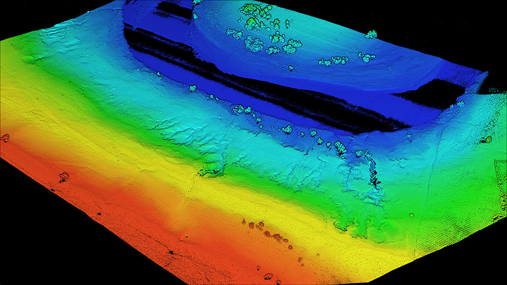
Processing was done the next day in the field to verify accuracy and any gaps in the point cloud. Using lidaretto enabled the team to quickly verify the data and the ability to export the .las file in any datum format made it very usable for their municipality customer. These details showcase how lidaretto is capable of providing a solution that can create accurate point clouds that look great but also allow them to extract relevant information.
“The usability of lidaretto solution is what stands out above all else,” said Beyers. “The setup is quick and easy. Flight planning was done in the office and minor adjustments were in the field before the fight. Without lidaretto on the drone, we could not get this job.”
The team behind lidaretto is committed to providing affordable solutions, which is why they try to get the most out of cost-effective technologies rather than technologies that end up being prohibitively expensive. This single tool can be used in multiple ways, helping to create a more efficient and effective option when compared to traditional methods of capturing data in the field, no matter where in the world that field resides.
To learn more about lidaretto, visit their site.

.jpg.small.400x400.jpg)


Comments