

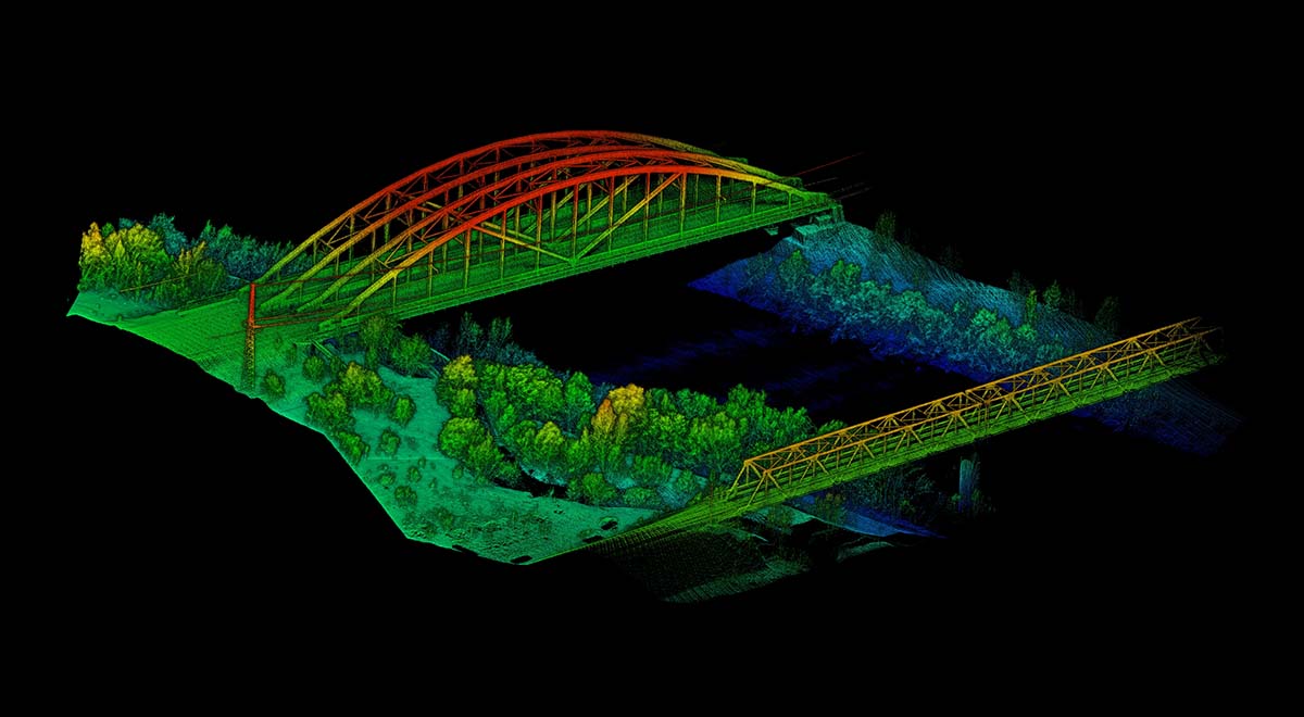
The newest technology and developments in the drone industry all come together at Commercial UAV Expo Europe to addresses critical issues commercial users face when it comes to drones. Understanding how this technology can and will make an impact in the survey space has long been a focus for the event, and it’s why we wanted to take a closer look at Lidaretto from GEOTECH, which represent the first international exhibition for the company. Their product produces highly accurate point clouds for various professional applications such as mapping, surveying, GIS and inspection.
GEOTECH has for more than 25 years been the official representative of Leica Geosystems. Their traditional customers are surveyors, but more and more they’re selling to non-surveyors interested in survey grade accurate GNSS devices. They also resell professional drones with different payload options. Six years ago they became the representative of Novatel which provided them with access to the premium GNSS/INS technologies that have been implemented in their Lidaretto product.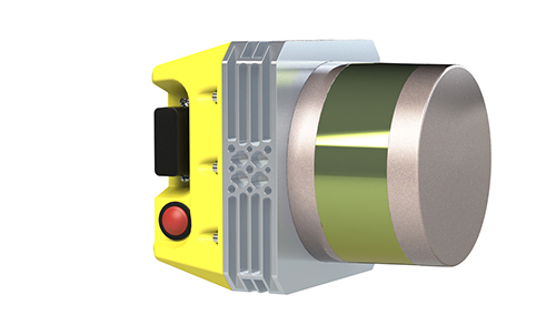 After working for GEOTECH for over 20 years as a specialist on GNSS related technologies, Erik Frohmann has developed a deep understanding of how Lidaretto is being utilized to make a difference on survey projects of all types. We connected with him to talk about how Lidaretto can fulfill the needs for anyone looking for lidar mapping technologies, what specific projects Lidaretto is being used on, what someone should do if they think the product might be a fit for them and more. Jeremiah Karpowicz: Tell us about how and when you first needed to put lidar on a drone for your customer. How did you approach that conversation? What did you learn from it?Erik Frohmann: We built our first lidar about three years ago for a research institution here in Slovakia. They wanted to have a drone with lidar onboard for their geographic research. We looked through the lidar market at the time and did not find a suitable solution that fit the budget of our client. That was when we decided that we would build our own lidar for them.We had a chance to create a highly motivated team of the hardware and software specialists that built, tested and tuned Lidaretto into the current product. We have found that we are able to produce a competitive and quality solution for the lidar mapping market while still listening to the requirements and ideas of our customers. What makes Lidaretto different and distinct from some of the other options currently available? At first, Lidaretto was primarily designed to be used on a drone, but the idea behind it has always been to develop a mapping lidar for multiplatform use so that someone would only have to make an investment in the technology once. After they do, they’ll have a mapping solution that can be used on a drone, car, backpack, scooter or boat, etc. Simply put, it’s lidar that can be utilized on any moving platform.Lidaretto can be even used on a tripod just like a traditional, terrestrial scanner. Users will often find themselves in an area that cannot be scanned with only one tool. For example, you really shouldn’t fly above the houses where people live with a drone, but you can drive around them with your car for scanning purposes. If it’s not possible to drive, you can walk. All of this can be done with Lidaretto.This single tool that can be used in multiple ways still isn’t very common in the lidar market. It’s also an extremely high-quality solution at an affordable price, and that opens up the technology to people that had otherwise been shut out because of the high price point. What are some of the practical and logistical considerations around using Lidaretto? The simplicity of the workflow is essential. The user interface of Lidaretto can be run on a smartphone if necessary, and it’s very intuitive. Users in the field don’t have to do much.We’ve also developed our own PC software we call Lidaretto Creator for producing point clouds easily. We are able to provide some parts of the whole workflow as a service – e.g. processing accurate GNSS/IMU trajectory which requires some skills.
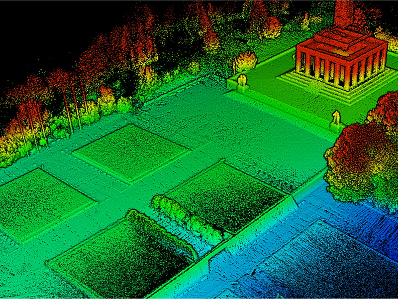
Slavin

.jpg.small.400x400.jpg)


Comments