

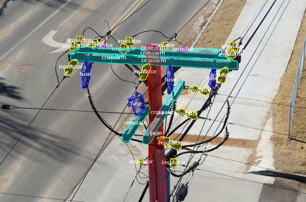
Drones and other automated data collection platforms have changed the way we collect information about our assets. They not only collect an incredible amount of data, but they are also collecting increasingly diverse datasets from multiple types of sensors and payloads. We are now able to visualize and track our assets in ways that would have been impossible with manual inspection processes, and because this data is digital, it is enabling collaboration across departments in unprecedented ways.
New ways to utilize this data is coming out almost daily, and the needs and requirements of the enterprise are becoming increasingly complex. But the key to making all of this work at scale is leveraging AI-assisted data analytics, visualization, and management. Without a way to efficiently comb through, organize, and visualize the collected data, determining what needs to be done may feel a little bit like trying to find a needle in a haystack.
Understanding the capabilities of remote sensing hardware and platforms, and the challenges that come with it, have led companies like Intel to develop AI-assisted SaaS solutions to really tap into the potential of this data and enable it to scale.
Powered by AI-based analytics, Intel Geospatial’s platform is aimed at helping organizations manage, visualize, and take control of their AI and data science portfolio. They provide valuable insights for all stakeholders across an organization about their geospatial data from asset owners to field workers, data scientists, developers, planners, SMEs, and more.
To learn more, Commercial UAV News sat down with Mark Davis, Head of Sales and Business Development at Intel Geospatial, and Rowland Marshall, Co-Head of Product at Intel Geospatial, to discuss the use cases for their platform, industry challenges, and their upcoming webinar, “Intel Geospatial Platform Overview for UAV Use Cases” on Thursday, April 22nd at 2:00PM EDT.
Watch the full interview below and learn more by registering for their webinar here.


Comments