

One of the more interesting aspects of the annual Commercial UAV Expo is the variety of use cases that drones are being used for, which of course is growing with every passing year. That leads to a fascinating mix of industries that have long utilized UAVs, as well as emerging spaces. The latter often gets a large portion of the attention, for good reason as everyone is interested in the next frontier, but there’s always plenty to learn from those with experience in the commercial space as well.
Surveying is perhaps the industry with the most experience using drones for commercial purposes, as they quickly realized that this technology could help both streamline projects already in existence and open up new potential projects that were perhaps unsafe or otherwise impractical to survey and map using more traditional methods. At this year’s Expo, there was a session dedicated to how these workflows have evolved over the years and how companies are currently incorporating drones into their projects.
This session, entitled Surveying & Mapping: Case Studies and Lessons Learned, was moderated by Thomas Haun of the Turner Staffing Group. The following speakers also joined the stage throughout the session, each giving a presentation on how they’re using drones in their work and answering key questions about what goes into these workflows.
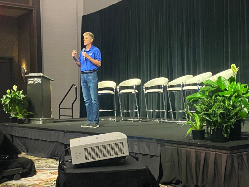
- Robert Wilhite, LJA Surveying
- Jacob Lopez, Towill, Inc., ASPRS
- Carlos Femmer, HDR Engineering, Inc.
- Austin Rains, Frontier Precision
- Brady Richmond, Coastal Frontiers Corporation
- Ramesh Naidu Chalumuri, GVP College of Engineering
Wilhite started off the presentations, speaking about his unique perspective into the drone and surveying space. Relatively new to the industry, he had a background in capturing images as a photographer in the entertainment industry, but he had to learn how the surveying and engineering spaces worked when he first made the career switch. He talked about how the demographics of the industry – “In the state of Georgia, the average age of a licensed surveyor is 58.5 years old, and I would venture to say it’s probably about the same for your state,” Wilhite said – and the resulting aversions to embracing new technology.
That said, he also gave pointers to those looking to start their own drone programs, pointing to the importance of getting the right people, equipment, and pricing, on that last point emphasizing that lower price does not always produce the best ROI. Above all, though, he said it’s most important to always keep in mind what your clients are looking for out of your work, and keeping that idea in the back of your head at all times when building up a program.
Following Wilhite, Lopez took the stage more so speaking from his experience in working with ASPRS. Specifically, he started his presentation by discussing the different standards from the organization for photogrammetry and remote sensing. Following that portion of the talk, Lopez transitioned to a case study for a project completed for the California Department of Transportation. For the project, they had to adhere to standards of using UAS to two centimeter horizontal accuracy and four centimeter vertical accuracy, looking at methods of control, hardware, software, and mission planning. Lopez shared some of the results of his survey, and then ended the talk by saying, “All of these systems, and you see it advertised, they’re becoming more turnkey. But there is still a need for education, and as ASRPS we hope that these UAS standards and best practices can be useful to you.”
Next up was Femmer, who discussed a particular project he and his team worked on surveying the Grand Canyon. He talked about how this project is something that he had pitched three years prior, but one that took persistence to actually get off the ground. Working with the National Parks Service and the Department of the Interior, they had some unique aspects to the project, such as needing to work with a biologist due to endangered condors in the area. Ultimately, they covered about 1000 acres with eight hours of flight time using two drones. What was particularly interesting with this case was that Femmer and his team not only provided the simple video of the area of interest – which is what the Grand Canyon was looking for – but also provided them with other data that was captured, and now for future projects have contracts to provide the video along with other surveying and inspection information.
After a few presentations focusing more on the photogrammetry workflows with UAV surveying, Rains spoke about lidar in surveying and how to achieve survey-grade accuracy. He discussed some of the advantages of using lidar, including being able to get accurate data beneath vegetation, and how implementing this aerial programs can keep surveyors safer than traditional boots-on-the-ground workflows. From there, he talked about how to use ground control points (GCPs) to get the most accurate data, as well as the importance of lidar verification shots. “GCPs, like we all know, are great for X, Y, and Z verification, but the biggest residual error that happens in lidar data is going to be that Z. So, you want to have some lidar verification shots just to make sure that everything is cleaned up, surveyors can use it and there’s not just going to be an accuracy in certain parts of the project but not in the entirety.”
In the next presentation, Richmond looked at some of his work surveying and monitoring coastlines and oceans, which is one of the fastest growing and most important surveying sectors right now. He talked about some of the different challenges and approaches that arise from these workflows, which are often unique compared to more traditional land-based surveying. Specifically, Richmond discussed two programs he’s worked on, monitoring beaches in California and coastlines in the Alaskan Arctic.
Finally, the session ended with a presentation from Chalumuri, who talked about the importance of public private partnerships and collaborations for sustainable development. He discussed a specific case study, which was part of the "Natural Drains-Catchment Area Development" project to augment the water resources and in turn decrease the risk of droughts in and around hill catchments. The goal of the project was to improve water management and conservation in the area, looking for ways to better capture and store rainwater. Particularly interesting in the talk, Chalumuri talked about the importance of using drones in this project, as it took place in a very hilly area with steep slopes, which would have made it a dangerous and impractical survey via traditional methods.

.jpg.small.400x400.jpg)


Comments