

We’ve all seen and heard the predictions around how many billions of dollars the world drone market possesses. Whether it’s the $82.1 billion between 2015 and 2025 that the AUVSI predicted in their report from a few years ago or the more recent $127 billion predicted by PwC, it’s safe to say there’s a lot of excitement about UAV technology.
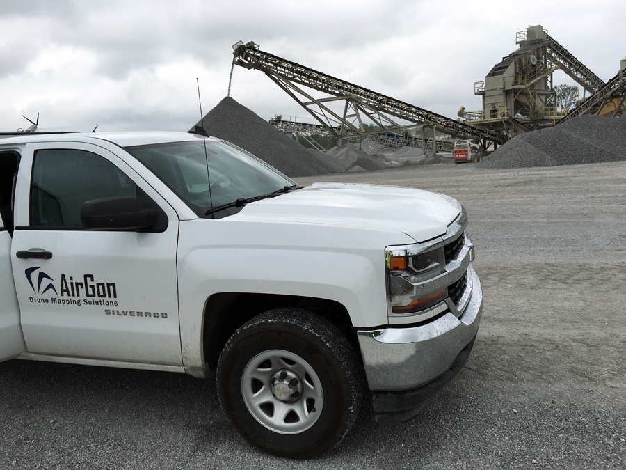
Leaving aside the legitimate concern that such predictions are far too ambitious, few would argue about the tremendous potential drones possess in terms of both costs and the approach that can be taken on a given project. Now that we have Part 107, the barrier to entry that had kept many people from fully exploring the technology has been eliminated. Professionals of all types and sizes are trying to figure out how they can turn such predictions around the economic impact of the technology into reality. However, doing so has proven to be a challenge, especially for surveying and mapping professionals.The reasons behind such challenges vary from person to person and from organization to organization, but many are related to the logistics associated with assembling a viable commercial drone platform. What sort of workflow should be utilized? How should deliverables be handled? Where is all of this info going to be stored? These were just some of the challenges that led AirGon to create the Bring Your Own Drone (BYOD) Mapping Kit. Making an Informed Choice with UAV TechnologyThe BYOD Mapping Kit is a new offering from the GeoCue Group, which provides geospatial solutions to help accelerate, automate and better manage imagery. Their AirGon subsidiary has been focused on how UAV systems can be utilized in surface mine, industrial and construction site mapping, and that process has yielded some critical insights.Thanks to hardware innovations that have made it so just about anyone can quickly learn how to fly a drone, many surveyors found themselves using these tools for inspections where accuracy didn’t matter. That sort of application is useful but limited, and many struggled when they needed to take things to the next level. It’s the main reason the BYOD Mapping Kit contains all of the software pieces that a professional surveyor might need to conduct mapping operations using a DJI Phantom or Inspire 1.“It combines a set of software that will realize a successful workflow,” said Lewis Graham, President/CTO of GeoCue Group. “We are providing software support, of course, but in addition, we do lots of mapping ourselves. We use this body of knowledge to provide operational guidance to our user base. This is often the more difficult aspect of drone mapping.”Those difficult aspects of drone mapping are more complex than many professionals realize. Little things like how to handle a battery change mid mission can totally ruin a job if someone does not have the right tools and training.The low-cost nature of the product is one of the most essential elements to consider, because that cost can mean the difference between actually seeing how the technology can make a difference on a project or not. While low cost mapping with a DJI Inspire is not a replacement for very high accuracy mapping systems, utilizing these kinds of systems can help users make informed choices around when and how they want to move up the technology scale.The reality is that as soon as a user needs to be able to quantify the precision and accuracy of the product, a rigorous and repeatable workflow is a must. The BYOD Mapping Kit is designed to give users that definition by establishing how things like blunders are being handled, and what can be learned from a given layout to improve the next. The BYOD Kit combines a set of software that will realize a successful workflow by providing operational guidance to the user base. Defining the Value for UsersMost solutions on the market right now can be thought of in three steps. You have software to fly a mission as well as a process to upload data for processing. The third step consists of that user generating products from that data. The issue that so many people run into relates to those steps being dealt with in isolation.For example, if a user needs to be able to generate 2-foot contours, that’s a consideration which needs to be taken into account when that data is being gathered. It needs to be considered when that data is being uploaded and processed, otherwise the deliverable will not be able to pull the necessary information. It’s the reason the BYOD workflow allows users to generate the metric accuracy that they require, based on the product that’s being produced. This process makes it applicable for several different types of professionals.“We are aiming this at several classes of users,” Graham explained. “That includes users who repeatedly measure volumes at the same site, surveyors who want to test the waters with a drone as well as aggregate site operators (quarries) who want to internalize the stockpile measurement portion of their inventories.”These different types of users can fall into very specific areas, whether that’s a paper mill measuring a feeder chip pile several times per month, a surveyor who is working in confined areas where they just do not have the space to operate anything other than a helicopter, or that aggregate site operator who needs to satisfy a need of frequently monitoring limited stockpile areas.These sorts of professionals and uses are just an example though, because the need to employ a true “mapping” or “survey” product will be defined by the situation and project. How UAVs will be best utilized is something that each situation will dictate, but the BYOD Mapping Kit was created to give users a distinct advantage by giving them all the tools they need for a current project, as well as the components that will be necessary if they need to go beyond that usage. Scale, Support and ServicesOne of the major benefits of the BYOD Kit is around the immediacy it can provide users. The BYOD Mapping Kit includes all of the necessary software components needed for a current project as well as an ongoing training program to ensure the bottom line remains a top consideration for users. However, even more important might be the advantages the kit provides in terms of moving up to more sophisticated systems, which is something that’s been top of mind for the company since they entered the drone mapping business.GeoCue has been providing software tools and training to the high accuracy kinematic laser scanning (airborne, mobile LIDAR markets) since their inception in 2003. Their desktop LIDAR product, LP360, is used world-wide for analyzing and extracting information from LIDAR point clouds, and that capability is not limited to that product. Users of the BYOD may be at the low end of the spectrum on drone capabilities, but they start at the very top with software. Being able to easily scale up in this matter is just as important for GeoCue as it is for their users.“I think a very important consideration is that drone mapping will go to LIDAR, sooner or later,” Graham mentioned. “Our users will acquire and use new hardware but their workflow practices, where the real expense lies, will need no modifications as this industry transition occurs.”The sort of support that comes with the BYOD Kit is an essential aspect to consider and something that can help people avoid the pitfalls associated with putting together their own systems. While assembling that kind of system is absolutely possible and something many professionals have done, it comes down to questions around risk and expertise. Delivering data that is incorrect or unusable can represent a career-limiting proposition, and doing so is a real possibility when assembling these kinds of systems.Drone mapping is challenging, and users can handicap themselves by not getting the right basic toolkit and not having the proper ongoing training. The training and support users receive from AirGon is a critical consideration since it’s coming from professionals that have been in the mapping technology business for the past 30 years.
  The Future of UAVs for SurveyorsIt’s readily apparent that drone mapping represents an evolution for surveyors and site mappers. Some are prepared and embracing that evolution, while others are not. The survey industry is highly fragmented and dominated by small companies and many independents, but the choice to utilize this technology won’t realistically remain one forever.“In two or three years, every survey truck will have a drone on board,” Graham concluded. “Upon arriving at a job site, the drone will be assessed as to its applicability to add to the project solution. It will just be another survey tool. Like other surveying instruments, the biggest advances will be in the accompanying software.”Graham, like many other industry leaders, believes drones will soon be thought of in the same way GPS is right now. A surveyor today would have an extremely limited career if they could not do a GPS topo survey. The surveyor of tomorrow will be similarly limited if they are not completely comfortable with supplementing their processing with drone acquired data.The ways in which surveyors are utilizing drone technology so that it can be thought of and utilized in this manner are varied in scope and scale. Critically, the BYOD Kit represents an important first step in that process. Some users will struggle with the ROI aspect of their drone usage, and the Kit ensures these users will not break the bank with their drone experiment. For many though, the BYOD will be quickly replaced by a survey grade drone. 100% of their training and software will move up the ladder with them.The BYOD Kit is not the ultimate mapping solution but rather a way for users to test the waters without assuming risk out of proportion with the potential reward. It provides a very affordable way to enter the business in a professional manner. That’s just as important of a consideration for surveyors who are trying to figure where and how the technology can work for them as it is for the ones who recognize that these tools absolutely will become just another survey tool. For a more complete look at the features and capabilities of the Bring Your Own Drone (BYOD) Mapping Kit, download Drone Mapping Considerations: Mapping with Low Cost Platforms


Comments