

Aerial surveys have proven their value over the years, offering unmatched efficiency and capability. Compared to traditional ground-based surveys, which can be labor-intensive and prone to data challenges, drone imagery has quickly become the preferred method for many types of projects. As demand continues to rise, technology must evolve to keep pace.
To showcase recent developments in the world of aerial mapping and imagery, Commercial UAV News hosted a webinar sponsored by Frontier Precision Unmanned and featuring YellowScan entitled “YellowScan Voyager: 400ft and Beyond.” Through the 60-minute webinar, attendees learned the ins and outs of the YellowScan Voyager, a high-altitude laser scanner, including it’s specifications and case studies across different industries.
Keegan Schaefer, Sales and Services Specialist at Frontier Precision Unmanned, moderated the discussion and provided the audience with an in-depth introduction into the general benefits of aerial surveying and photogrammetry. Joining him was Nathan Stephenson, Business Development Manager at YellowScan, who gave attendees a deep dive into the YellowScan Voyager.
To kick off the webinar, Schaefer discussed the challenges that come with traditional surveys, such as safety risks for field crews, difficulties accessing sites that are surrounded by dangerous terrain, long wait times for data and deliverables, and high operating costs make these surveys undesirable. Shifting to aerial techniques allows for a safer, more efficient, and more cost-effective survey. Some of these points included rapid data collection of large areas, safely accessing hazardous areas, cost-effective high-resolution imagery, on-demand deployment of the drones, and more.
“We are seeing a lot of growth with the on-demand deployment of drones,” explained Schaefer “No longer do we have to hike deep into the mountains. Instead, we can send the drone out to do the job. We can now get the data when we need it, versus waiting for a third party to do it.”
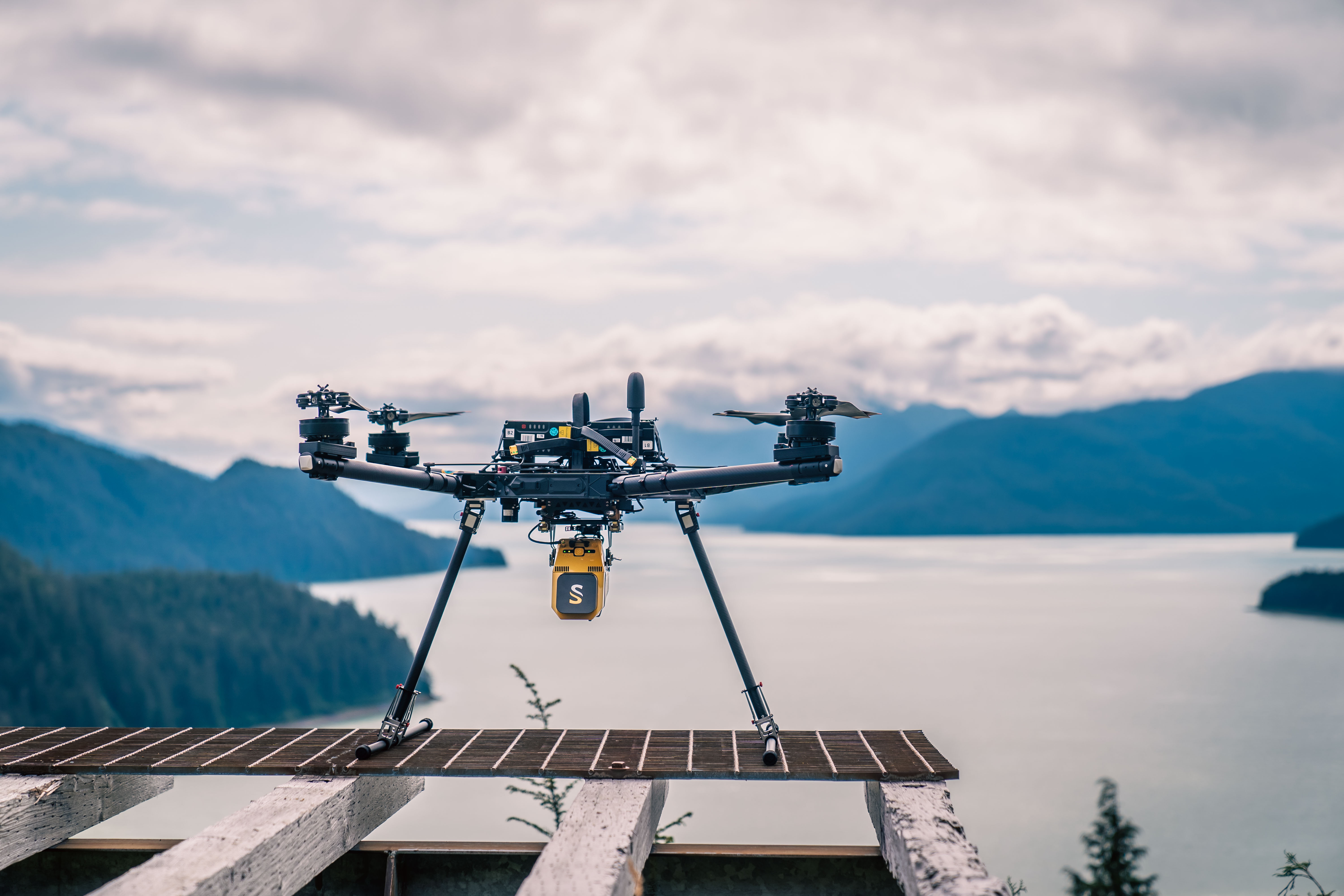
To help put all of this into perspective, Schaefer handed it over to Stephenson to explain exactly what the YellowScan Voyager, their flagship lidar scanner for heavy lift UAS, can produce for an aerial survey.
The Voyager, he explained, is ideal for large-scale mapping, excelling in powerline inspection, corridor surveys, and dense vegetation environments. This scanner can be mounted on crewed or uncrewed aircraft, making it versatile for all jobs.
Specifications on the Voyager include:
- Up to 2.4 million points per second
- Precision of 0.5cm
- Accuracy of 1cm
- Max altitude of 1,444ft
- Up to 32 returns
- FOV 100° x 20°
- Operating temperatures of 14° to 104° F
- Max laser range of 4,101ft
Powering the Voyager is the YellowScan Cloudstation, an all-in-one lidar data processing suite that generates point clouds and visualizes data. Stephenson played a video demo to highlight how fast the data can be processed and showed clear examples of how the voyager can see through dense areas of vegetation.
What sets the YellowScan Voyager apart from other lidar scanners, according to the presentation, is its ability to easily capture data in heavily forested areas, where other scanners struggle to see through these areas to get accurate data.
“There is not an area in the United States that the Voyager can’t penetrate (vegetation) to capture data” stated Stephenson.
This feature is especially important for inspecting areas that are prone to landslides, as hightlighted in one of the case studies featured in the webinar. After a catastrophic landslide in Northern California, the state tasked Frontier Precision to scan the area with the Voyager to measure changes in the land. Within 24 hours of deployment, data was delivered to the state, giving them valuable information on when they could reopen the roads.
The webinar wrapped up with three more case studies to highlight the versatility and strength of the YellowScan Voyager, including avalanche mitigation, vegetation encroachment on powerlines, and a special engineering project in a Idaho that is currently under way.
Registration for this webinar is still open, with registrants receiving access to free, on-demand recording as well as slides from the presentation.


Comments