

Questions around how UAVs can change or impact the tools professionals are currently utilizing are prevalent across every industry, but they’re especially apparent for mining professionals. Will UAVs be able to augment the processes they’re using? How will drones improve the approach that is currently being taken? What sort of an impact will they have on the bottom line?
To help answer some of these questions, I got in touch with Michael Singer, CEO of DroneView Technologies. His company works with enterprise customers throughout the United States to collect, process and extract real value out of drone derived data, He is able to work with his customers to figure out the best fit for their needs and what will be best for the organization.
I talked with him to ask specific questions around how drones are impacting the way mining professionals are working, how the conversations he’s been having about drones have evolved, what sort of practicalities he deals with and plenty more.
In Part 2 of this interview we get specific about the ways in which UAVs can make things faster, cheaper, safer and more efficient for a project and even an entire organization.
Jeremiah Karpowicz: Tell us about how you got involved in the commercial drone space.
Michael Singer: DroneView Technologies got into the commercial drone market place almost two years ago now. I had a prior career of owning and running three different technology companies. So I came in with a technology bias, and all of those companies served enterprise customers to provide value added technology and/or software solutions.
As the “commercial drone industry” was taking shape, we jumped in with a very broad perspective, not really knowing where the most realistic opportunities would be. And we went through many different conversations across various industries and verticals over many months to really narrow it down. We talked to people in the ag industry, in search and rescue, in the movie business and in real estate. We were looking for the niches that we felt were going to benefit from this disruptive technology, which would help transform their current way of doing things. Moreover, we had seen and heard plenty of enthusiasts talk about the “coolness” of the technology, but we wanted to identify an industry that could move beyond that sensation. These tools would have to be something that provided real value.
When and how did you narrow your focus?
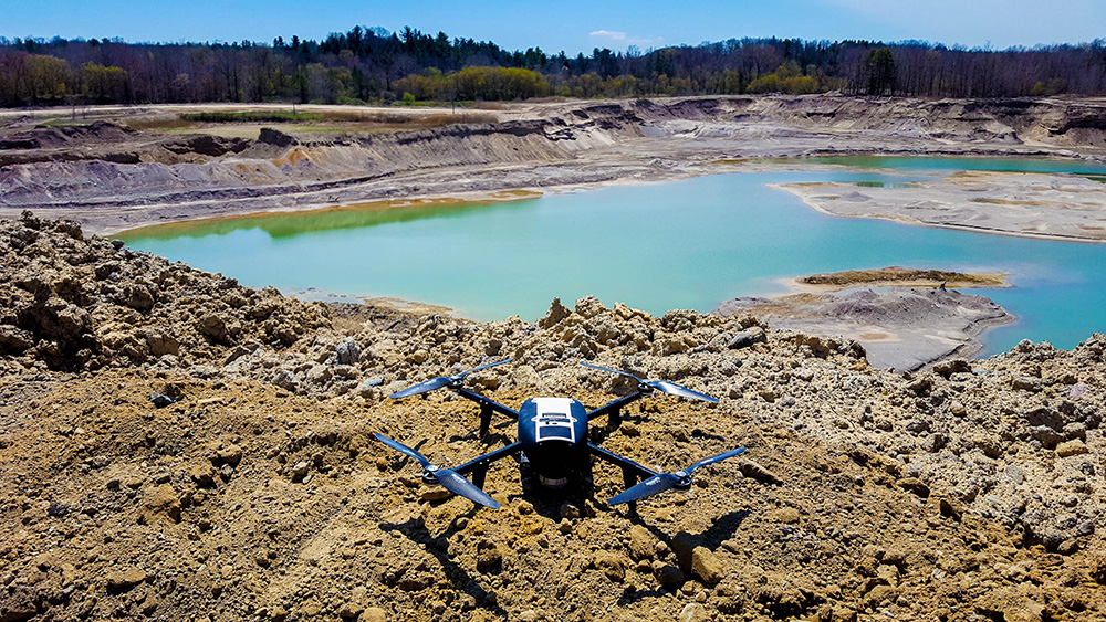
We got to the stockpile and volumetric area somewhat circuitously as we started to understand the capability of photogrammetry and what rendering images to 3D models could do. It was the one area that not only manifested itself as a large market that had established practices, but one that had many third party reporting and measurement requirements. That means not only do they have to measure everything accurately, they have to rely on independent third party providers to make that happen. So it was an obvious launching pad to really focus our energies and efforts, because we saw both the need and the desire of the people working in these professions.
So are you offering these professionals something that’s inherently different, or something that will be completely new to them?
The reality is that photogrammetry has existed for a long time. The new element is being able to move it from 3,000 feet with fixed wing piloted aircraft down to 200-300 feet with commercial quality drones and having the requisite resources available to process that data to their specific use cases. It’s not new technology that needs to be developed.
In that case, are UAVs replacing tools and processes that people are already using and have familiarity with?
How changes come about is different for every individual and organization, but it can all be viewed as a continuum. The fax machine didn’t replace the post office. Email didn’t eliminate faxes, and texts didn’t eliminate email. They all still exist today. Depending on the specific requirement, there’s going to be a time where one tool is more appropriate than another. The same is true for UAVs and how they have and will impact the tools people are using today.
Is that how you phrase the conversations you have with mining professionals? How do you approach these people in terms of being specific around how UAVs can make an impact on them and their business?
It all comes back to being able to provide something of real value for all the relative constituents. That means those benefits needs to exist for everyone from the operators to the financial teams, to the legal teams who have to deal with the FAA and insurance issues.
At an enterprise level, we have to be able to speak to multiple stakeholders. We needed to understand their current way of operating and bring to them a solution of a technology that is better in multiple areas. UAVs have to be safer than the current way they’re doing things. They have to be more timely in terms of bring info quicker, and they have to be as good if not better in terms of quality of the information they’re delivering. Lastly, they need to be a less expensive solution.
None of that is to say the technology is only going to impact a project or company in only those four areas, but we knew achieving value along all four of these areas is critical to making a meaningful difference. We knew those were things that the multiple stakeholders would notice in an especially big way.
You mentioned the multiple stakeholders, but who do you need really convince when you’re having these conversations? Is it the operators? Or the accounting department? Or the c-level executives?
As I mentioned, even when you’re able to make things faster, cheaper, safer and more efficient, effecting change isn’t something that happens overnight. It needs to be approached from multiple positions and perspectives. So it’s not so much about zeroing in on a particular person or department, but about how what you’re communicating impacts all of them.
We find that means we often need to be a bit of an evangelist but are also able to educate people. We also know that we need to show that what we say about this technology is actually going to be true. Say what you do, and then do what you say as means of proving to them that the info is as accurate and the timetables are as quick as you’re saying they will be.
If you’re able to do these things, the right people will be able to make the right decisions. Regardless of where that conversation starts or how it kicks off.
How have you seen these conversations change and evolve?
Last year we went through a lot of demonstrations and pilot programs where we were going on site and doing the work that we spoke of where operators were still using traditional means. Oftentimes they were using laser, but sometimes where it was much more rudimentary and they were using measuring wheels and things like that. In each case, we needed to collect data points to prove to clients and potential clients that what we were saying was actually true and credible.
In many of these instances clients and perspective clients will be resistant because they think we’re trying to replace a tool or process that they’re familiar with, but that goes back to what I mentioned about change being different for every individual and organization. Directional photogrammetry and aerial acquired data will replace what is being done today with laser measurement. This won’t happen overnight and saying one solution will fit all use cases is far too draconian.
Until that happens, don’t UAVs just represent an additional headache and expense?
Change for big companies does not come quickly. People are busy and in many cases believe if something is not terribly broken they why attempt to fix it. Measuring stockpile volumes using drone technology brings an incremental operational, safety and cost improvement. Once several large companies embrace this technology many others will quickly follow.
We’re the first to say that UAVs are just another tool. People need to understand the capabilities, understand the limitations, and use it in the way that brings the highest and best value and don’t try to use it for everything. A sledgehammer isn’t good for putting nail on the wall to hang a picture, so no one should use it for that. Understand what it’s designed for and use it to the best of your ability and reap those benefits, but one tool to use everything all the time isn’t realistic.
As we deliver this data, we know there’s going to be a continuing evolution of ways that people are finding value from it. In a relatively short amount of time, we’re getting feedback that values this data as something far more than just a number they can know about, for many different reasons.
How have you seen your clients find that value?
In some cases, customers have gone from measuring their stockpiles once a year to a monthly cycle. Every month we will use a drone to capture images and from these visual snapshots we will process the date and deliver a volumetric report. From that they’re able to capture things quicker and optimize more efficiently to potentially identify things like fraud. Maybe there was a truck that was missing the scale. With UAVs we can capture that info quickly and bring it to closure much sooner, which gives people options and creates opportunities.
How have you seen people struggle when it comes to appropriately creating these options and taking advantage of a new opportunity?
Ultimately, what we’re going for is an understanding on a nuanced level of what the real deliverable needs to look like. It can sometimes be a challenge to get people to comprehend what it takes to get that real deliverable, and where they can go from there.
It’s not as simple as collecting a bunch of images and running them through a photogrammetry platform in a black box and delivering that out. To deliver a survey grade product, you have to understand how to create that deliverable. There’s processing and then there’s secondary post processing that’s required to achieve that for most topography applications. It’s essential to be able to both understand the tool and technology and have enough industry expertise. It’s imperative to be able to deliver with accuracy, reliability, scalability and repeatability using these technologies.
How is that imperative being reflected in the market?
We’re finding great interest when it comes to being able to provide services as they relate to acquiring images, process the data, and deliver accurate and timely volumetric measurement reports. Various companies throughout the market want and need these services, and more and more realize the imperative everyday, especially if they’re able to see the data points we can lay out for them. We’ve figured out many of the small gotchas and are now consistently doing this for customers around the country.
Part and parcel with that is the opportunity to take it a step further and create survey grade maps. We’re finding that doing so is of great interest to traditional mining operation and in general to civil engineering and other survey and mapping applications. It uses similar technologies while adding an element of ground control to enhance horizontal and vertical accuracy and some additional post processing of the data. This is the next transformative opportunity that this technology will bring to the marketplace.
Pulling things back to today, where and how have you seen UAVs make an impact on the market and on how people are working right now?
At this point we’ve measured thousands of stockpiles with drone imaging. We’ve approximately 950 independent data points with stockpiles measured with laser at the same time as we have measured it with a drone. On average we have seen about 1-2% variance in volumes. We intuitively believed that to be the case, and now empirically have the documentation to support that.
This variance is one of the important ingredients to be credible as a third party services provider as well as helping to be the catalyst for change within an industry. We think that change is going to be coming, and we think it’s coming quickly because of the impact UAVs can make things faster, cheaper, safer and more efficient for a project and even an entire organization.


Comments