

Last week, Commercial UAV News staff attended Geo Week, our sister event that serves the geospatial industry in many facets. The show floor was packed with exhibitors who are leading innovators in all things lidar, photogrammetry, remote sensing, mapping, and more. In recent years, adding an aerial element to these data capture technologies has been a game changer for the industry. While the idea of aerial geospatial operations by crewed aircraft is not novel, doing so with a drone is.
It was exciting to see so many drone companies support this effort and exhibit at the show, with their presence solidifying the collaboration between the geospatial and uncrewed aerial world. CUAV News caught up with a few of the drone companies on the exhibit hall floor to understand how exactly they are helping shape the geospatial industry of the future.
To carry out a high-quality mapping or inspection operation, every minute counts. With that in mind, drone companies came to Geo Week to showcase aircraft that have been redesigned to feature longer flight times, even with the heavy payloads required to do the job.
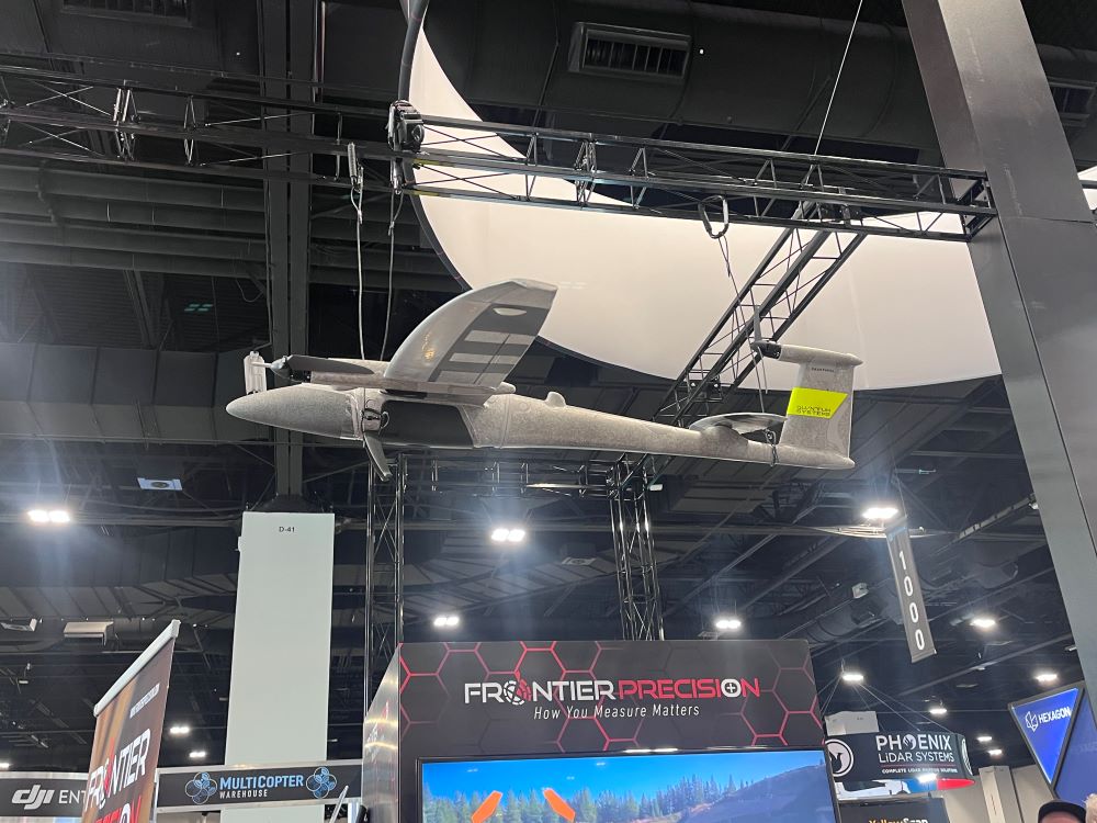
The push for endurance was a common theme across exhibiting companies. At Frontier Precision’s booth, regional sales manager Austin Rains pointed to a drone they distribute designed specifically for extended flights.
“The fixed winged drone, The Quantum-System Trinity Pro, is largely used in the oil and gas industry. These drones have a longer flight time of around and hour and are great for inspecting long gas lines,” explained Rains.
American drone manufacturer Arcsky presented a hybrid UAS model capable of staying airborne for up to two hours. The company is about to launch a smaller version of their flagship drone, the Xplorer, that is battery powered and has a flight time of an hour and a half, a significant margin for operators working large or remote sites.
“This is a very versatile drone, operators can attach different payloads for thermal, inspection, security, lidar, surveying and mapping missions,” stated Eli McDaniel, product engineer, as he demonstrated the quick interchangeability of the payloads.
Other companies exhibited at Geo Week to showcase the special operational capabilities of their products.
Chinese drone manufacturer, DJI, displayed a variety of products, but their docked drone caught the eye of those responsible for large-scale mapping projects.
“Our docked drones are used more at manager level because of their ability to run multiple projects at once. These are commonly used for inspection projects and for public safety operations,” said Run Li , senior solutions engineer. Overall, their booth received plenty of interest around mapping applications for their products.
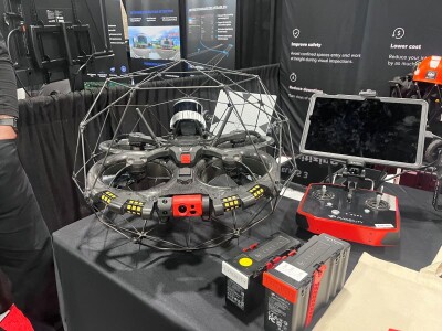
Flyability was also in attendance to showcase their multi-purpose drone, one capable of maneuvering in dark or tight areas where it’s too dangerous for humans to work.
“Our Elios 3 drone operates inside enclosed areas for mapping, lidar and inspections. It’s largely used for special operations inside tanks to carry out inspections, or even to test radiation levels,” explained Devin McClure, field operations specialist.
Beyond performance, compliance was the other major conversation happening during Geo Week. Considering the recent restrictions around operating new foreign drone models in the United States, the push for NDAA-compliant drones has become impossible to ignore. For many surveying professionals, the ideal solution isn't just compliant but it's also practical and efficient. As Rains noted, surveyors are increasingly looking for a smaller, affordable drone they can deploy quickly in the field without a lot of setup.
ArcSky answered that demand directly, showcasing a new smaller compliant model at the show that will be available later this year. Skydio, a large American drone manufacturer, also had a presence at Geo Week. They featured their NDAA-compliant drones alongside the many partnerships with geospatial groups, which suggests that the industry is moving toward building compliance into broader workflows, not treating it as an afterthought.
While the companies mentioned above were only a handful of the UAS-related booths at Geo Week, the presence of the UAS industry was strong on the show floor this year. Based on the conversations on the floor and the insightful content presented in the conference sessions, it’s clear drones play a big role in gathering high-accuracy geospatial data from a birds-eye view.


Comments