

In anticipation of Commercial UAV Europe, we’re connecting with some of the organizations that are operating across the continent to explore how drones are being utilized for commercial purposes throughout Europe and beyond. Drone technology continues to make a major difference in terms of how professionals can and are approaching their work in this area of the world.
ABRIS Design Group, out of Ukraine, has been providing products and services in light and ultra-light aviation, aerial mapping, and land monitoring for over twenty years. We talked with ABRIS DG Lead engineer Vadim Kolesnichenko to learn more about their offerings, what makes the FLIRT different from other tools for aerial mapping, how they’ve helped their customers overcome a variety of challenges and plenty more.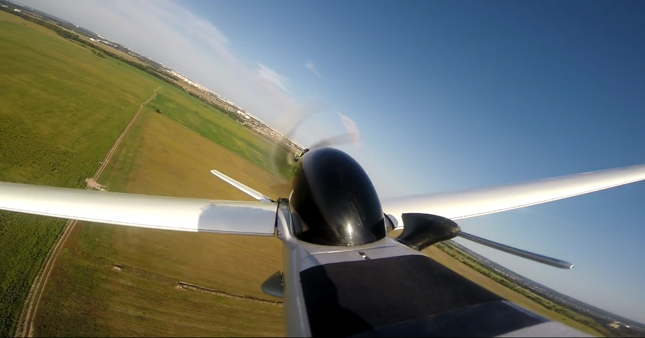 Jeremiah Karpowicz: What can you tell us about ABRIS Design group? Do you focus on both products and services?Vadim Kolesnichenko: ABRIS DG is a company that unites experienced professionals from different fields of knowledge: aircraft design and aerodynamics, control systems, technology, programming, geodesy. This is a group of professionals who are fascinated with a common goal – the creation of effective unmanned systems for aerial photography.ABRIS DG supplies unmanned systems around the world. At the same time, we provide services of aerial photography and agricultural photography in Ukraine. Actually, during the process of providing various aerial photography services, our unmanned systems were being designed and developed. We are constantly improving our technologies, because we know our customers’ needs. How have you been able to create value for your customers in the aerial mapping space?ABRIS DG solutions allow users to obtain high-quality photographic material, which can be used for mapping or precision agriculture. The additional advantages are high standards of shooting quality, high productivity of our systems, minimal costs and simple preparation.We are not limited to working with clients remotely, as we also delegate our specialists to work on-site. It allows us to provide direct support to our customers and to easily receive useful feedbacks. Tell us about your products. What makes FLIRT different from some of the other aerial mapping tools that are currently available?ABRIS DG products are used for different survey and aerial photography applications. The FLIRT Cetus is used for carriage of a full frame camera for a long time missions up to 3 hours each. The FLIRT Arrow is a lighter version of the FLIRT Cetus with narrowed fuselage, making it capable for hand launch. The FLIRT Iron is a metal version of the Flirt Cetus and was designed for agricultural applications.The main idea of the FLIRT system is to bring the quality and performance of classic manned aerial photography systems to unmanned aerial systems. The FLIRT Cetus is aimed to obtain initially high-quality and well-oriented images.The FLIRT planes can be easily adapted or supplemented by the user to solve a new task. Despite the complexity of the FLIRT design, its modularity allows to be repaired by the user. What are some of the features and advantages of the system as a whole? FLIRT operates the way it does because of FlightPlanner software. It interactively takes into account the features of the airplane, the camera, the lens, the actual weather in the region of the flight and the terrain. It allows users to plan a mission easily and optimally right before the flight.
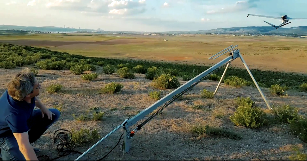
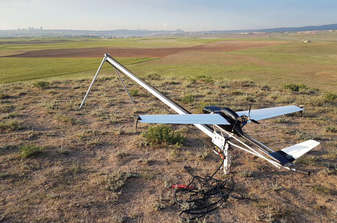 As part of that system, the LuckyLaunch catapult system guarantees 100% successful aircraft take off in winter and summer conditions, and in valleys and highlands. The LuckyLaunch catapult is scalable and suitable for launching with other aircrafts as Skywalker X-8, Trimble/Delair UX-5. The LuckyBeak parachute system will ensure a safe landing even if any critical situation occurs.The LuckyBeak is a regular reusable parachute landing system for all FLIRT aircrafts, also it serves as an emergency system on planes. In addition, it can be used as an alarm system on a wide variety of multi-rotor and fixed wing aircraft systems. The LuckyBeak’s main feature is an extremely fast canopy deployment. There were cases when the system managed to rescue an aircraft at altitude even less than 10 meters. The patented design of the LuckyBeak ensures triggering at full loss of power supply.Another important feature of the FLIRT planes is the ability to capture a large area during one flight. This is possible because of the powerful batteries and good aerodynamics of the aircraft. A wide range of operating flight speeds (from 60 to 100 km / h) allows the system to operate even in a strong wind. The aircraft can also optimize speed by itself for these conditions. What sorts of professionals are utilizing Skylink? How is it making a difference for them?One of the typical applications for SkyLink is in forest monitoring during a drought. Another use is a monitoring and operational management at farming. It’s also been used quite frequently as a radio repeater.
 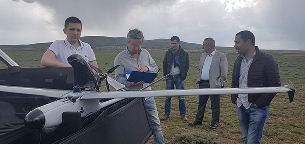 What are some of the biggest challenges you’ve helped your customers and users overcome?It was a big challenge to start using FLIRT systems in the mountainous regions of Turkey, which we carried out with our good partners from Turkey - MapAir.We had to simultaneously deal with rarefied air in high-altitude conditions (over 2000m), extremely high temperatures (up to 45 degrees C in the shade), extremely difficult terrain for launching and shooting, and unpropitious conditions for landing, because of plenty rocks and stones. A separate challenge was to overcome the language barrier in dealing with customers, who spoke only in Turkish. It was a test both for the technicians and for the personnel of our company.However, as a result of this experience, ABRIS DG team has created a special custom version of aircraft for mountainous hot regions. It also allowed us to make many improvements both in the design of the aircraft and in the software. How have you helped your customers quantify their investment in your technology?We are constantly in contact with our customers directly or through our partners in the regions. We’re able to support customers in missions planning or even manage the aircraft that is in flight many thousands kilometers far from us.A close dialogue with end-users is typical, which allows us to improve our solutions. We combine the trainings of our clients with the realization of their commercial tasks. We can provide our equipment and specialists. In addition, we also provide engineering services to buyers of our solutions on preferential terms. That can mean, for example, post-processing of aerial photography.
 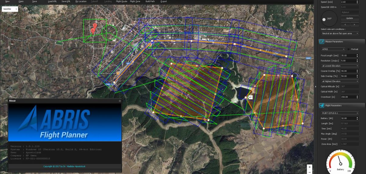 What’s the best way for someone to figure out whether or not your solutions are the right fit for their organization or project?The most effective option is to find the solution on a practical task. ABRIS DG is always open to meet new clients needs. If the application is new, our team will be ready to test our solution in practice to show that this is a right fit for customers project.


Comments