A lot has changed for Redbird CEO Emmanuel de Maistre since I caught up with him last year to discuss how UAVs were taking mining and aggregate operations to the sky. Emmanuel’s company was acquired by Airware last September, which has helped put Airware in a position to be able to offer more complete solutions for construction sites, mines and quarries. After settling in as the Vice President, AEC Solutions at Airware, Emmanuel has played a major role in various developments for Airware, the most recent of which saw Airware team up with Caterpillar Ventures to help construction, mining and quarrying organizations utilize drones.
Emmanuel has a keen understanding around how drones are and will be used in mining & aggregates, and it was why I was anxious to connect with him for our “
How are Professionals in High Tech Industries using Drones in 2017?” series. The report that focuses on Mining & Aggregates utilizes some of the info that Emmanuel laid out for me, but I didn’t want the additional insights he discussed to fall to the wayside.

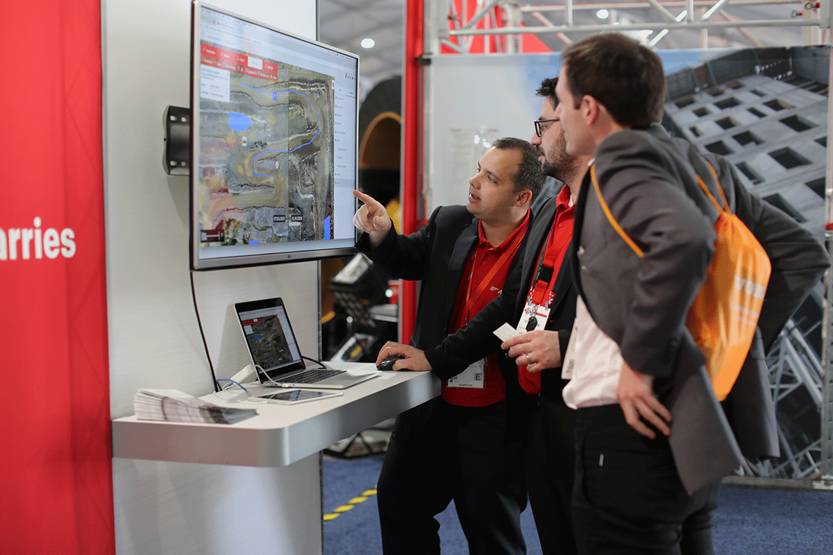
The Airware team at ConExpo
The interview below features all of the info Emmanuel talked through when I connected with him to get a better understanding of how drones can and are being used by enterprises in mining and construction in 2017. We also talked about Airware’s experience at ConExpo, how safety plays a role in adoption, what kind of an impact the desire to operate BVLOS will have on UAV adoption and plenty more.
Jeremiah Karpowicz: Tell us a little bit about your experience at ConExpo, where you were giving demos for attendees. What kind of feedback did you get from attendees?Emmanuel de Maistre: We’re really excited to have had the opportunity to showcase Airware’s solution at ConExpo. It was great to see the excitement and response to our solution and the value it can bring to the industry. This trade show was an incredible opportunity to demonstrate our technology to customers from more than 100 different countries, and to meet with dozens of Cat dealers, who are now ready to partner with us.
Airware featured its interactive demo at the center of the Caterpillar booth, in the Cat Connect area, and drew a big crowd. We were able to show that our technology goes beyond aerial imaging: with our solution, site managers can not only view and analyze aerial data on mines, quarries, and construction sites but also integrate machine data: this element was key during most of our discussions.
What were some of the biggest and most common questions you talked through at the event? Were they related to regulation?The questions and discussions have really evolved over the last few years. We used to get a lot of questions about the drone itself and it is great to see this industry really begin to realize that the value of drone technology is in what you can do with aerial data and turning that into actionable business intelligence through powerful analytics.
Of course showcasing at ConExpo was a really important opportunity for us to discuss how customers can leverage the Airware Redbird solution and talk about our partnership with Cat dealers. There were specific questions about the program -- what our end-to-end solution encompasses, how long does it take to process data, how long does it take to fly a drone on a site, what is the accuracy of the data provided, how we fit into the Cat Connect Services offering, etc. -- but we also discussed bigger picture scenarios, like if online solutions will be leading in the future of these industries, versus desktop tools.
Staying with that theme, what kind of opportunities have you seen opened or do you anticipate coming together in 2017 now that professionals can take to the sky under Part 107?Part 107 was a big step for the industry. It removed a lot of uncertainty and gave many enterprises the green light to move from testing to deployment: in mining, quarries, and construction, as well as insurance. We saw a lot of progress in terms of regulations in 2016, and we look forward to seeing progress for rules regarding BVLOS (Beyond Visual Line of Sight) and safe operations over people.
Was regulation the true barrier to widespread adoption, or are many professionals still uncertain about the value propositions of drones in terms of efficiency?While waiting on regulations did impact widespread adoption, it wasn’t the only barrier. There was also a gap in understanding the true economic benefits of using drones. Today, professionals we are working with are convinced that drones enhance efficiency. Some of the biggest mining companies in North America have been working with drones for the last five years. Flights are performed almost every day by internal operators. Construction companies we’ve been working with would fly weekly on their sites and sometimes daily, to gather data that will help them enhance collaboration on the job site. We’re seeing more momentum from enterprises interested in making drones a part of their business. Professionals are realizing that their ROI comes from the actionable information from aerial data reports, not just the map of their site. The real value goes beyond making aerial data easier to collect - it is about what you are doing with it: taking the actionable information to generate business outcomes. Professionals have expressed the need for industry-specific analytics tools that enable them to optimize global operations and use of equipment, track progress over time, and meet site safety requirements.
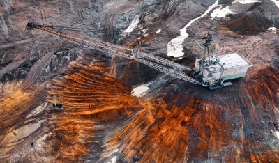
Can you talk a little bit about those safety requirements? Are enough professionals aware of the difference it means to send a drone to measure a stockpile versus sending someone onto it to capture the needed info?Safety is key. Safety issues are the #1 reason why mining and construction companies sometimes have to shut down their sites. Stockpile surveying is still a long and dangerous process - I would even say it is an outdated process. Professionals are aware that flying a drone to measure sites and machinery, while the surveyor is outside of the quarry, is much safer and makes a big difference. This is known, but professionals also need to understand that utilizing drone-based safety assessments can prove that their site is in line with local regulations. For instance, in aggregates operations, site managers will need to monitor the safety berms of high walls are high enough. This is easier and safer to do with a drone-based safety assessment, versus more traditional methods. By using a drone flight over their entire site and post-processing in the cloud, operators can access powerful analytics to easily determine areas that need to be checked, and have a complete view of their site.
Does Part 107 change the paradigm around how an organization might be considering whether to build their own drone program or if it’s better for them to utilize a service provider?The biggest impact from Part 107 was the shift from requiring operators to have a manned-pilots license to the development of the remote pilots license for drone operators. This is big for enterprises, who can leverage their existing workforce and integrate drone technology seamlessly into their present workflows. If you haven’t read Don Weigel’s post on the Drone-enabled workforce, you should check it out.
http://www.airware.com/blog/2017-drone-operators-predictions How do you see the desire for the creation of a “complete drone solution” playing out in 2017? It’s understandable that users want something simple and easy to use, but is that a realistic goal for this industry? What kind of an impact will that have on the current and future autonomous capabilities of drones?Our mission is to eliminate every barrier to enterprise drone adoption. We’ve built our technology from the ground up by truly understanding how enterprises would use it. As enterprises look to digitize and optimize operations, and as job sites become increasingly intelligent, drone technology is at the forefront of enabling new efficiencies. Enterprises want to integrate drone technology to solve complex problems, without having to build their own solution. They are looking for a partner that can provide everything they need -- data analytics software, integrated and fully automated hardware, professional services -- at scale.
Based on our four years of experience with customers, we are truly convinced that a complete offering will be the only solution to be widely adopted on the market. A “complete” drone solution has to go beyond just drones. In the case of construction and mining, our customers’ success requires the ability to manage equipment and operations on a constantly evolving site. One of the objectives of working with Caterpillar is to integrate mobile equipment data on a site with the geospatial data acquired by drone, to provide customers a full and up-to-date view of their site. With both drone technology and cloud software becoming more automated, the goal of solving complex problems is more realistic than ever before.
How will the desire to operate beyond visual line-of-sight (BVLOS) impact what kind of success and value operators are able to get from drone technology in 2017? There are certainly reasons why businesses will want access to beyond visual line-of-sight capabilities, but for mining, quarrying and construction companies, there is a lot of value that can be achieved already, without BVLOS guidelines. Large operations such as mines will eventually require BVLOS operations at scale. These types of operations are already allowed on a frequent basis in some European countries where we are already active, including France.
What kind of opportunities do you see being opened up in 2017 by new sensor capabilities?We will see strong improvements in sensors and how they integrate with machines and the cloud, especially as drones become increasingly dependent on cloud-based operations planning. By adjusting sensor settings in the cloud, operators will be able to manage an entire fleet in order to consistently get data. Drones, like any other technology, will need to be more precise as the industry continues to develop, and that’s where new sensor capabilities come to play. Sensors like lidars and structured light sensors will help capture more accurate information in real time. Improved sensors will allow drones to map larger areas in the same flight time.
Do you think drone adoption will be more easily enabled by dealers like Bergerat Monnoyeur since they’ll be able to speak to mining and construction professionals in specific terms? Will that be an important new development this year?It is further proof of the momentum we’re seeing and the impact this technology is having on job sites around the world. This 3 year-long relationship with the Caterpillar ecosystem allowed us to work closely with dozens of customers and dealers around the world to deploy our solution and to tailor it to customer’s needs. The partnership we signed back in 2014 with Bergerat Monnoyeur helped us build the best in-class drone data analytics application for their customers, as they have a deep understanding of the industry and the challenges. We’re excited about what 2017 has in store.
Is that excitement related to how professionals will be able to use these tools this year, or about the opportunities they’ll be able to see and understand for the first time?Construction and mining industries have been left behind due to huge decreases in productivity gains. The old analog way of doing things isn’t working. What we are looking at now is a paradigm shift, where we are bringing job sites into the digital world, by leveraging drone technology. We want drone data to be integrated into the business workflow and processes of our customers. We’re excited to enable companies to move on from the long and outdated processes of surveying sites and tracking operations. In the past, it took days to capture data with a GPS, before going back to the office for manual processing and analysis, and a lot of paperwork! With drone technology and the power of cloud computing, we now get access to much more dynamic data that can be share in real-time, allowing the field and the office to be connected.


Comments