Now that we’re living in a world with Part 107, many professionals are finding out the hard way that regulation did not represent the biggest challenge around properly utilizing drones. Sorting through drone data, building a drone program and integrating drones into an established workflow are just a few of the issues professionals of all types and sizes are sorting through in 2017. Professionals of all types are discovering that getting past federal and/or local legal hurdles simply represents the beginning of a process to leverage the technology, not the end of it.
Fortunately, construction professionals have options like
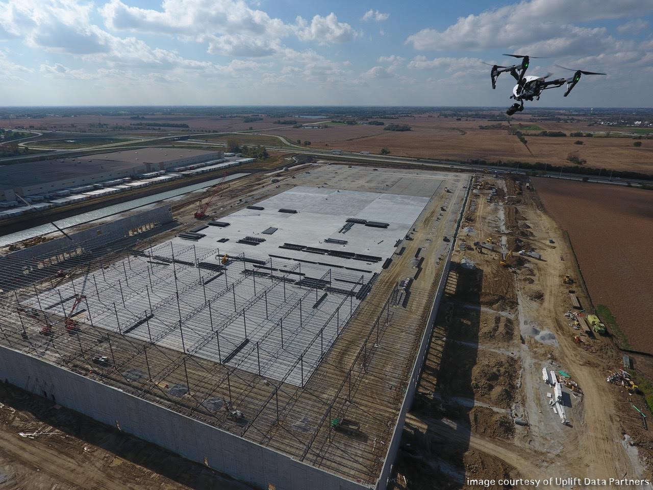
Uplift Data Partners to help them sort through their specific issues. Uplift is set up to capture and analyze aerial data to deliver construction insights for peak project performance. Their turnkey data service supports construction managers and BIM engineers during pre-construction, construction and inspection as they collect 3D data that is accurate to five centimeters.

Suzanne EL-Moursi
As the President of Uplift Data Partners, Suzanne EL-Moursi is intimately involved with the efforts of her team as they take to the skies to implement drone technology for their enterprise clients. I caught up with Suzanne to talk about what kind of value Uplift is able to provide, but we also talk about how the conversations around the value proposition for drones has changed, what kind of efficiencies drones are creating on construction projects, where professionals can start a conversation around using drones and plenty more.
Jeremiah Karpowicz: Before we talk about how you’ve been able to make an impact for construction professionals with drones, what can you tell us about the conversations you had with attendees at the recently concluded Groundbreak event? Was there a recurring theme or topic? Suzanne EL-Moursi: Overall, we had phenomenal conversations with the attendees at Groundbreak. The event brought together a higher caliber of attendees that were all hungry to learn more about what we had to offer. This audience primarily consisted of early adopters in the construction industry, which provided us with an unprecedented platform to showcase all of our service offerings with an audience that understood our value.
Our recurring theme was that drones have the ability to deliver survey data. The attendees were very excited to learn this and eager to understand how they could incorporate this into their business.
Were attendees curious about the value proposition of drones, or were they asking far more nuanced questions? The majority of attendees that we spoke with did not need to be convinced that they should use drones in their construction projects - rather they were thoroughly interested in how our service could add value to their business.
Most attendees knew about drones and, in fact, many attendees had already used drones on their sites for photos and videos. When they learned about our drone survey data, questions started to get nuanced and new product ideas would flow.
How did terms like “topos,” “point clouds,” and “line work” come up in these conversations? Because we focus specifically on construction, we speak the same language as the AEC industry and in that way, we were able to share and inform the attendees about these terms and their meaning. These terms come up when we explain that there’s more value to drone insights beyond photos and videos. This is Uplift’s value proposition; the further data analysis we complete to get to engineering grade insight. This is the value that our customers see when partnering with Uplift.
I want to focus on the work you’re doing in the construction industry, but what can you tell us about how you’ve been able to use drones to create value for real estate and broadcast professionals? Nationwide news broadcasters tap into our network because we have a higher standard for vetting, which allows us to identify expert cinematographers to recruit them for our network. We’ve covered floods, forest fires, elections and more.
Real estate agents use our drone videos to help sell properties. We combine interior/exterior footage with satellite imagery and voiceover to create a full sales video.
Insurance companies use our network to inspect roofs without the need for risky ladders.
In terms of integrating drones into a construction project, what kind of a difference can they make when it comes to planning, site selection and estimating? What does adoption look like?Adoption is simple. The client calls us, and we begin delivering drone data immediately. We customize our deliverables for each site as every project site has its own set of complexities.
Developers are using topos and orthos to minimize earthwork costs and also to obtain a better picture of site conditions. Estimators use the topos to determine cut and fill costs, as drone topos are more accurate and provide a better view than the standard topos pulled from the U.S. Geological Survey.
When it comes to cut and fill analysis as well as volumetric measurements, what kind of efficiencies can drones create? Bulldozers move faster, they don’t push dirt more than once, and disputes between surveyors, excavators, and GCs are settled. Sites are beating earthwork budgets with drone data.
Would you say the linework overlays that drones are able to provide create an entirely new value proposition for users since they allow operators to detect layout accuracy and catch mistakes before they happen?This is correct. We are teaching the sites how best to use linework overlays by detecting small mistakes before they become large. Because we know that on average 10% of a project's budget goes to rework, knowing that you can detect these mistakes before they become large allows for significant savings echoed throughout the project.
What information are drones providing project managers in order to allow them to better understand the progress of their projects? How do these reports different from traditional reports? Volumetric, cut and fill, and topos are all the same as traditional reports. The difference is in the cost to collect the data - drones are much faster and less expensive, so reports can be delivered more frequently.
In what ways are thermal sensors being used on drones to make a difference for construction professionals? Thermal sensors can detect cracks and leaks in a building envelope. Contractors use them to inspect the building before they commission it, and for inspecting warranty claims after the building is constructed.
How have you been able to quantify the difference a drone can make for your customers? Is that something you can define in terms of an ROI?ROI is difficult to determine. How do you quantify the value of a prevented mistake? Right now, ROI passes the eyeball test - detecting one mistake easily covers the cost of the drone flights for the entire project.
What would you say to a construction professional that wants to explore what drone technology can mean for them or their business, but isn’t sure how or where they should begin? Call us! We do demos all the time, and the engineering-grade data drones is a great way for potential users to see where they can get value from the drone.
Before construction companies look to invest their time, money, and resources into drone technology, it’s imperative for them to understand how they can use drones and what it would would mean for their business. Uplift Data Partners helps clients everyday build out use-cases so companies can evaluate how drone technology and insights would significantly impact their operations.


Comments