In recent years, uncrewed systems have become commonplace in the world of surveying. No longer a novelty or an unusual “add on” to the day-to-day work, drones and related systems are central to many operations, and surveying professionals have come to rely on the efficiency, accuracy, and safety the technology offers.
This widespread acceptance has improved surveying operations in innumerable ways, but many surveyors are still not getting all they can out of the technology. Ongoing advances in hardware and software, changes in regulations, and other factors are holding some surveyors back.
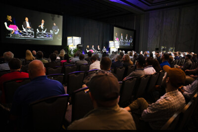
To explore these issues and help surveyors unlock greater value from uncrewed systems, Commercial UAV News recently hosted a webinar entitled “Maximizing Uncrewed Systems for Surveying in 2025.” Featuring a panel of industry experts, including Juan Plaza, CEO of Plaza Aerospace, Aerotas CEO Logan Campbell, and Larry Donelson, CEO & Co-Founder of InTerra, the webinar offered surveying professionals a chance to learn about best practices and unique approaches to using uncrewed technology.
“Drones have become common to the point of being almost necessary in certain types of jobs,” Campbell said. “People are learning where the use cases are, and, where drones are good, they are becoming near ubiquitous because they are so much more cost-effective, so much faster, and you can get absolute perfect quality.”
Campbell cautioned, however, that “it’s really hard to be a surveyor with just a drone because there are so many things that you have to do to be part of the larger surveying industry.”
Building on Campbell’s remarks, Donelson said that he looks at each surveying job in terms of the “deliverable” to determine if a drone is right for the work. “For some situations—topographic mapping, for instance—the data collection capability, the speed, the efficiency at which you can get data from a drone can’t be matched,” he asserted.
Digging deeper into the use of drones in regular surveying operations, the panelists explored issues around certain types of jobs and the challenges of matching the right vehicles with the right sensors, cameras, and software to ensure maximum quality and efficiency. They also looked ahead to changes in the regulatory landscape—specifically the forthcoming FAA Part 108 rules around beyond visual line of sight (BVLOS) flights—to see what further efficiencies can be unlocked.
Campbell thinks Part 108 could enable longer, cheaper flights that will benefit many companies and government clients. However, he said, until we know the exact language in Part 108, it will be difficult to determine the advantages. “We have no idea what the final rule is going to look like but, unfortunately, I have my sinking suspicion that they will make things ‘legal’ but so regulatorily burdensome that it’s still not cost-effective over a manned aircraft,” he said.
Donelson also saw possible advantages to Part 108 but he said the forthcoming rulings could present challenges for surveyors who deploy drones. “Regulations are also restrictions,” Donelson stated. “They containerize what we can do to help the deliverable downstream.” Given that reality, Donelson said that he would rely on his central approach of considering the “deliverable” of each operation to see how the increased flight times and coverage areas enabled by Part 108 would provide value to individual operations.
Despite the many questions surrounding drones and surveying, Plaza sees a future of “longer flights and higher altitudes,” which will enable better drone-based surveying work. “I would like to see the industry, especially in mapping, exploding by increasing the area that we can cover,” he said.
The panelist also presented unique use cases, discussed the battle between legal surveying and mapping that is working its way through the US court system, and more.
Click here to watch the webinar “Maximizing Uncrewed Systems for Surveying in 2025.”


Comments