

To improve weather forecasting, a specialist team at the University of Wisconsin-Madison is using Routescene’s UAV lidar system to detect and visualize forests in Northern Wisconsin, as part of the CHEESEHEAD (The Chequamegon Heterogeneous Ecosystem Energy-balance Study Enabled by a High-density Extensive Array of Detectors) project. By understanding how vegetation and forests influence the atmosphere, the CHEESEHEAD project aims to collect data to enable better carbon emission reduction policymaking in the future.
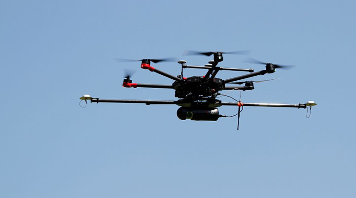
To understand how water, heat, and carbon interact across a variety of landscapes like forests, the UW-Madison team used Routescene's UAV lidar system to survey the prominent tree species in the Chequamegon-Nicolet National Forest, USA, and collect high-density 3D point cloud data of the full tree structure - from the tree canopy to the vegetation at ground level. Surveys were carried out around eleven 100ft flux towers within areas that ranged from 0.25 to 1km², and the team identified six forest types, including Aspen, Pine, Poplar, Larch, Cedar, and Hardwood.
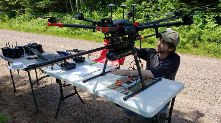
“The tall canopy of 20-30m height created difficult flying conditions. It was difficult to keep a visual line of sight, so we decided to fly smaller 500 x 500m flights to keep sight of the drone.” Christian Andresen from the University of Wisconsin-Madison commented. “The Routescene system worked flawlessly, and we achieved all we had planned. Over the 3 days, our crew of two covered a total of 4.2 km². We were particularly impressed with the density of overlapping flight lines and the mapping of the forest structure.”
Routescene’s turnkey drone lidar solution is ideal for sites where accurate mapping is essential but difficult to achieve, such as hard to reach, dangerous or hostile environments, and contains everything to collect precise survey data. The system can collect data for up to 12 hours enabling long-range data collection.
The UW-Madison team’s case study will help to generate knowledge that advances the science of surface flux measurement and modeling, relevant to many scientific applications such as numerical weather prediction, climate change, energy resources, and computational fluid dynamics. This study also represents the first effort to characterize the forest canopy structure by tree type in Northern Wisconsin employing a drone with LiDAR and serves as a key baseline dataset for up-scaling ecosystem structure and modeling land-atmosphere gas interactions at a regional level.
In the future, Andresen and the UW-Madison team will look into extrapolating lidar data and associated ecosystem structure and function to the regional scale using airborne lidar data by the Wisconsin Department of Natural Resources; integrating airborne hyperspectral imagery for cover classification and derivation of main structural patterns for tree species; and developing a fine-scale classification of LiDAR point clouds by tree species based on structural patterns.

.jpg.small.400x400.jpg)


Comments