Regulation has long been the issue that GIS professionals have been focused on, but Part 107 has redefined the legal landscape in a way that has provided many aerial survey professionals with a place to begin. However, it’s not the beginning phases that some are most concerned about, as questions around the processing and sharing of data of captured by a drone are more prevalent that ever.
One product that addresses those issues for GIS professionals along with plenty others is called
Drone2Map for ArcGIS by Esri. As you can imagine of a product from Esri, it’s both robust and powerful, and a
recent article by Colin Snow explored the impact it’s having on the market. His piece got me curious about how this product is actually being used though, and I wanted to get a better understanding of the real-world impact the product is enabling.
To find that out, I got in touch with Kurt Schwoppe, Business Development Manager for Imagery at Esri. We discussed why he believes imagery is so important, what sort of advantages Drone2Map provides users, what kind of an impact effectively sharing information can have for an organization and plenty more.

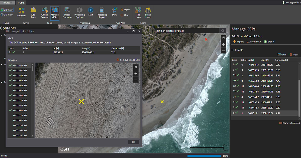
Screenshot of the Drone2Map interface.
Kurt Schwoppe: Well, it had little to do with my efforts (laughs).
Esri has been around for a long while, but we are constantly adapting to market conditions and ensuring the technologies we develop can fit all of the various geospatial requirements that get generated by our users. If you want to talk about this push toward drones, that started at the top when the owner of the company, Jack Dangermond, recognized that this technology was going to be a big deal.
From a content standpoint drones are a game changer, because in the past you had to rely on 3
rd party sources for high-resolution imagery. Jack recognized that with a low-cost drone, which you can keep around in the trunk of your car, you suddenly have a content producing machine capable of providing very high-powered information for your area of interest. Jack immediately clued in on the value of that content, so when we came to him with a recommendation to move forward with a solution that would help integrate the ArcGIS platform with drones, he was immediately in favor of it.
That in-depth understanding and awareness about the geospatial market has kept Esri in such a position of strength for years. Jack can see these things and immediately realize their impact and value on the community itself.
We’re definitely going to talk all things drone related, but I heard you mention that you believe the utilization of imagery is at the heart of all things GIS. Can you talk about the sentiment behind that statement?Those are words spoken by a real imagery guy, and I’ve been involved with imagery since my career started in the Army as a Topographic Engineer in the eighties. I was dealing with a region of the world that that didn’t have much geospatial info available.
Because of the Cold War, Germany and Korea had been mapped to death, but pre-Desert Storm Middle East had barely been mapped at all. By default, the only sources we had to work off of was imagery, so it became immediately clear to me that imagery is at the heart of building up any type of geospatial information about an extended region of interest.
And how do drones impact or change that need?What’s exciting about drones is that they’ve brought it down to a new level. We had reached a point of diminishing returns where the cost of collecting aerial imagery exceeded the value of the information collected. The smaller the area of interest, the more unaffordable it was to collect and use imagery.
At different points in my career, I’ve actually seen a couple companies try to start up imagery aerial collection services to map golf courses, but the cost effectiveness of it just didn’t work. But a drone changes all that. They’re opening up what I call “micro-geographies” and making it cost effective to use image-processing techniques to map, analyze and assess small tracts of land that previously were too expensive for that type of approach.

Before and after swipe comparison of a landfill in South Carolina. You can see how the drone imagery provides a tremendous comparison of all the activities at the landfill. Photo courtesy of McKim & Creed.
 In what ways specifically?
 Landfills are pretty non-glamorous things, but a landfill is a perfect example of what I would call a micro-geography, and I recently read a case study that showed how UAVs can have a real valuable impact for that particular use case.
A landfill is maybe a couple hundred acres in size, so you can fly a drone over it collecting imagery and in a matter of hours, create 3D volume maps of the site. When you compare that data with previous flights, then you instantly know how much volume has been added to that landfill since it was last measured. If you think about how many landfills are around the United States and how this could serve the environmental needs of being properly monitored, you can understand the kind of potential we’re talking about. Drones are something that I think will benefit society in a very big way.

This is a 3D textured mesh of the landfill showing how large it has grown and sticking above the normal terrain. This data will serve as a base layer, so when McKim & Creed recollects the site, they can easily calculate how much volume has been added to the landfill. Photo courtesy of McKim & Creed
The key is the immediacy. We just talked about the importance of imagery, but without a drone you can only get that imagery based on someone else’s collection schedule. When you’re using your own drone, you know that the imagery you acquired is 100% reflective of what you wanted to collect and when you wanted to collect it. That drone imagery is extremely current, and unlike traditional maps it provides context.
In addition to immediacy, context is the other real value proposition of drone imagery. That warehouse may look real nice from the street view but a quick drone flight might show a bunch of corroded 50-gallon drums in the woods out back near the stream you’re fishing in. No map would ever give you that information. Drones give you high-resolution imagery that provides context, and that’s why they can be so valuable.
Can you give us an example of how operators can see and understand the difference this immediacy can represent? We did a demonstration/pilot project for the Corps of Engineers, Wilmington District, down in Wrightsville Beach, North Carolina not too long after we started to roll out Drone2Map. They have this issue along the Outer Banks, and other stretches down the Carolina coast, where there can be severe beach erosion problems. The property values are such that the Corps has to regularly come back and renourish the beaches every few years just so the houses and structures that have been built along the banks don’t go into the ocean. This is a big concern, and the Corps needs to accurately measure and map that erosion, and so I wondered if they could use drones to do just that.

This shows the extent of the area we collected over Wrightsville Beach. The D2M created image has been draped over the most recent image map of the entire area. You can see the vibrant colors produced by drone in comparison to the older basemap. The most important thing is that the drone imagery is “map accurate” and so can be displayed over the map.
They needed to get a 3D measurement of how much volume has been lost along a section of beach, so for the pilot project we flew a nearly mile long stretch with a 3DR Solo drone with a Sony camera. After processing the imagery with Drone2Map, we got 3D results with an accuracy of 2 ½ centimeters, or basically about an inch. These results were verified by our partner in the project, an engineering firm by the name of McKim & Creed. Their survey team had placed a number of blind ground control points in the project area, and they measured our results against those points we knew nothing about. The accuracy was pretty astounding to all the participants, as the Corps was just hoping to get a 3D accuracy within 6.5 inches.
Additionally, instead of surveyed cross-sections every few hundred feet, we provided the Corps a detailed elevation model with 3D points every few inches. With a drone, the entire beach was precisely mapped in 3D. With these numbers the Corps knew exactly how much beach had been eroded since their last survey, and could therefore more accurately predict when they needed to perform another beach renourishment program along that stretch of beach.
It became immediately obvious to all of us that this was a new way of doing land survey. While you can never replace traditional survey, drones can augment it in a way that provides significantly more value for the nearly same effort and cost. For us, it was clear that every survey team in the future is likely to have a drone as one of the key tools that is used to collect highly accurate geospatial information. The pilot program really proved that.

These images are a “swipe comparison” of the newer drone imagery compared to the best available imagery. With a 1 inch resolution, extreme accuracy and taken just a few weeks ago, you can see how drone imagery is a great source for planning or project work.

 You mentioned Drone2Map, and I wanted to get specific in terms of how people are able to use it. Drone2Map works through ArcGIS, but users aren’t locked in around a requirement for the full version of ArcGIS, are they?
 It’s something very important we did in our design of Drone2Map. It does not require our ArcMap software, which is our traditional desktop GIS capability. We decided that we didn’t want to force new drone users to become GIS experts as well. So we made Drone2Map a separate, stand-alone application. ArcMap can certainly consume Drone2Map content and provide a number of rich analytical tools for further processing of the imagery, but it is not a requirement.
We also wanted to make Drone2Map more than photogrammetric software, so we added our web GIS capability that we call ArcGIS Online. This is the primary publishing tool for all the content that is produced with Drone2Map.
For instance, after flying your drone, you use Drone2Map to create all the imagery basemaps or 3D site models of your area of interest. With a simple push of a button, you can publish this content as 2D and 3D maps on ArcGIS Online. Now they are instantly available as web maps to all your potential consumers. Additionally, ArcGIS Online provides access to a number of other map feature layers that can embellish the Drone2Map content to make rich and detailed 2D and 3D information products. This is something much more than what typical photogrammetric processing software does.

Drone2Map in action for the Wrightsville Beach project.
The beauty of all this is that you get tremendous capabilities without the upfront expense for a full ArcGIS system. You get the great advantage to process and publish to the web, and then once you get more familiar with GIS ArcMap and all the other ArcGIS capabilities are right there and available for you.
How much of a factor was pricing for Esri in terms of deciding to structure things in that manner?The reality is that when you’re able to get such amazing results from a $1,500 drone, you don’t want to spend tens of thousands of dollars on software, so we worked to ensure that the Drone2Map Software was market competitive. At the same time, we also wanted to make sure there was enough capability that did more than take snapshots off these drones and publish them as .jpg images on the web. Our goal was to ensure our users could actually make very rich image maps and 3D products that in turn could be shared over the web with their customers and users.
What makes Drone2Map different from some of the other software options that are out there?We wanted the computer to be the photogrammetrist, not the end user. The fact that we added an individual ArcGIS online account gives our drone solution so much more power. If you play around with ArcGIS online, you’ll see the easy ability to make apps, story maps and to apply various additional feature layers to create information products that solve real problems. That’s a true advantage of Drone2Map.
 We’ve touched on the investment that might need to be made to take full advantage of tools like Drone2Map, so what can you tell us about how you’ve seen users leverage that GIS investment in terms of sharing drone-captured imagery across an entire organization?
It’s something we call enterprise imagery management.
Esri is very strong with taking lots of imagery and being able to work with all of it in a way that can be shared and distributed across an entire organization. We also have some very powerful analytical processing techniques that can be done against the imagery on the fly to produce a number of value add information products. An image is an image, so all the content coming out of Drone2Map can readily be managed and processed across an enterprise environment.
If we’re talking about an organization like a big engineering firm where there are potentially hundreds of consumers of that imagery, it’s really not difficult at all to take the content from Drone2Map, store that imagery in our management system, and then serve that imagery up to the various consumers across the organization. For instance, the Computer Aided Design (CAD) Team, the GIS Team, and Environmental Remediation Team may all need access to the same drone imagery, but rather then storing it in multiple data silos on different computers, it’s smartly distributed from a central location via web surfaces. Store in once; use it many times is the concept of enterprise imagery management, and Esri has actually delivered these types of systems that can store and serve many petabytes of imagery content.

Esri was fortunate to get approval to fly the USC Coliseum with a drone, and these are the resulting 3D Textured Mesh products of the stadium. These textured meshes are not pictures – they are actually thousands of elevation postings “meshed” together and colorized. Unlike a picture, GIS can interact with these meshes for more in depth analysis like calculating viewsheds, mobility parameters, sun shading, number of building stories, volumetric calculations, etc.

 What advice would you have to anyone struggling to figure out how they can and should make a change to the tools and technology their organization is currently utilizing?
More than anything else, I'd tell them to keep at it. We are just at the very beginning of figuring out the various types of applications that these drones can support. Be creative and push the technology. Esri and Drone2Map will support your discovery efforts. The commercial drone community is still pretty close right now, so reach out as they can help. Once the decision makers begin to understand the benefits, they'll come around to support your efforts, simply because the investment isn't that significant and the potential rewards are tremendous.


Comments