

With their latest developments, RIEGL once again underlines its pioneering role as a provider of high-performance LiDAR sensors and systems for integration with UAS. The ongoing trend in the UAS industry  demands for performance-matched and survey-grade laser scanners for integration with both compact multi-rotor and high-speed VTOL or fixed-wing UAV platforms.
RIEGL has recognized this trend and aligned its product range in this direction. RIEGL’s typical accuracy/precision and the multi target capability, in combination with exceptional measurement ranges, wide field of views, extremely high laser pulse repetition rates, and fastest line speeds are the basis for the users’ success. These key attributes allow UAS flights at maximum possible operating altitudes resulting in highest possible area coverage. Both time in the field and acquisition flight times are reduced significantly resulting in lower overall costs and increasing the safety in UAS applications. At the same time even more accurate point cloud data with complete coverage can be acquired. This increases the flexibility and most importantly the efficiency of the platform used for the project.
In short: High-performance sensors from RIEGL are the optimal tool for the professional service provider in UAS-based surveying
RIEGL VUX-18024
– Lightweight and Versatile UAV LiDAR Sensor for High-Speed Surveying Missions
The new RIEGL VUX-18024 offers a wide field of view of 75 degrees and an extremely high pulse repetition rate of up to 2.4 MHz. These features in combination with an increased scan speed of up to 800 lines per second make it perfectly suited for high-speed surveying missions and applications where an optimal line and point distribution is required. Typical applications include mapping and monitoring of critical infrastructure like power lines, railway tracks, pipelines, and runways. The RIEGL VUX-18024 provides mechanical and electrical interfaces for IMU/GNSS integration and up to 5 external cameras, mirroring the form factor of the VUX-16023. For smooth and straight forward data storage, an internal SSD memory with 2 TByte storage capacity and a removable CFast memory card are available.
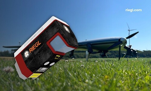
RIEGL VUX-18024: lightweight and versatile UAV LiDAR Sensor for High-Speed Mapping
More information: RIEGL VUX-18024
RIEGL VUX-24024
– Lightweight Aerial LiDAR Sensor with Enhanced Scanning Performance
The RIEGL VUX-24024 is the new enhanced version of the well-established RIEGL VUX-240, now offering higher pulse repetition rates and faster scanning speed for further increased field performance and workflow efficiency. A wide field of view of 75 degrees and an extremely fast data acquisition rate of up to 2.4 MHz, which results in a measurement rate of up to 2 million measurements per second, make the sensor perfectly suited for high point density applications like power line, rail track, and pipeline inspection. Its increased scan speed of up to 600 lines per second allows operations not only from fast flying UAVs, but also small helicopters, gyrocopters and other crewed aircraft at operating flight altitudes up to 4,700 feet.
Mechanical and electrical interfaces allow for the optional integration of an IMU/GNSS system and up to 4 cameras. Data can be stored either on the internal 2 TByte SSD Memory or with a removeable CFAST memory card providing quick data transfer to a PC.
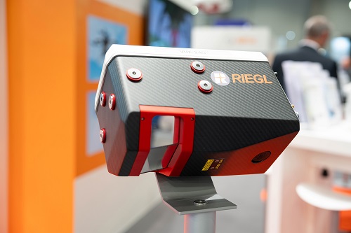 RIEGL VUX-24024: now with enhanced performance for high point density applications
More info: RIEGL VUX-24024
– Now In Combination with RiLOC, an Entry-Level IMU/GNSS System
In addition to the stand-alone versions of the RIEGL miniVUX-1UAV and the miniVUX-3UAV LiDAR sensor, RIEGL also offers system solutions with IMU/GNSS systems and cameras.
Now RIEGL provides RiLOC, an integrated component to complement RIEGL's kinematic LiDAR systems for localization and orientation of LiDAR data in a reference coordinate system. This fully integrated subsystem with a small and lightweight form factor is directly attached to the housing of the miniVUX-1UAV or miniVUX-3UAV with a total system weight of only 1.75 kg. RiLOC itself consists of one or two GNSS receivers, an inertial measurement unit and a data acquisition controller with accompanying software. It makes use of tight coupling in processing inertial, GNSS and LiDAR data providing a new entry-level option for RIEGL’s cost effective UAS LiDAR system solutions.
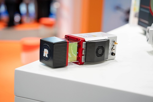
RIEGL miniVUX-3UAV with RiLOC, RIEGL’s entry-level IMU/GNSS solution
More info: RIEGL RiLOC

.png.small.400x400.png)


Comments