

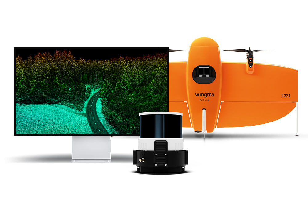
First announced in mid-February, the launch of a new LIDAR drone solution from Wingtra was significant for multiple reasons. By integrating the efficiency of WingtraOne GEN II drones with a state-of-the-art Wingtra-engineered LIDAR sensor, this new solution enables users to capture data in ways that are both simplified and repeatable. Even more significantly, the LIDAR payload represents an all-encompassing solution that can perform tasks during the initial discovery phase through project implementation and as part of infrastructure maintenance.
 That completeness and ease of use further defines the concept of a “complete drone solution” that’s been discussed for years now. However, as the needs of users across industries continue to develop and get more specific, is having a single solution as much of a priority?
“We're very confident that having one platform that can do all the work is crucial and of paramount importance to customers,” said Wingtra Product Manager Julian Mackern. “Having one platform that flies fast and easy allows you to change payloads on the go, copy the previous mission and go fly again without losing time.”
This new LIDAR fits into the GEN II to allow established users to go through the same flight planning software with the same checklist. It reduces the need for post-processing strip alignment by allowing users to capture precise terrain information immediately from each flight. These efficiencies will be evident to anyone that has experience with the technology and with GEN II specifically, but users of all types will be able to easily take advantage of them.
“For partners and customers who have been flying with LIDAR, they know that if you fly a long line, there will be a drift between the IMU and GNSS data that will bring errors,” Mackern told Commercial UAV News. “The longer the line, the bigger the error you're inserting. Wingtra has solved this by flying fast (same 16 m/s) and by segmenting the long corridor lines so we do not see a drift between GNSS and IMU data in our flights.”
Mackern further explained that anyone who has experience using LIDAR will likely have spent many hours aligning LIDAR strips in post-processing software since every strip needs to be in the right position to avoid duplicating objects and missing information. Many LIDAR systems require the alignment of strips which is time-consuming, expensive and can skew the data. Wingtra LIDAR is built in such a way that it does not need to do any strip-alignment. Not having to do any strip-alignment has a major impact on both the quality of the data and the time consumed on post-processing point clouds.
More info about this process is available here.
Users can experience additional efficiencies related to trajectory correction with Wingtra LIDAR App, but all of these features were designed to enable established and new operations with LIDAR, especially ones where a surveying team needs to gather information of terrain. Those sorts of teams will get immediate use out of the new product, but the simplified and repeatable process truly opens it up to users in multiple industries and for countless applications.
“This new product allows your surveying team to perform operations in a more efficient way, and can be used by any pilot,” Mackern said. “You really don’t need to have any experience or expertise when it comes to correcting trajectory or aligning strips. Anyone can gather high-quality data consistently.”


.jpg.small.400x400.jpg)


Comments