

Along the Outer Banks in North Carolina there are severe beach erosion problems. Municipalities need to frequently monitor beach conditions and actively attempt to mitigate the effects of erosion due to storms and other natural events. Doing so in an effective way can be a challenge financially and logistically for the US Army Corps of Engineers (USACE), which conducts regularly scheduled beach re-nourishment projects.
In May of 2016, officials in Wrightsville Beach, North Carolina connected with Esri and McKim & Creed to conduct a ‘proof of concept’ beach-mapping project that involved imagery data collection from a drone. I was able to touch on a few of those details in an interview with Kurt Schwoppe, Business Development Manager for Imagery at Esri, but it was clear there were a number of important insights associated with the project that we weren’t able to address, the least of which were the logistics of how they were able to get 3D results with an accuracy of 2 ½ centimeters from the drone.After further exploring the processes which were utilized on this project, it became clear that drones and tools like Esri’s Drone2Map have and will make a major impact around the approach geospatial professionals can take for projects like beach re-nourishment surveys, especially when compared to traditional procedures. UAVs and Geomatics McKim & Creed is an employee-owned civil engineering and geomatics firm with about 400 employees in offices throughout the southern region of the United States. They’re one of the top engineering, design and geomatics firms in the country.While the company has plenty of experience in areas like conventional land surveying, mobile LiDAR, and subsurface utility engineering, they’ve seen how drones have literally opened up new worlds in terms of their approach to gathering data. Their UAV focus has been around being able to utilize small drones with big sensors that allow them to collect imagery for orthophotography and photogrammetric extraction, among other things.“One of the goals for us from the beginning was to try and focus on smaller unmanned systems with the best possible sensors,” said Christian Stallings, R & D Manager and Pilot at McKim & Creed. “We wanted it to be another tool in our tool truck. We have a lot of field people and we wanted to provide them with the tools to collect information which would allow us to create different derivative products in the markets we service.”The applications for drones include, but are not limited to, small and medium site mapping, volumetric measurements inspections, construction site monitoring and damage assessment. However, these new capabilities have not impacted the expectations of clients in terms of their desire to receive mapping products that they’re familiar with and are consistent with their design process.“Drones are just another tool to give our clients the exact same thing they've already been getting, just at a better cost and in a quicker time frame,” said Todd King, Business Developer at McKim & Creed for their geomatics division. “It's given our clients the best product for the best price.”Being able to produce the best product for the best price was the focus for everyone when they assembled on Wrightsville Beach in May of 2016 in order to assess how effective it would be to collect and process imagery via a drone. Those results have and will impact how professionals utilize low-cost drones for various types of projects and produced numerous takeaways for everyone involved. Wrightsville Beach and Drone2MapAlong the shores of both North and South Carolina, the USACE conducts frequently scheduled beach re-nourishment projects to mitigate the effects of events such as storms and hurricanes. Re-nourishment projects need to be initiated and monitored on a regular basis, and that need is why people from local, state, and federal agencies gathered on North Carolina’s Wrightsville Beach to work with the teams from Esri and McKim & Creed.At its’ core, the project was looking to evaluate the use of low-cost commercial drones for the production of accurate high-resolution 2D and 3D geospatial products and to understand the environmental impacts of using drones. Specifically though, the team wanted to evaluate the use of drones for beach re-nourishment surveys and volumetric measurements. They were able to find and document all of these details by utilizing Esri’s Drone2Map application, which allows users to quickly turns raw still imagery from drones into professional 2D and 3D imagery products.“Drone technology is able to provide a way to quickly monitor pre and post storm events,” said King. “Using the Drone2Map software with the appropriate data collection, allows a municipality or USACE to quickly and easily gather information, process that info, then send it over to the federal government to help setup assistance for the post storm situation. It's an easier and faster way to process imagery and get back the info they need.”
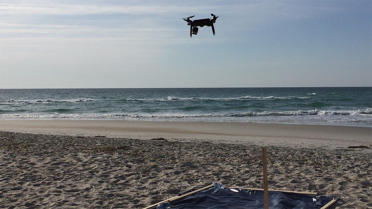
 Speed was a critical consideration for the project. The team used a 3DR Solo to capture about 75 acres of topographic data in sixty minutes at a 1.05-inch resolution. However, it was the specifics of the Drone2Map capabilities that really made a difference for the team.“I was involved in the beta of Drone2Map prior to this,” said Stallings. “At the time there still were things that hadn’t been implemented yet, but even then you could see how they were building upon Pix4D's processing to seamlessly integrate with Esri's products like ArcMap which is perfect for a company like us.”McKim & Creed placed 14 survey targets on the beach and set up 22 blind checkpoints. After Dense Image Matching (DIM), the Point clouds were compared to the blind checkpoints to verify accuracy. A TIN model was created in the ArcGIS extension LP360 to calculate the DeltaZ of each point. This is the same method used for verifying LiDAR point clouds.Those points of comparison were things the team was actively looking at as they focused on how UAVs compared to both conventional survey methods and terrestrial LiDAR. Their results confirm how sophisticated and powerful the technology has become.
 Comparable DataTo create a business comparison that the team at Wrightsville Beach could leverage and use to make short and long term decisions, the team put together a 5 mile beach profile that looked at the results of the UAVs versus a couple other more traditional survey methods. To ensure the comparisons were going to be accurate, the USACE planned to do the terrestrial LiDAR tests in nearly the exact same conditions.“After we had done our UAS flight the terrestrial data was collected over the same site and the USACE were able to incorporate the targets we had placed for the UAS flight from the morning,” said Stallings. “We were able to check the data against our blind checkpoints. It hit at the same accuracy as the UAS data.”The accuracy of the terrestrial LiDAR was nearly the same as the R10C data from the blind checkpoints. The two surfaces matched up in every important way, and the differences were mostly in regards to the terrestrial data which extended further out than the UAV data only because of the differences in time it took to gather both sets of data. The UAV simply wasn’t out there as long because it didn’t need to be.The team also made sure to look at how these methods compared to conventional survey methods, and the results of these comparisons are easiest to see when laid out against one another.UAS vs. Conventional Survey
- Accuracy - UAS is within 4 cm on control points
- Cost - UAS is 30% less expensive for competitive project
- Time - UAS captures greater detail in less time
- Accuracy - UAS is within 2 cm of LiDAR specifications
- Cost - UAS is 15% less expensive for competitive project
- Time - Similar mobilization & coverage, faster collect & processing
 UAVs and FutureResults like the ones McKim & Creed were able to produce clearly demonstrate just how capable UAV technology has become. It’s easy to get caught up in the excitement around how many different problems these tools can solve, but it’s just as important to remember drones are not about replacing anything. They’re creating and inventing alternatives for professionals, and professionals are the ones that can and should be exploring the possibilities.“What’s essential is keeping the technology on the forefront and making sure the correct information is actually being produced,” King mentioned. “we're excited to see what we can do with Esri’s Drone2Map, and it's definitely opened the door with our crews that are in the field right now.”Talking about all of the time and money that drones can save is a relevant point of discussion, but professional service providers understand that there are certain tools for certain applications. It’s something that came up as we explored what it meant to try and compare photogrammetry and LiDAR. UAVs are an incredible tool for engineering and surveying, but it's not for everything. There are applications where it doesn't make sense, and those realities need to be understood by clients as well as by the people making the decisions.We can see that in the Wrightsville Beach project, since it was one that needed to capture a high level of accuracy. However, just as a project like this needed that kind of insight, others might not. All of that goes back to selecting the right tool for the right job, regardless of what type of person is making that decision.“The intended use dictates the level of accuracy required,” Stallings concluded. “For a project like this, high accuracy was very important and we wanted to show what Drone2Map was capable of doing when fully controlled. There are many applications where this is not necessary and we encourage students, small government, and others to see if the technology is right for their needs but to also understand when the scope is beyond their own means. I think it’s wonderful that hardware and software is this affordable which can bring more people into mapping and help push the envelope of what is possible.”Regardless of the type of project, what matters is the result. Drone technology is going to allow companies like McKim & Creed to capture more precise data in an efficient manner, but it's also going to allow municipalities that are already using Esri products to collect ground control data correctly and use that data effectively, which isn’t something they could have done before.The technology has created options for people that are continually being explored, and those options extend across different markets, industries and experience levels in countless ways.
Picture of the team, taken from the drone.


Comments