

With the U.S. Department of Justice recently making its ban on Chinese manufactured drones official, the topic of security and country of origin is intensifying. But the U.S. Government is not the only national government contemplating and enacting restrictions on drone hardware and data, and this makes country of origin an international concern. Many countries, China being the most notable, around the globe have laws that require businesses to provide access to data stored upon local servers upon request puts valuable information at risk of falling into the wrong hands. Realizing the risks and consequences of these laws, governments have been quick to act to curtail this access and put regulations and restrictions in place, with the U.S. and Europe being the most notable.
This is one of the reasons why Auterion recently partnered with Freefly to create the Astro drone, a secure drone platform using US Department of Defense-approved Blue sUAS software architecture. Following on the heels of that announcement, Auterion revealed integrations with Site Scan for ArcGIS from Esri, a leader in location intelligence, providing an all-in-one, cloud-based drone mapping solution.
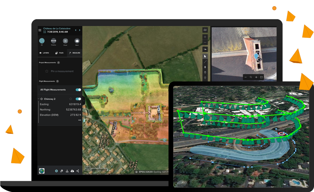
“Site Scan for ArcGIS is used by organizations that require drone imagery for visual inspections, site monitoring, asset management, and situational awareness,” stated a recent press release. “It’s an all-in-one, cloud-based drone mapping solution for managing fleets and collecting, processing, analyzing, and sharing data products.”
This announcement continues to build upon Auterion’s goals to provide secure, open-sourced solutions to the global enterprise.
“Our expertise in providing an enterprise drone platform based on open-source software enabled us to meet the needs of the US government and governments worldwide,” said Dave Sharpin, CEO, Auterion Government Solutions. “We are very excited to partner with Esri and provide [its] users with our groundbreaking technology.”
In recent years, government entities have been left trying to figure out how to conduct critical missions with increasing advisory warnings and bans on software and hardware. For example, in Europe, data gathered from publicly funded or critical infrastructure projects cannot leave the European Union (EU). In order to help the industry operate within these restrictions, Site Scan for ArcGIS has been deployed to a server cluster in Ireland so that European customers can use this server cluster to keep their data within the EU, meeting stringent project requirements. Therefore, with the integration of Site Scan for ArcGIS and Astro, these agencies will have a much needed, all-in-one scalable drone workflow.
“The relationship we have established with Auterion is key in being able to offer high-quality, secure drone software to our US customers looking to take advantage of our advanced, secure, drone-based imagery collection and management platform,” said Richard Cooke, Esri director of imagery and remote sensing in the press release. “Additionally, through the development of the EU deployment, an even wider range of customers located in Europe will be able to maintain their data and data processing locally.”
The ability to trace data storage back to local servers will make all the difference for drone companies looking to secure government funding and commissions, making this an important paradigm for the future of security within the industry.


Comments