


What does it mean to enable success with a drone program? And how can that success drive further scale in the future?
Recent reporting has detailed how the United States Forest Service (USFS) is using drones to transform wildland firefighting, outlining what that success and scale looks like for the agency of the U.S. Department of Agriculture which manages over 193 million acres of land across the nation. This success has meant implementing well-established uses of drones when it comes to getting an aerial view of wildfires, but also includes some innovative aerial operations that drop “dragon eggs” onto the forest floor for prescribed burns. It’s a reflection of the belief that the agency has when it comes to using drones to support a host of natural resource management activities which can save taxpayer money and keep their teams safe.
What has it meant to create training for drone pilots across the agency? How is the department approaching the transfer of risk associated with certain helicopter missions to drones? What is the best approach to sorting out challenges when adopting the technology? The Forestry Service’s answers to these questions demonstrate an approach to adoption that is relevant to programs and organizations of all types.
Initial training and continuing education
The Forest Service began experimenting with drone technology in the early 2000s when the department’s remote sensing team realized how much info and data could be captured below the traditional satellite and crewed aircraft perspective. The resolution they could get with drones sparked the interest of various team members, as they quickly saw what it meant to collect more high-resolution data to hone in on what was happening on the ground.
Usage of the technology was dependent on individual teams and specific projects for many years, but that changed in 2018 when Dirk Giles, National UAS Program Manager for USDA/Forest Service, was hired. He needed to define how the technology could not only be utilized across regions, but also for distinct applications, as teams were asking for specific collections of data associated with their projects. Those needs helped to outline the goals and objectives of what the agency wanted to build with their drone program. Those details also impacted the approach to they took to buying and education.
“We knew we need to make sure we had focus and intent with what we were moving forward with,” Giles said. “We utilized a Keystone Document that was really prescriptive around the business case. It dictated what we were going to buy and how many of them we were going to buy. But then we focused on a programmatic risk assessment of what it was going to take to make this work, not just at the national office, but at the regional offices where the work would actually take place. How could we establish jobs that would oversee everything at the national, regional and local level? Creating an operations guide was also a big part of this initial adoption process so that everything we were doing could roll out to the field.”
That rollout would eventually establish the IAT, or Interagency Aviation Training. For that training, Part 107 is treated as the floor, not the ceiling. The IAT outlines a minimum requirement for training standards for aviation but then quickly expands into how to fly for the government, how to plan a mission for the government and how to execute that mission. From there, training is broken out into different areas of focus that are geared towards a specific mission. The National Wildfire Coordinating Group class is one of those areas. Another is focused on resource management. Eventual areas will include one focused on law enforcement.
The educational elements of the Forest Service’s drone program aren’t just about initial training though. The continuing education that is built into the program is just as important, which is something that Dusty Kavitz, an Unmanned Aerial Systems program manager with the Rocky Mountain Region of the U.S. Forest Service, saw and experienced firsthand. With a background in natural resources, he hadn’t even considered flying a drone until 2018, when the training program began to take shape. Now it’s something he’s enabling in a way that supports the standards for UAS utilization and performance of the agency as well as the needs of individual drone pilots.
“Our training is designed to make sure we’re meeting the needs of our pilots,” Kavitz told Commercial UAV News. “We take a lot of pride in that, which is why we offer refreshers and additional trainings that folks need to continue to grow in their knowledge of the use of UAS. A lot of that entails planning; planning different types of trainings, getting people together to talk about what went wrong, or what went right, and how we can continue to grow and be a professional UAS organization within the Forest Service.”
Pilots in the Forest Service’s drone program are trained on drone sensors and systems from start to finish and beyond, which is essential given that many pilots are firefighters or fuel technicians first, meaning they all have day jobs. Their approach is centered on policies, practicalities and standards that are essential for a drone program of any size or type.
Data, processes and people
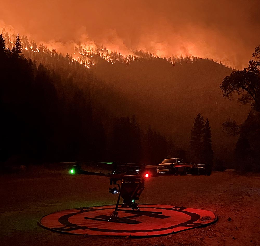
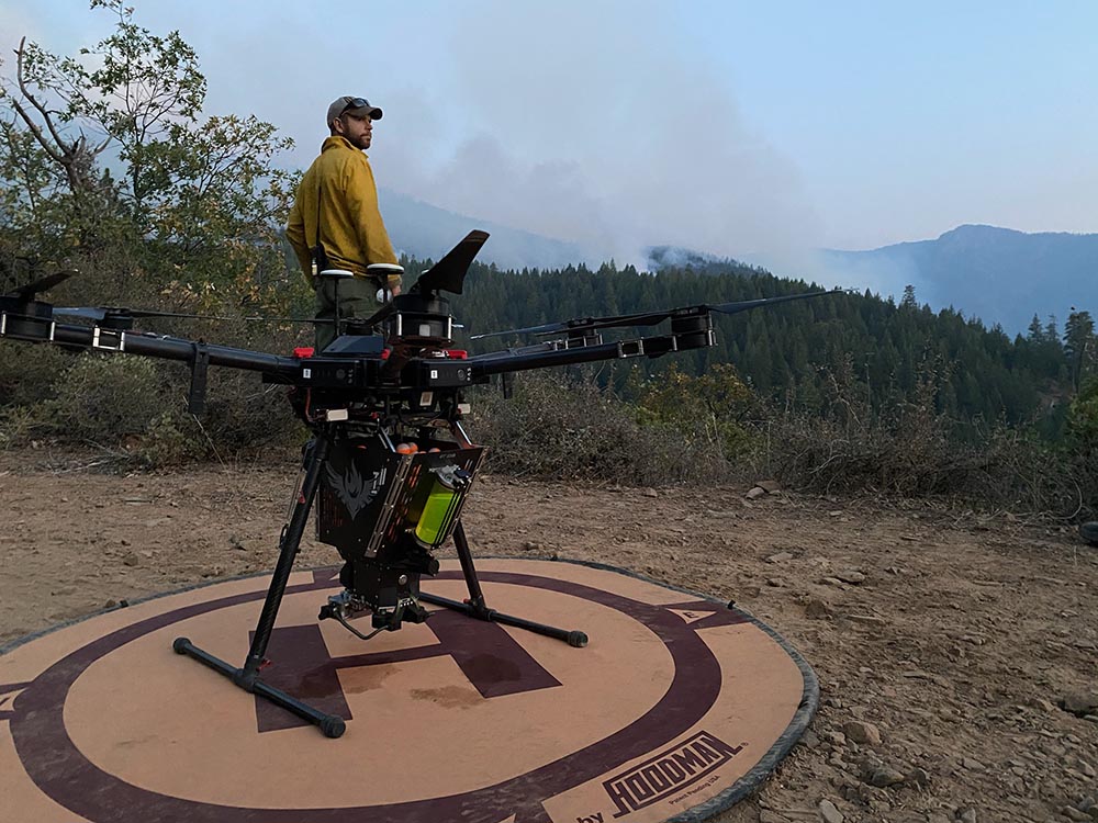
As ever, success with drone technology isn’t really about the platform itself, but is instead about the goals and mission of a given operation. Objectives for a Forest Service mission can vary from data capture on a wildfire to the monitoring of wildlife but they can also include physical operations like aerial ignition, which is the practice of dropping spheres from a payload. These spheres are chemical-filled plastic balls about the size of paintballs. Known as the aforementioned “dragon eggs,” they ignite after they are released. Based on the needs of land managers, drone pilots load spheres into the payload and fly patterns on the lands to perform prescribed fire missions under the direction of on-the-ground personnel.
This variability in terms of the goals and operation of a given mission speaks to the incredible flexibility of the technology. It also highlights the importance of the data, processes and people that facilitate these solutions to support better management decisions.
“Our pilots are trained to be pilots for specific drones and sensors, because they need to understand the data process,” said Kavitz. “In the case of LiDAR, we want them to have an understanding of that data's process, because that plays into how they plan their mission. They need to make sure they're collecting accurate data because it’s going to be used by different teams, at different times.”
There’s no lack of data for the department because whether it’s from their Alta-X or ground-based sensors, data is coming in from everywhere. That creates a challenge that isn’t unique to the Forestry Service, as a deluge of data from drones and everywhere else can cause integration challenges. Sorting them out can be more about stepping all the way back though.
“It really comes down to the storage management governance,” Giles said. “In the beginning, that was a real challenge because I was specifically told that data was something for the IT folks, and the data challenges were their problem to solve. The safety of flight was my objective. The problem was there was no existing system to manage this sheer volume and scale. And then at the same time, how were we supposed to keep a system of records? What is the schedule for this data? If it's not maintained, when does it go away? I collaborated with one of our data specialists to come up with a plan for all of that. I think that engagement, especially in the beginning, is so important.”
After a fire occurs, there might be 10 to 15 years of restoration efforts that are focused on stabilizing the soil. Teams are using drones to help define a plan around how any data associated with that fire is captured, processed and stored. Doing so has given these teams a baseline for a management plan of these areas. Because of this, they can now look at the rehabilitation strategy used on a slope that burned two years ago and explore how they want to do the same or something different moving forward.
Those specifics are what’s needed to outline the goals and mission of a given operation and an entire program. Such details are directly related to creating value with the technology that represents a real ROI but is also a difference in terms of safety that is literally immeasurable.
Where else can you go with the technology?
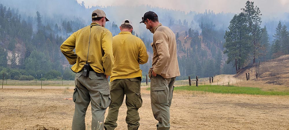
The value that drones enable for most organizations is typically related to how it can enable certain tasks to be performed in faster, cheaper or safer ways. That safety impact is often tough to quantify but the difference it represents for Forestry Service teams goes beyond the bottom line. As many have detailed, flying low and slow in a single-engine helicopter above a wildfire is quite dangerous. These are the exact situations where drones can be utilized instead of helicopters, which makes all the difference to people who would otherwise be in those precarious environments.
“Over the last eight or nine years, we've had multiple helicopter crashes that resulted in fatalities,” Giles mentioned. “They were all within that low and slow mission profile. We’ve seen a big shift though, because for about 80% of the burns that we’re doing with UAS, the original intent was to perform those tasks with a helicopter. We know there is a safer system that we can move to and that’s what we’re doing with drone technology.”
Defining how drones can work within an established aviation portfolio is a priority for Giles, as helicopter units aren’t set to be displaced. There are heights and tasks that helicopters will always be best suited for but drones can serve as a substitute in certain situations to minimize risk. This kind of augmentation to established operations goes beyond safety though, opening up brand new opportunities for individual teams and the entire agency.
“There are just so many other places we can go with this technology,” said Kavitz. “And that’s in every sense. You can look at things like adding additional sensors to capture better information, but there’s also potential to do something really different, like using drones to help irradicate invasive species. We need to be flexible in the utility of the technology and continue to grow with it as we grow as an organization. If we can improve the efficiency and effectiveness of how we make management decisions on the ground we're saving taxpayer dollars.”
The quantifiable savings as well as the immeasurable safety impact that the Forest Service’s use of drone technology has enabled was driven by leadership that believed in and was committed to creating this value. It’s the sort of leadership that Giles called out as key to the department’s success. It’s also something others can similarly enable, no matter the application or industry.
“If I were to distill it down, I think success with the technology is a matter of perseverance and finding the right way to effectively communicate with somebody when they can't see your point of view,” Giles said. “You’ve got to get whoever you're working for engaged so when something big is coming down, they're going to support you. We know we have that kind of support, which is why it’s such an exciting time for us. We know there's a new way that we can fight fires smarter or better, which is mostly about using the existing technology to build, maintain and then scale these solutions in the future.”
The value that drone technology has created across the Forest Service stems from efforts to create standards for UAS utilization and performance that began in earnest but have since scaled to a whole new level of capability. However, the success and scale of their drone program is as much about this approach as it is about technology, highlighting the importance of having people who understand what it means to think strategically and act intelligently to best leverage drone technology across individual teams and entire organizations.


Comments