

The surveillance capabilities of drones are often the first things people think about when it comes to applications in law enforcement, but UAVs can be used by police departments in far more circumstances and situations. At the SPAR 3D Expo, those capabilities were discussed and demonstrated for attendees by actual law enforcement officials.
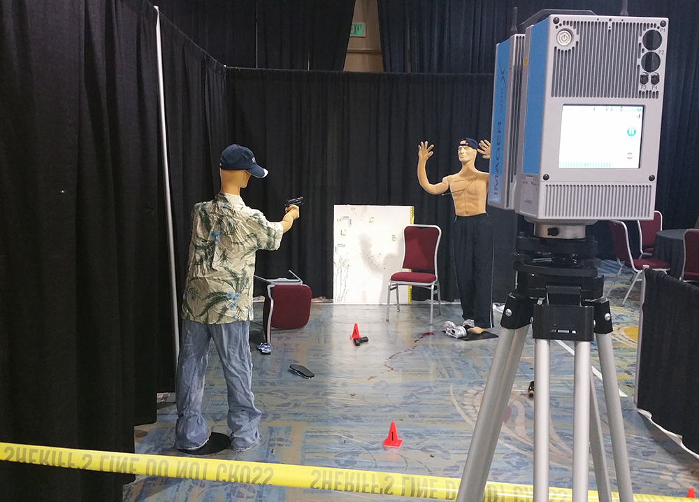
As part of the pre-conference package, attendees were able to attend “SPAR CSI”, which featured a staged crime scene. Various laser scanning solutions showcased how they’re able to accurately capture the information in a given crime scene and recreate the scene in 3D. These systems can capture the minutest details, up to and including individual blades of grass that are on the periphery of a scene.The information gathered from the scan can be essential pieces of information for crime scenes and locations that will almost always change very soon after the crime. A piece of information from the scan might offer investigators a critical perspective or serve as an essential piece of evidence if the case needs to be presented to a jury. This 3D scanning technology isn’t especially new, but what’s different is the way in which drones are impacting the how this info can be gathered, which attendees heard about and witnessed for themselves. Damon Hall, a Lieutenant in the Montgomery County Sheriff’s Department, talked through how his department utilizes traditional laser scanners. They mostly deploy their unit in homicides and officer-involved shootings, but drones have opened up a variety of opportunity for them. Originally, the department was interested in a drone for emergency situation purposes, such as wildfires, S.W.A.T. situations and floods. However, they quickly realized they could take advantage of the opportunities drones presented for crime scene documentation purposes.Lt. Hall discussed a recent case where a body was found in the river. After it was reported, their agency sent out a helicopter to grab the actual GPS location of the body, and then sent a drone to catalogue the scene in detail. Without knowing the specific nature of the death, it was extremely important for them to gather as much genuine information as possible from the scene before anything could happen to it via natural or unnatural means."Getting the data before it's destructed is absolutely critical," Lt. Hall told the group.
 As I mentioned though, Lt. Hall wasn’t there to simply tell people about how his department uses their drone, he showed everyone what that actually looks like. Their Tactical Air Unit vehicle is outfitted with a station that rolls out and allows the operator to easily setup the controls. Once the drone was in the air, Lt. Hall explained how and why the conditions were impacting where he was able to fly, and also showed attendees what it took to control the drone as well as how the data was being gathered.It’s one thing to talk about all of the opportunities that UAVs can and have enabled, but it’s quite another to actually see them being realized. Attendees of SPAR 3D were able to do both courtesy of the Montgomery County Sheriff’s Department, which provided a great look at how drone technology has influenced the way in which they investigate and document crime scenes.
See if you can spot the drone in the sky.


Comments