
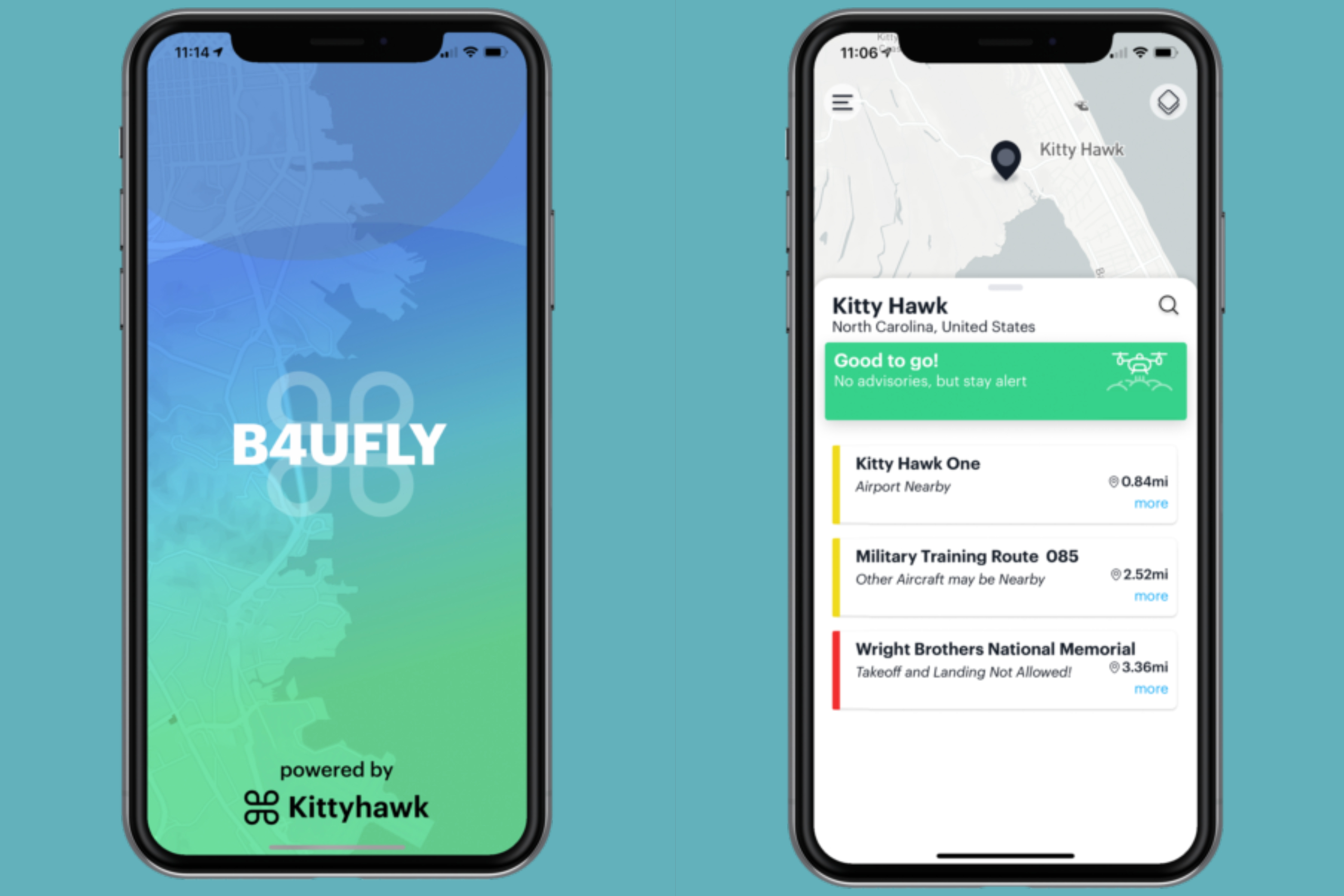
The new app leverages Dynamic Airspace, Kittyhawk’s patented airspace controller for managing real-time flight restrictions, authorizations, and guidance. B4UFLY programmatically consumes FAA data sources for controlled airspace, special use airspace, critical infrastructure, airports, national parks, military training routes and temporary flight restrictions.The app also provides links to helpful UAS educational content, safety resources, and LAANC."B4UFLY provides the entire drone community in the U.S. with an important tool to quickly and easily check the airspace before they fly" Steve Roy, vie president of marketing at Kittyhawk, told Commercial UAV News. "If we can all be hardwired to think of safety first and the app becomes part of that habit, the industry will to continue to enhance its reputation. That's a good thing whether you're just flying for fun or doing important work as part of your job."According to Kittyhawk, more than 700,000 people have used B4UFLY since its original launch in 2016.The exclusive public-private partnership between Kittyhawk and the FAA was announced in February. when the agency selected company to upgrade its B4UFLY app.
“B4UFLY is a hallmark of our commitment to ensuring drones are safely integrated into the NAS. Our partnership on B4UFLY with Kittyhawk represents the kind of public-private partnership that is essential to advance this burgeoning industry," said Jay Merkle, executive director of the FAA UAS Integration Office. "As the skies become more crowded and UAS operations become more complex, basic airspace situational awareness, especially for the newest of fliers, will be essential.""It's a true partnership with the FAA where the common goal of safety is paramount. Being focused on that one single goal of making it easy for drone fliers to check the airspace around them made the development process seamless," said Roy.
Future development of B4UFLY will include new capabilities for weather, Remote ID and additional data layers for uses in public safety, natural disasters and emergency response.


Comments