

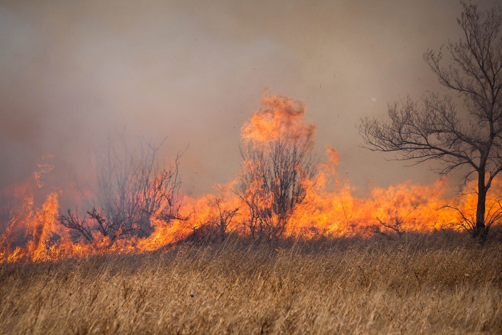
In June, the Canadian Interagency Forest Fire Centre declared 2023 as the worst wildfire year in the nation’s history. To put a number on it, the agency reports over 13.2 million hectares have burned across the country as of August 8, nearly doubling the previous recorded high of around 7.1 million hectares in 1995, with the CIFFC presenting data going back to 1983. The fires, in addition to the physical danger and displacement that comes with any wildfire, have led to air quality issues not only in Canada, but also throughout the northeastern United States, with smoke even traveling across the Atlantic and into Europe.
While annual repeats of this will hopefully not become common, effects from climate change will likely lead to worse-than-average wildfire seasons more often than not. The good news, insofar as good news can be possible with these disasters, is that technology has improved and can lead to new capabilities to help mitigate consequences from the fires. UAVs are among the relatively new tools which can be used for these important missions, which we’ve outlined recently here at Commerical UAV News.
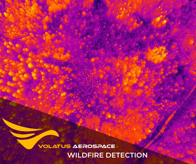
The linked article is focused on the use of UAVs to fight wildfires across the United States, which of course also deals with plenty of their own fires throughout the country. UAV usage is not limited there, though, and Canada is also taking advantage of the technology in their own ways. One company helping to lead the way in implementing the tools in these crucial missions is Volatus Aerospace, who recently announced the completion of their first field deployment supporting wildfire suppression agencies in Western Canada with remotely piloted aircraft.
Walter Weselowski, Team Lead, Special Flight Ops for Volatus, and Dean Attridge, VP of Solutions Engineering for Volatus, recently spoke with Commercial UAV News about how UAVs are used to help fight wildfires in Canada, where there may be differences between Canada and the U.S., and what the future of these missions could look like.
Hot spotting with UAVs
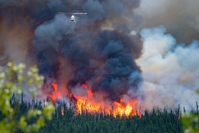
Right now, UAVs largely support firefighting missions by hot spotting, using thermal scanners to search for still-burning areas along a fire line. Weselowski told Commercial UAV News, “Traditionally, they’ll send a helicopter or an aircraft with a thermal scanner to try to go and find these hotspots that are left on the fire lines, that way they can extinguish them and they’re not worried about the fire picking up and taking off on them again. It moves from a ‘being held’ status to ‘under control,’ basically.”
Now, UAVs are taking on some of this work, boasting payload thermal scanners which Weselowski notes are “basically the same as any handheld, or what you’d find in any commercial, civilian-grade infrared camera that’s on an aircraft.” These payloads have the ability to see potentially dangerous hotspots that would not be visible to the naked eye.
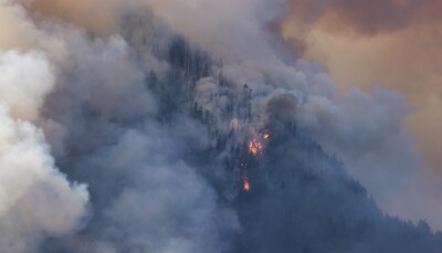
“What they’re looking for is not necessarily the stuff that’s out in the open and burning, because anybody can walk by and see it. They’re looking for a lot more innocuous stuff, hotspots burning inside of trees, or in the roots underground. I’ve seen peat moss that’s been burning 14, 15 feet under the ground and you can’t see it. There’s no indication at the surface, but when you look at it with a thermal camera it lights up like a Christmas tree.”
This work is crucial to keeping these fires under control, as these sorts of “hidden” hotspots can restart a fire in an area that was previously thought to be contained. For example, with a hotspot inside a tree, if that tree later falls over at some point, that hotspot can now be refueled and picked back up after the firefighters and equipment have moved on to other locations. These kinds of missions undertaken by Weselowski and his team help to ensure, to whatever extent possible, that these fires truly are contained before moving out of the area.
Differences between Canada and the US
While there is a good amount of coordination between agencies in the United States and Canada, each assisting the other in fighting fires when necessary, there are still some broad differences in how these fires are fought and more specifically how UAVs are incorporated into those efforts. While implementation of UAVs is still relatively new in both nations as regulatory issues had to be hammered out before utilization fully started, both Weselowski and Attridge agreed that the US is at least slightly ahead. The former said, “To me, in Canada, we are behind on just having very limited applications for drones on fires right now with what they can do, when there’s capabilities to do more with them.”
Attridge echoes that, saying, “The US is tested, I would say, a little bit more, and has started to employ some different techniques with drones to a certain extent.” Even so, he makes clear, “I wouldn’t say they’re leaps and bounds ahead. There’s still a hesitancy, as Walter was talking on, of coordinating drones into [fighting wildfires].”
In recent years, Attridge has accompanied the US Forestry Service in efforts to contain wildfires in California, and noted a couple of differences from what Weselowski described. Perhaps the largest was the time of day they could fly. In Canada, these missions generally take place between midnight at 5:00 AM while it’s still dark, keeping the UAVs out of the airspace of crewed aircrafts performing other duties, and flying away from where firefighters on the ground are at work. In the US, however, Attridge notes this wasn’t the case, with drones flying during the day at high altitudes to track fire lines as they were active.
There is also the difference in the location of the fires between the two nations. The US certainly has wildfires all across the country, but generally the worst fires are contained in the Western part of the nation in states like California and Oregon. In Canada, however, that’s different. There are plenty of fires out west as well, but they also occur further east. For example, the fires which were causing air quality issues in the U.S. and Europe were burning in Quebec. This year especially was a “banner year,” according to Weselowski, in terms of coast-to-coast fire incidents.
What is the next frontier?
In both Canada and the US, use of UAVs for these missions is still relatively new as regulatory questions held things up in the early stages. Weselowski says that in Canada, much of this work didn’t get started until 2018. In fact, he says, before Part IX was put into effect in 2019, “We were using the special flight operations certificate process, which was designed to permit air shows. So, every air show they did in Canada, you’d have to fill out this permit. And Transport Canada’s thinking, How can we get drones into the airspace, given that up until 2019 there were no regulations on them. They said, Well, this is the only way we have, is to make everybody go and apply for this permit to be able to operate a drone.”
Things have certainly improved from there, but there is still growth to be had. Attridge notes a couple of areas where we are already seeing some testing that could be a more common role played by UAVs in the near future, one of which being fire line tracking. He says that is still being done largely by crewed aircraft right now, that those aircraft “have similar, drone-like cameras mounted on them to do fire tracking, and line tracking, and everything else. There’s an overlap there between capabilities to a certain extent.” Switching to UAVs for those parts of the mission would not only save money, but more importantly, represent a safer alternative.
In addition to the live fire tracking, other potential future use cases offered included tracking firefighters’ locations during a mission, providing aerial intelligence before and after fires to help with planning and/or rebuilding, hauling cargo and water to firefighters on the ground, back burning against a fire to remove fuel and try to control burns, and eventually assisting or replacing low-flying crewed aircrafts in actually fighting the fire.
Of course, implementing these new use cases is easier said than done, especially from a financial perspective. “There’s only a finite amount of budget for these fires, and where do you put your money? Where do you get bang for your buck,” Attridge said. “That’s the agency’s challenge in doing this.”
What no one can deny is that these efforts are only going to become more important, and more difficult, in the coming years. Usage of UAVs in these missions is still developing, providing hope in reducing the effects of Canada’s future fire seasons, which could at least approach the severity of 2023.
“We’re very closely looking into at the moment, as a company, what we can bring to Canada to make a real difference in next year’s fight,” Attridge said. “We’re not there yet, but we aim to be prepared to be able to offer additional services in the future.”


Comments