SimActive released Correlator3D Version 1.0 for large-format aerial sensors in 2008, and the company has not looked back since. The proliferation of drone technology in subsequent years led to the creation of Correlator3D UAV in 2013, which opened up a whole new value proposition for users of all types, although the
difference that surveyors can see when using high-end drone software proved to be especially notable.
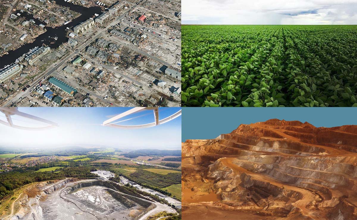
Today though, it’s not just surveyors who are able to use the technology to make a given task faster, cheaper or safer. While aerial imagery companies like First Base Solutions
use Correlator3D for large-scale projects, SimActive software has also been used to do everything from
perform damage assessment after a hurricane to
transform data into useful and pertinent information for farmers. Regardless of the use or source, the software enables the rapid processing of imagery to provide exceptional precision and survey-grade accuracy.
Philippe Simard
To further explore the benefits and opportunities that are being enabled across industries and all over the world, we connected with Philippe Simard, Ph.D., President of SimActive. He told us about what makes SimActive software different, how user feedback impacts the development of the software, what advice he has for professionals trying to figure out which software solution is right for their project and much more.
Jeremiah Karpowicz: SimActive has been in the headlines of late in a major way, showcasing everything from how the software is being used for large-scale photogrammetry projects to the way in which government entities are using the solution. What should these stories tell us about the power and capabilities of SimActive software?Philippe Simard: Our Correlator3D™ software was designed originally in the 2000s to process large format imagery collected (250+ megapixels) by airborne platforms. Typical projects from our clients comprise 20,000+ images of such images, representing terabytes of data, which need to be processed rapidly and often in one single batch. Our traditional clients thus need processing software that can handle large volumes of data, and easily scale to big projects. We provide them with scripting and batch processing tools to elaborate custom photogrammetric workflows. This allows the quick generation of core geospatial data products, such as point clouds, DSMs, orthomosaics and 3D models.
What have been some of the most notable aspects about how you’ve seen SimActive software enable growth or change at a company over the past year?The drone industry has brought multiple new companies that started offering image collection and processing services. We thus adapted our software a few years ago to support small camera systems mounted on UAVs. Several of our clients in that field were very successful with their new business and gradually expanded their offering to larger format cameras mounted on aircrafts. Not only our Correlator3D software allowed them to scale their production on larger drone projects, but also to support processing of bigger sensors, without changing their production workflows. The software actually supports any sensor (e.g. color, infrared or multi-spectral), mounted on any platform (drone, aerial and satellite) within the exact same interface, allowing projects of any type.
The variety of industries that SimActive software is being used in is incredibly varied, as it ranges fromagriculture to emergency response to the mining sector. Are there any trends you can identify in terms of the types of problems that people across all of these spaces are using SimActive software to solve? The main need for any industry that requires mapping products is quality. This includes at the very least relative horizontal/vertical accuracy, and quite often an absolute one as well. Our software offers tools to import GCPs, manage data from direct georeferencing devices such as PPK/RTKs, and to perform quality control on results. Detailed accuracy reports are provided for our clients to review and ensure that final results do meet quality requirements.
Do you see these use cases influencing the way other professionals in these industries can adopt SimActive software?Fifteen years ago, mapping firms were almost exclusively collecting and processing geospatial data. This meant data users from the different industries (agriculture, emergency response, mining, etc.) were buying processed data from these. With the rise of drones, there is a growing trend of such users collecting and crunching the data themselves. In that respect, we have been definitely contributing to the democratization of photogrammetry, providing an easy-to-use yet powerful processing software.
What are some of the biggest differentiators between SimActive and other software options that are out there? What are some of the main reasons that your users choose SimActive over these other options? As a higher-end solution, our Correlator3D software offers significant advantages over competing software. Processing speeds are up to 20 times faster using GPUs on standard PCs. There is also no limit on the number of images that can be processed in one single batch. As an example, clients flying large-format cameras will typically need to crunch 20,000 images at 300MP for a given project. The software also provides scripting and batch processing capabilities to streamline project pipelines. In addition, it leads to higher accuracy results, which can be not only controlled for quality through numerous reporting tools, but also can be edited to meet specific end-user requirements.
How has the feedback you’ve received from your users influenced the way the software has been developed?One of our big strength is the quality of our technical support. This means helping our clients during their production on a timely manner and in doing so, constantly receiving their feedback. We definitely use their feedback to improve our software, but also to predict where exactly they will need our technology to be in the longer term. As an example, drone users do not necessarily have the same photogrammetry knowledge than large format camera users. Their comments have led us to further simplify our workflows, without comprising the power of the software.
Have your customers been able to quantify the difference that your solution has enabled for them? Is that a difference they measure in terms of the bottom line, or in terms of time that is being saved on a given project, or with some other measurable?Our clients are actually able to see the benefits during their evaluation before even buying the software, so they are definitely able to quantify them. Faster processing times necessarily lead to quicker turnarounds, which in turn provides an increasing productivity. The ability of the software to manage any kind of sensor data also translates into their teams being able to use the exact same workflow for all projects. The higher quality of results implies less editing time required, and if it is required, the efficiency of our tools also means less resources. All these combined do lead to an improved bottom line.
What advice would you have for a professional that is trying to figure out which software solution is right for their project? What sorry of questions should they be asking?We frequently have new users coming to us not only after buying a sensor / flying platform, but even after collecting their first project. And unfortunately, it is often already too late because when they start processing the data, results do not meet their requirements because of the wrong equipment, and incorrect data collection strategy. So definitely our main advice is to come to us first so we can help them make the right purchase decision for their hardware. Then, definitely they need to consider scalability of the solution since they will be investing not only in a software, but in the definition of a workflow as well as training their personnel for not just a single project. Another key factor is technical support. Photogrammetry is a very complex field and in a real production environment, there are always issues that arise. In general, they will thus need feedback and guidance to quickly find solutions so that their schedule stays on track.
 What are you looking forward to seeing happen or develop with SimActive or in the drone industry as a whole in 2019?
Since our inception in 2003, we continuously invest in research and development efforts to maintain our technological advance. Our main focus for 2019 is to keep improving the productivity of our clients. We are working on several aspects of our editing tools to further increase their efficiency. Another aspect is our overall workflow to optimize production at an even greater level. Our core clients use the software on very large projects, often with medium and large format camera systems, which means any further optimization is profitable to them.


Comments