
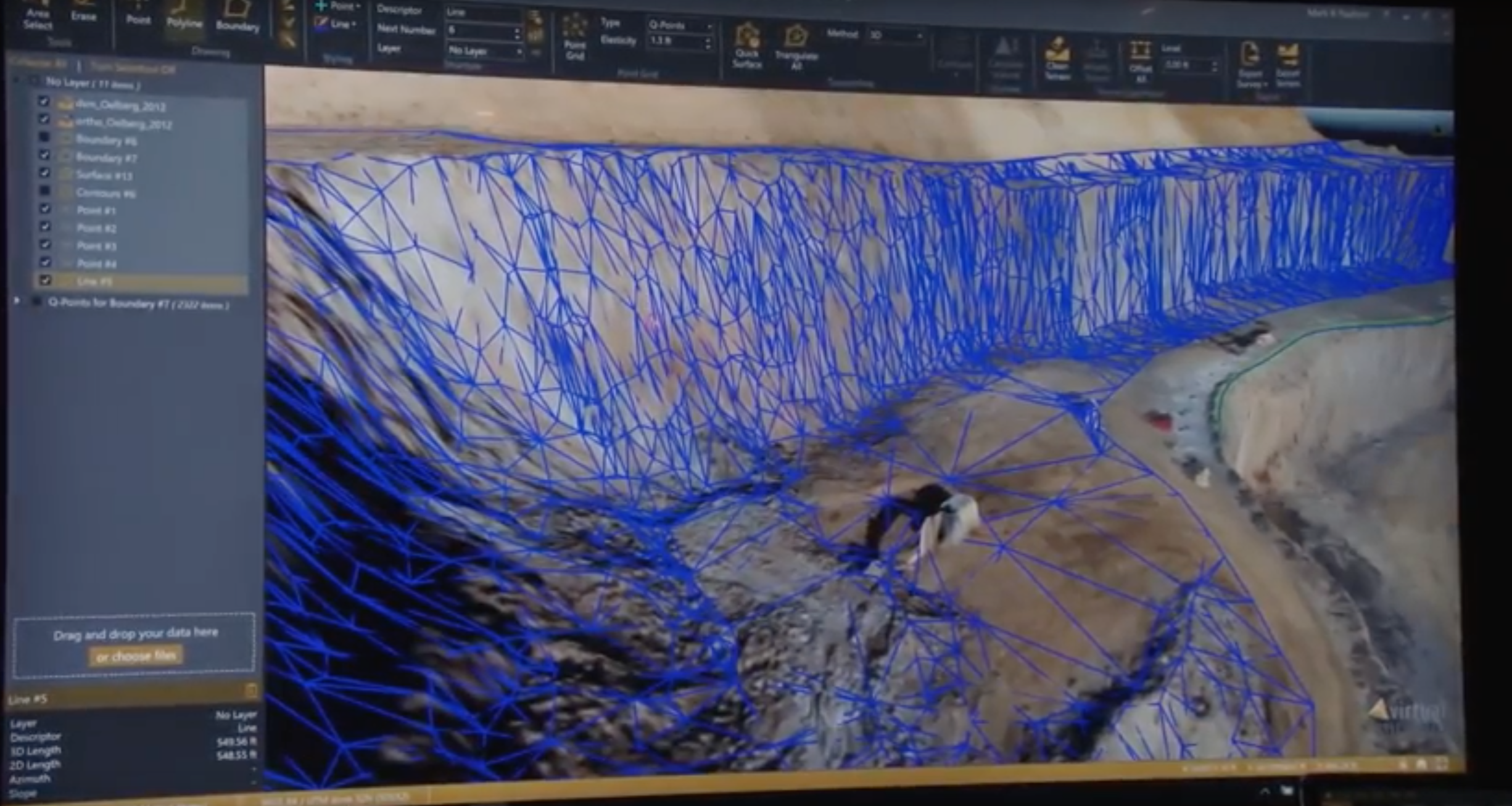
We've discussed in detail how Virtual Surveyor starts where modern drone photogrammetry stops, and the differences the product has made for projects of all types are considerable. Virtual Surveyor offers the tools to view those huge data files captured and created from drones in an interactive viewing environment. It gives users an experience as if they were on site, boots on the ground.
To get a better understanding of how these opportunities and advantages are being positioned to users, we stopped by the Virtual Surveyor booth at Commercial UAV Expo 2018 to learn more. Tom Op ‘t Eyndt, Managing Director for Virtual Surveyor, talked with us to explain how Virtual Surveyor allows surveyors to focus on being surveyors, bridges the gap between systems and much more.Subscribe
The information you submit will be stored and used to communicate with you about your interest in Commercial UAV News. To understand more about how we use and store information, please refer to our privacy policy.
October 11, 2018
Bringing the Survey Process into the Virtual Environment with Virtual Surveyor - Commercial UAV Expo 2018

Want more stories like this? Subscribe today!

.jpg.small.400x400.jpg)

Jeremiah Karpowicz is the former Editorial Director of Commercial UAV News. He has spent over a decade cultivating communities of all different types, both in-person and online. He has created articles, videos, newsletters, ebooks and plenty more for these communities as a contributor and editor. He has also shaped and defined various conference programs. Today, he is focused on defining what it means to take the engagement that happens in both the physical and digital worlds to the next level. You can get in touch with him on LinkedIn.
Featured Report
Featured Authors More Authors ›

Featured Authors


Newsletter Signup
Our Events


Our Events
September 1-3, 2026 • Las Vegas
February 23-25, 2027 • Salt Lake City
Comments