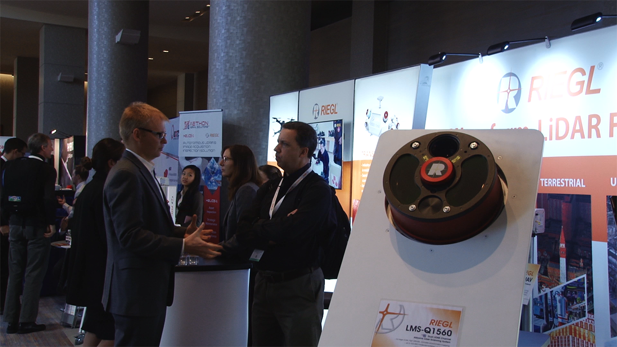
RIEGL announced the newest addition to their UAV-based LiDAR sensor family at the end of 2016, and that technology along with many of their other products were on display at the recently concluded International LiDAR Mapping Forum (ILMF), where they were especially well received. Aethon Technologies expressed an interest in the mini-VUX as soon as it debuted, which showcased just how enthusiastic one of the leaders in the surveying community was around being able to leverage the product’s new features. The miniVUX-1UAV will be utilized in Aethon’s creation, the Helios-1, which debuted at ILMF to a great reception.
During the
North American launch of the mini-VUX, My-Linh Truong and Andres Vargas detailed many of those features, which include its multiple target capability, scan speed and 360° field of view, just to name a few. The product can be utilized in various industries and markets, but hearing the CEO of Aethon Technologies, Alastair Jenkins, mention that the mini-VUX was “ideally suited” for the aerial survey of infrastructure and complex urban environments sounded like an opportunity to further explore what his plans were. What made the company so confident around what the miniVUX could do, and how exactly were they looking to leverage it?

Pictures from ILMF 2017
As profiled in an
Industry Pioneers article from a few years ago, Alastair Jenkins has been providing digital imagery to the power line industry for almost two decades. He helped develop a gyro-stabilized LiDAR sensor system to help better serve his utility customers, but the changing tools and technologies made him realize a new opportunity was unfolding in front of his eyes.
“Every power utility in the world uses helicopters to inspect their power lines and distribution assets,” Jenkins said. “They use LiDAR for vegetation clearance, and to build 3D models of those power line assets. What I recognized 2 or 3 years ago was that ultimately, as UAVs became ubiquitous, we'd be able to replace helicopters with UAVs.”
Aethon Technologies was created to build the next generation of autonomous acquisition systems, which Jenkins initially wanted to fly on manned helicopters, but he knew the technology could be pushed even further. The company is dedicated to bridging the gap between sensor technologies and big data analytics to deliver data efficiently and practically.
Jenkins has used the
RIEGL VUX-1UAV and digital cameras to capture the survey-grade detail he needs, but the weight of the units meant he could only deploy the unit in a helicopter. To get that same capability from a drone he really needed a product that was lighter. Being able to utilize a product that has the sort of measurement performance of the VUX-1 on a UAV is something that he’s been envisioning ever since he came to the realization about the transition from helicopters to drones.
“In the power line industry, its one thing to be able to fly a 55lb drone, and do an inspection of one tower,” Jenkins mentioned. “What we've seen is the need to go long distances. So we need to build small, lightweight helicopters that can handle that sort work and also travel long distances. You need something that's light, but provides the same sort of precision that RIEGL's traditional products produce.”
Ultimately, the reason Jenkins expressed interest in the
miniVUX-1UAV is because he saw that the product was going to allow him to do exactly that. Just as the VUX-1 allowed him to demonstrate what it meant to capture survey-grade measurement data from autonomous systems on manned helicopters, the miniVUX will allow him to take the next step and show that the same data can be acquired from a UAV.
Power Line Inspection LogisticsPower line mapping inspection is the business that Jenkins wanted to be in not only because he’s developed such expertise in it, but also because he saw the numerous possibilities in this space. Aethon has been able to create a business model that allows the timely capture and delivery of critical information as a service but that model is evolving rapidly.
“Our model is evolving to provide the entire hardware and software solution and deploy them through our affiliates,” Jenkins said. “Our clients are affiliates located around the world, and their customers are typically power companies. These affiliates are currently operating and familiar with a helicopter-borne systems, but in time they will operate the UAV-borne systems as well to acquire data that gets processed on our cloud processing solution to deliver that data to their customers.”
Jenkins treats that transition as a given because he now has the ability to put a device that can capture survey-grade measurement data on a drone, but capturing so much precise data is a topic that he sometimes gets push back on. Do those power companies really need all of that survey-grade data?
The question of when to use LIDAR and when to use photogrammetry is one that Jenkins has dealt with. Many people ask him why he doesn’t just make point clouds out of imagery. As
we’ve seen though, treating LIDAR and photogrammetry as a zero-sum choice really isn’t the right approach.
“I'm a very firm believer that's it's not either/or but it's both,” Jenkins said in regard to whether he would choose to use LIDAR or photogrammetry on a given project. “Imagery gives you finesse in terms of pictures, LIDAR gives you true accuracy which you can typically get without using extensive ground control. It's not that images themselves don't get you point clouds, but typically point clouds produced with photogrammetry don't have the same degree of accuracy if you don't have extensive ground control, because there will be ambiguity in terms of the range. Images really only get you so far. If you're dealing with vegetation or soft subjects or you want precise edges, then you need a mixture of those two.”
Many have questioned whether professionals will need to continue to gather the sort of info that the miniVUX is capable of capturing, but there will always be a need for power companies and other organizations to capture and make decisions based on info that only LIDAR can provide.
Safety and OpportunityTraditionally, power line customers have two requirements. One is that they need to determine the clearance of vegetation. That can be done with traditional LIDAR systems and the larger, heavier helicopter-borne LIDAR systems that fly above power lines. This allows them to fulfill their other requirement around being able to take a close look at their equipment for deficiencies, but flying over a power line in a helicopter for the duration of a project is not the safest thing you can do.
“To do close-up inspection of the damage, cracks, displaced wires and more that we want to document during an inspection, a helicopter will typically need to fly very close to a powerline,” Jenkins said. “Often with less than a 30 meter offset or 30 meters above, the wires. Most patrol flights, where they have to do a visual inspection, require the helicopter to fly in a zone and at a speed that is typically only safe if nothing goes wrong. It's a challenge because you don't have a lot of time to react in that situation. By moving to a UAV, it obviously takes the human out of that situation, and that will ultimately save lives.”
Accidents during these sorts of inspections
can and do happen. We often talk about how using a drone represents an increase in safety, but that increase means something very specific to the people who will no longer have to potentially risk their lives during an inspection.
The aerial perspective that can be captured via a drone is relevant in other industries as well. There are plenty of situations and environments where being able to gather aerial data would be ideal, but the logistics have prevented professionals from doing so. The use cases Jenkins is developing for power lines can be leveraged across other industries.
“I talk about power lines because that's a core piece for us,” Jenkins continued. “But I can also talk about infrastructures in urban environments. We're also using UAVs with specialized imaging systems that can be used for inspecting cell phone towers, construction sites, bridges, and any construction project in a small urban environment. The key piece here is that you can bring UAVs into places where it's not practical to bring a helicopter in.”
Being able to use a UAV with a unit like the miniVUX on it in place of a helicopter has an obvious benefit to safety, but using it in places where it had not previously been possible creates new opportunities in efficiency that have only begun to be explored.
Utilizing the miniVUXUltimately, questions around being able to properly leverage tools like the miniVUX need to be sorted out by individual users and organizations. What makes sense for one company might not make sense for another, even if they’re looking to gather and process the same kind of information. Similarly, there are numerous products that can gather this sort of survey-grade information, and the reasons to use one over the other can be just as numerous. Some factors should be given greater significance than others though.
“The reason I picked the RIEGL system I have is because they're built for the professional environment,” Jenkins explained. “They’re designed to work where I need them to work, and they work every time. That's very important, because at the end of the day we make our living on the fact that when we turn that unit on in the field, it works. You're only as good as the last job you did, so I need tools that do what I need them to do every time I need them to do it.”
That kind of dependability and usability is what makes a difference for Jenkins, and his familiarity with the RIEGL product line allowed him to immediately leverage the miniVUX. Whether or not other users would be able to do the same thing is something that depends on their previous experience with the product line, although it’s not a critical consideration.
“The miniVUX is essentially plug and play compatible with the larger VUX-1,” Jenkins concluded. “If you’ve operated the VUX1, the transition to the miniVUX is going to be very simple. For anyone unfamiliar with the product line, there will be a learning curve to get up to speed with the RIEGL solutions, but that process is easier than using some of the other options that are out there.”
We often get caught up in the tools that are utilized to capture information, but the people who ultimately use the data don’t care where that data came from. Their only concern is whether or not that data is accurate, and whether it’s giving them what they need to make better business decisions.
For Jenkins, the miniVUX is the ideal tool that allows him to do just that. Jenkins summed up by mentioning that everyone knows it’s not the piano that makes the music, but the person playing. That goes for data acquisition tools just as it does for pianos.


Comments