

Together with Bandung Institute of Technology and PT Airborne Geophysics Indonesia, Terra Drone Indonesia, a drone service provider, is combing drones with Ground Penetrating Radar (GPR) for soil structure modeling.
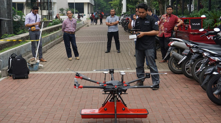
Traditional GPR methods usually require field personnel to walk with GPR equipment over dangerous terrain, sometimes during adverse weather conditions, to survey a specific area. To avoid this, Terra Drone Indonesia saw an opportunity to use drone technology with GPR sensors, offering a safer and, according to the company, more efficient GPR survey solution.
To put the drone to the test, Terra Drone equipped it with a GPR sensor and flew with different speeds and heights over tunnels and underground utilities in the Bandung Institute of Technology (ITB). The collected data was then analyzed and compared by geophysicists against actual field conditions and confirmed to provide accurate results, opening new opportunities for the use of drones and GPR, especially in areas that are both challenging and unsafe.
This is not the first time Terra Drone partnered with ITB to test new ways of using drones, as both have done multiple tests in the past, such as using Terra Lidar to conduct topographic mapping at ITB’s Jatinangor Campus.
Terra Drone has branch companies in more than 20 countries - Terra Drone Indonesia being one of them - and completed more than 5,000 projects for various kinds of work using drones. The company allows professionals in construction, GIS, mining, oil & gas, as well as power and telecommunications to “see it clearer, see it better” when mapping or performing inspections with drones. Seeking to become the top industrial drone solutions provider in the world, Terra Drone is continually working to improve both hardware and software to provide superior services to clients.
Going forward, Terra Drone is open to collaborating with parties interested in this new application.


Comments