


Drones vs |
|---|
A four-part series exploring when and how drone technology can be considered and utilized in place of or in addition to other potential solutions. |
Part 1 - Drones vs Manned AircraftPart 2 - Drones vs SatellitesPart 3 - Drones (Photogrammetry) vs Terrestrial LiDARPart 4 - Drones vs HALE |
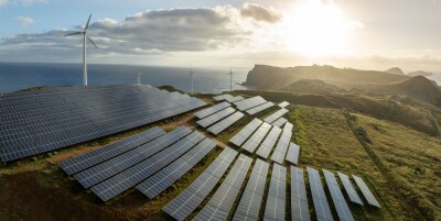
The emergence of drones has meant that professionals in a variety of industries have that many more powerful options to help survey, photograph, measure and map a variety of spaces and places. They've created incredible efficiencies for both small and large organizations, but the details associated with doing so can sometimes create challenges, especially when compared to the traditional approaches around how an organization is gathering data. Firms that need surveying aren’t always certain that a drone or a drone service provider can help them, especially if it means replacing an approach that utilizes a manned aircraft. That's often because the firm is used to collecting such data in this certain way, and drones represent something that doesn't fit their workflow or project.
The reality is that it's usually not a question of choosing drones over a manned aircraft or any other piece technology, but rather, deciding how much of the project could be done with a drone, and what sort of gains or efficiencies could be created by doing so when compared to a traditional approach. Should a company collect info via laser scanners, or from manned aircraft? Should they utilize satellite data if it's available? Or can they do the entire job with drones?
The answers to those questions depend upon a plethora of factors. For generations, surveyors have taken to the skies to use manned airplanes to capture info that details the terrain below. They still do and will continue for the foreseeable future to gather info in this way because of the inherent advantages associated with the ability to cover so much territory in a short amount of time. That means the first question shouldn't be about whether a drone can replace a manned aircraft, but instead about how a drone might be able to complement or augment that approach.
Drones have been referred to a disruptive technology because of their potential to replace expensive or time-consuming tasks, and to create brand new opportunities when it comes to how and where critical information can be gathered. The game-changing capability of the technology is evident, but it's more useful to focus on where and how the technology can make a difference right now, rather than the changes the technology might be able to someday make in terms of replacement. Defining what those efficiencies are today will help unlock that value in the future.
Drones have added powerful alternatives when it comes to capturing information from large areas of land, but the distinct strengths and weaknesses of the technology are much different than the strengths and weaknesses associated with a manned aircraft approach. These distinctions have allowed us to come up with some rules of thumb around where and when it makes sense to use one over, or in addition to, the other.
Choose Manned Aircraft When…
You need a large area covered quickly.
Manned aircraft surveying a land mass can cover a lot of areas very quickly. Manned aircraft can stay in the air for an exponentially greater amount of time than a drone. While a fixed-wing drone can cover a great deal of territory, the actual flight time and BVLOS restrictions are a factor in this kind of drone coverage.
Choose Drone When…
The task is suited to a drone because no other tool can do it as effectively.
Often, particular tasks are more suited to a drone than to a manned aircraft, because of the nature of the area to be surveyed.
“Drones come in where there are small areas; areas in remote locations that are hard to fly. You can get higher resolution with drones, as compared to manned aircraft surveying,” said Matt Coleman, VP of Solutions Engineering for PrecisionHawk.
Choose Manned Aircraft When…
Use a manned aircraft when it’s required by the RFP (requests for proposals).
Some jobs require manned aircraft. It’s part of the specifications for the job, and there’s no way around it.
“Right now in the industry, there are still a lot of requirements that call for flying an entire country or state,” Coleman said.
But while drones can provide higher resolution images than surveys from manned aircraft, it’s not as if the newer technology is elbowing out the older tool, even without RFPs that stipulate manned aircraft must be used for a project. Part of the reason is that all surveys don’t need the highest resolution for all the terrain to be covered—some places can have a lower resolution where others will require higher resolution images.
Choose Both When…
When both tools are needed to do the job best and most expeditiously.
“Say a manned aircraft company is contracted to fly a whole county," Coleman continued. "We see where there are certain areas where they need higher resolution, and that’s where the drone will come in and do that part of the job safely and efficiently. If we get a contract to fly 2,000 miles of power lines we do a combo of manned aircraft, using drones for detail work. We’re seeing more opportunities for combinations of manned aircraft and drones working together to get clients the data they need.”
Many drone systems need just one operator, and numerous firms consider this as an advantage when it comes to utilizing a drone solution. But in some surveying jobs, more employees can make the work go faster, and perhaps more accurately.
“Under Part 107, you can legally operate a drone on projects with a single pilot,” Coleman said. “But at PrecisionHawk, we still have a pilot in charge and a spotter on every project. The pilot in command is totally focused on the stability of the drone, and our visual observer can observe.”
Before Part 107, many considered the drone industry to be somewhat impeded by antiquated regulations. Regulation was long cited as the main reason drones had drones have had difficulty in meeting some specifications for companies used to using manned aircraft for surveying jobs. Today though, manned aircraft surveyors are teaming with drone companies to combine both technologies to create a more powerful data package.
Manned aircraft are competing with drones on tasks like surveying. There are also areas that manned aircraft companies realize would be done better with a drone company because of safety concerns and the need for better data accuracy.
“Manned Aircraft are still competitive for Aerial Mapping. There are still large areas that cannot be covered by Commercial Grade UAS,” said Noah Ruiz, owner of Skynetwest.
But there’s enough pie for everyone, and so cooperative efforts are happening more frequently. Sometimes a manned aircraft company will subcontract a job directly to a drone company, or vice versa. Working relationships have developed between such companies, making the process even smoother and providing a better product for clients.
So in the case of the question of whether to use manned aircraft or drones for a job, an owner might want to ask whether or not the project is an opportunity to use both technologies, or if others—like HALE, satellites, or laser scanners—should be used. It's not about "drones vs" a particular solution or approach, but "drones and". Knowledgeable firms understand this, and are focused on providing whatever solution a client might require.
Because of improvements with LiDAR, manned aircraft companies will continue to provide surveying work for the foreseeable future, experts say. And that’s a good thing—it means firms will have the best of both worlds in terms of technology. Rather than being a disruptor edging out older tools, drones are helping companies providing such methods to be more competitive.
“Drones are just another tool in the tool box,” Coleman concluded.


Comments