
Whether photogrammetry can or should be used in place of LIDAR is question that professionals have been weighing out in many different situations and contexts, but it's not the right question to be asking. Ultimately it's really not a case of "either/or" when it comes to LIDAR and photogrammetry in the context of aerial surveying, because there are certain situations and projects where one is going to be a better fit than the other. More than anything else, these kinds of decisions need to be driven by the needs and requirements of the project. To see that topic fully explored, check out the full Figuring Out Aerial Surveying with a Drone Instead of Arguing About Photogrammetry vs LiDAR article.
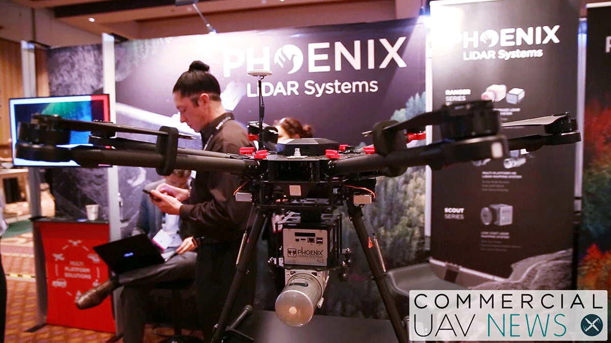
One of the experts I was able to connect with for that article was Phoenix Aerial Systems CEO Grayson Omans. His company specializes in providing solutions for collection and management of geo-spatial information and I was able to chat with Grayson at the 2016 Commercial UAV Expo. We discuss the sort of topics he talked through with attendees, when and why LIDAR is a fit to use on a drone and plenty more. &feature=youtu.beSubscribe
The information you submit will be stored and used to communicate with you about your interest in Commercial UAV News. To understand more about how we use and store information, please refer to our privacy policy.
November 22, 2016
Commercial UAV Expo 2016 - When and Why to use LIDAR on a Drone with Phoenix Aerial Systems

Want more stories like this? Subscribe today!

Jeremiah Karpowicz is the former Editorial Director of Commercial UAV News. He has spent over a decade cultivating communities of all different types, both in-person and online. He has created articles, videos, newsletters, ebooks and plenty more for these communities as a contributor and editor. He has also shaped and defined various conference programs. Today, he is focused on defining what it means to take the engagement that happens in both the physical and digital worlds to the next level. You can get in touch with him on LinkedIn.
Featured Report
Featured Authors More Authors ›

Featured Authors


Newsletter Signup
Our Events


Our Events
September 1-3, 2026 • Las Vegas
February 23-25, 2027 • Salt Lake City
Comments