
The opportunities that drones represent when it comes to small site mapping are incredibly powerful, but many have found that using low cost platforms for high accuracy mapping has been a challenge. While new direct geopositioning systems that enable professional mapping with these low cost solutions have helped resolve many issues, users of all types have been asking about a more complete solution. Now they’re going to have one.
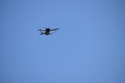
AirGon LLC, a wholly owned subsidiary of the GeoCue Group, has announced that they have been appointed as an official DJI Enterprise Dealer. This new appointment will enable AirGon to offer the full range of DJI products, including its industrial lines of drones. It’s a development that is set to open up brand new opportunities for anyone looking to adopt or leverage drone technology for photogrammetric mapping.“The business is now moving to the more serious phase,” Lewis Graham, President and CTO of GeoCue/AirGon, told Commercial UAV News. “Customers who are coming to us no longer want to try to piece together solutions and try to figure out what works and what does not work. They are looking for a reliable turn key supplier so they can come back to a single source when they have issues or are trying new applications. Thus the primary advantage of us entering this agreement with DJI is the ability to supply all components of the mapping system, tuned to optimize performance from the DJI platform.”Ever since the company released the AirGon Loki PPK direct geopositioning system for the DJI Inspire 2, they have been receiving inquiries from industrial customers asking them to bundle the drone with the positioning hardware and software. As an official DJI Enterprise Dealer, AirGon will now be able to precalibrate the X4S camera for their customers, a critical step in high accuracy mapping applications. The company can now offer a turnkey solution to their customers, which is something DJI clearly saw as being especially powerful.“AirGon has a unique solution for applying DJI’s industry-standard technology to high accuracy mapping projects,” said Jenna Zhao, DJI Enterprise Sales. “AirGon recently flew a mine site project with several hundred feet of vertical relief, a difficult challenge for photogrammetric mapping. Using a DJI Inspire 2 with an AirGon calibrated DJI X4S camera and the AirGon Loki PPK direct geopositioning system, they achieved a vertical accuracy of 0.11 feet (3.4 cm) RMSE with no ground control. This result shows that DJI drone data is able to match industry accuracy standards while significantly reducing site preparation times for high accuracy topographic mapping."The concept of a “complete drone solution” is one that’s become especially pervasive this year, and with good reason. As companies have transitioned from exploring to adopting the technology, many face challenges associated with how these tools fit into an established workflow. Those issues are difficult enough, meaning that additional problems associated with piecing together a drone solution can make adoption that much likely to succeed. More complete solutions like these will help ensure those adoption challenges are as minimal as possible.DJI technology is available immediately from AirGon.Subscribe
The information you submit will be stored and used to communicate with you about your interest in Commercial UAV News. To understand more about how we use and store information, please refer to our privacy policy.
November 21, 2017
AirGon and DJI Deliver a Complete Drone Solution


Want more stories like this? Subscribe today!


Jeremiah Karpowicz is the former Editorial Director of Commercial UAV News. He has spent over a decade cultivating communities of all different types, both in-person and online. He has created articles, videos, newsletters, ebooks and plenty more for these communities as a contributor and editor. He has also shaped and defined various conference programs. Today, he is focused on defining what it means to take the engagement that happens in both the physical and digital worlds to the next level. You can get in touch with him on LinkedIn.
Featured Report
Featured Authors More Authors ›

Featured Authors


Newsletter Signup
Our Events


Our Events
September 1-3, 2026 • Las Vegas
February 23-25, 2027 • Salt Lake City
Comments