October 11, 2016
senseFly’s New RTK/PPK-ready Mapping Drone Provides Options Around Gathering Survey-Grade Data

At Intergeo 2016, senseFly debuted their new
eBee Plus system, which is their next-generation fixed-wing system for survey-grade photogrammetric mapping. The system is notable in three specific areas, as it can map more hectares per flight than any drone in its weight class, it includes built-in RTK/PPK functionality and features the first sensor developed specifically for drone photogrammetry work.
Sean Higgins over on SPAR3D.com has already laid out how and why this new product is
built for big high-precision surveys, but the built-in RTK/PPK functionality is what’s especially notable about the product. The capability takes away the need for operators to make a final decision on which they want to utilize. Previously, operators needed to make a choice in regards to what type of information they were going to want and need when they made their initial purchase, but this new functionality can be activated either out of the box or later when required. It gives users the option to gather data that has survey-grade accuracy if and when they need that sort of accuracy.
Those are options that users will be able to experiment with themselves, since the eBee Plus will be supplied with four free weeks of RTK/PPK activation. It can even be activated on demand when the customer chooses.
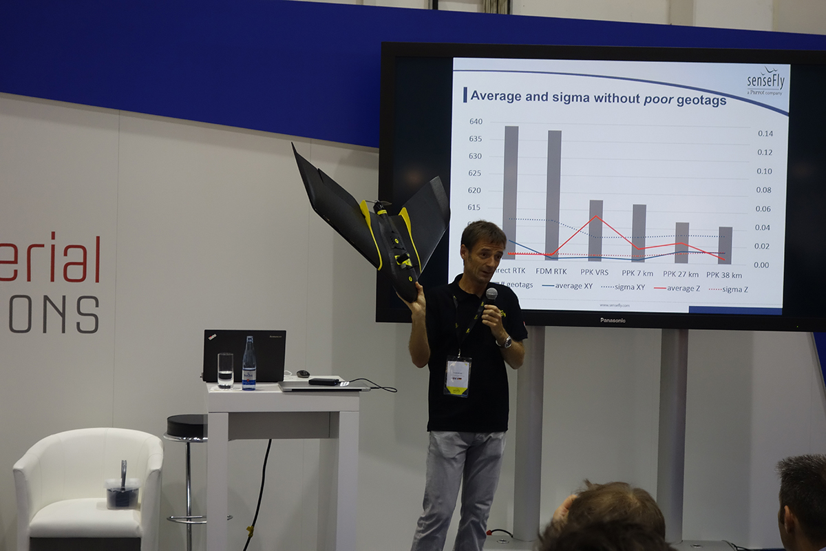
Most attendees were interested in talking through the details associated with both options, but Francois Gervaix, Product Manager Surveying at senseFly, conducted a live demo that gave attendees a real sense of the capabilities that the hardware and software possess. Being able to see the fixed wing drone operate in this environment was a real highlight since so many of these presentations focus on multi-rotors.

Gervaix was really able to demonstrate what kind of options and capabilities users can expect to see, as he set up a flight path for the drone and flew it. He then went back and showed the audience what all of that data looked like. He highlighted how he was able to mark off the specific areas where the venue did not permit him to fly, and even showed a 3D view of the info that the drone gathered.
The presentation highlighted additional insight as well which included info about geotagging and what it meant to measure an area that the operators did not have access to, which is what happened when they captured data on the Aletsch Glacier in Switzerland.
Those were just a few of the specific instances where users will be able to appreciate the wider coverage area capabilities, high precision on demand (HPoD) options as well as the payload abilities of the new eBee Plus system.


Comments