

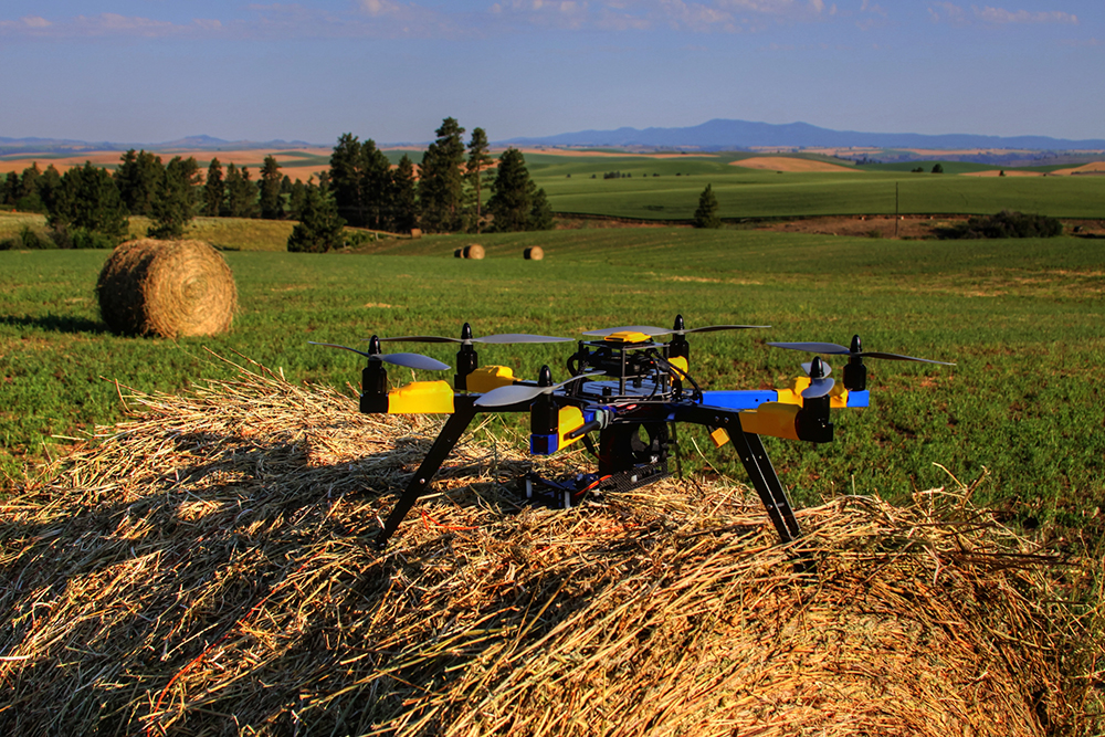
Hexa-copter on Robert Blair's farm in 2013
Robert Blair is an early adopter of UAV technology, and is likely the first person to commercially use a UAV in agriculture. He runs a 1,300 acre farm in Idaho, and while he can tell you what it means to take care of a sick calf, it was his experience developing the Drone Flight Calculator, and how that tool can help farmers get a better grasp around ROI, that I wanted to focus on in Part 2 of our discussion.
In Part 1 of our interview, Robert talked through some big picture items around the sorts of challenges the agriculture industry is facing as a whole, as well as what kind of impact technology developments have had historically. He also explained how the challenges farmers are facing all across the world are similar and how government regulation and policy have impacted farmers in the United States.
In Part 2, we get into the specifics of how farmers can and should look at an ROI when it comes to flying a drone, along with a few insights about the type of information that UAVs are able to gather. He also touches on the difference between proactive and reactive data, what farmers struggling with ROI need to know, and plenty more.
Jeremiah Karpowicz: You mentioned the quick learning curve that you acquired after growing up on a farm. Do you think that learning curve has been a factor in the approach you take around new technology like UAVs?
Robert Blair: In some ways, but I’ve always been mechanically inclined. My parents had to hide the keys because I would hop into the rig as a little kid and knew how to get it started. My first delve into fieldwork partly involved driving a two-ton truck at age eight.

Robert in 1979 moving the sprayer out of the shed to look over for spring work
You can think of drones as being new and different if you want, but the thing everyone needs to remember is that technology doesn’t inherently change what we’re doing or what needs to be done. Take the weather as an illustration of that. Farm work has always depended on weather, and being able to utilize technology to help us understand weather at a scientific level allows us to be that much more precise and refined. What we can do now with UAVs allows us to gather and make critical decisions, but we’re just as concerned about, and conscious of, monitoring the weather as farmers were hundreds and thousands of years ago.
We’re doing the same thing with these new technologies, but now we can quantify the info. It makes what we’re doing scientific. It gives what we see a value, whereas before that info was just something we knew. Now we can do something proactive with it.
So are UAVs enabling farmers to gather better information, or simply more of it?
If you want to talk about precision agriculture, the first yield monitor came out in 1992. That was the start of gathering data at the farm level with equipment. But we need to look at how that info was gathered.
If you have a 40-foot header on the combine, that’s the width of your data point, and it’s usually measured in 10 feet of travel. So you have a 400 square foot data point that you’re basing management decisions off of. That’s precision agriculture.
UAVs have taken us to surgical agriculture because our data points can be 3cm or less. It allows us to gather better information.
How does what you can do with a drone compare to what you can do with a yield monitor?
The difference between utilizing a UAV versus a yield monitor is that a yield monitor is reactive data. The crop has matured and died, and we’re harvesting the seeds, so we can no longer do anything to affect the outcome of that crop for that growing season because we’re harvesting it. UAVs enable us to get proactive data that allow us to make better management decisions.
Even with that said, agriculture experts are still trying to answer the same question my grandfather was 70 plus years ago with his soil test kit. I actually still have that test kit, and it’s quite a sight with all of the vials to analyze and do testing on the soil for nutrients. He was trying to answer the same questions we are with different tools. It’s always been a question of how we can better our soils and better our productivity.
What kind of a difference can this better info make on a practical and decision-making level?
A yield monitor is good information, especially when you’re in the combine on the go. You can get an up-to-date synopsis of what’s taking place in the field and you can use that info on the screen with your visual observation. That visual observation piece is a huge part of agriculture. Farmers have been doing remote sensing since the beginning of time. We’ve been doing remote sensing in shades of green. If the crop is yellow, it’s too wet. If it’s brown, the crop is dead. Different shades of green inbetween tells us how healthy a crop is.
I purchased my first yield monitor in 2004 and started doing variable rate nitrogen management. I started doing tests on my farm because I was trying to figure out how to reduce costs while maintaining or increasing yield. I was able to validate that through test strips on my own farm, and then small test fields and then larger areas until finally I went all across the farm. That process took a while though.
What kind of a time frame are we talking about?
I started the test strips in 2004. I harvested them in 2005. I harvested the small fields in 2006 and harvested the other fields in 2007. So 2008 was the first time I did whole farm variable rate. That’s how slowly things move in agriculture. And that was actually really quick when you compare it to some other farming initiatives.
You need that evolution because agriculture is a biological industry. Our business cycle is one full year or growing season. We can’t change quickly. If we change too quick and don’t get it right, we’re out of business.
That’s an area where I’ve seen a big disconnect between UAV manufacturers and the ag industry. I’ve seen a lot of companies trying to sell a product to farmers even though they don’t understand agriculture. The only thing they see are the sales numbers that are associated with telling the community, “you need this, and you need it now.” Agriculture doesn’t work like that. Agriculture moves at its own pace because it has to. When you throw in weather challenges along with commodity prices, it can adversely affect how quickly technology is adopted.
For example, last year we had a drought in my area. It was a generational drought. We had no rain from June 3rd to September 1st. That meant we weren’t getting the yield. Couple that with the fact that commodity prices have dipped. We’ve lost $1-$1.50 on our wheat price. To put in real terms, if I’m losing $1 per bushel with an average yield of 50 bushels per acre I’m losing $50 per acre of income. I don’t know many businesses that can withstand the pressures that the agriculture industry has to contend with.
That’s where technology can come in, and it’s unfortunate we’ve had so many manufacturers and service providers overselling what could be done with the technology and services. Because of that, the agriculture community is both skeptical and gun-shy about UAVs.

Robert posing with his first UAV in 2007 not realizing the importance of what he was doing.
Do you think easing farmer’s feelings around UAVs will help with that concept of “keeping farmers on the farm”?
On a list of the 10 most endangered jobs in the United States, farmers ranked 2nd with around a 20% attrition rate. If you stop and think about it, that means out of two million farmers in America, we were losing approximately 400,000 of them. That’s nearly a quarter of our industry, and it’s also where drones can help in the present and the future.
For every one kid going into an agriculture field at a higher institute of study, there are four jobs waiting. How are we going to replace the current workforce expertise? We’re replacing it with hardware and software experts. We can positively affect yield by minimizing the affect of droughts and lowering our costs through better management by using tools like drones.
Is it true for everyone? I can’t say that. I‘m talking from experience on my own farm and through my Fellowships where I’ve seen these tools make a real impact around operations and our bottom line.
The hesitation farmers are feeling around UAVs isn’t just due to the lofty promises they’ve seen being made and broken though. Many are unwilling to go through the requirements of filing for a 333 Exemption, so what sort of impact do you see the new FAA rules around commercial regulation having once they presumably go into effect later this year?
While I do think we’ve lost a lot of opportunity because of certain restrictions, I also want to recognize the fact that the FAA is charged with a terrible responsibility around keeping the airspace safe, and I greatly appreciate that. However, the disconnect we’ve been talking about in the agriculture industry from a governmental policy perspective extends to this area as well. President Eisenhower summed it up eloquently, “It’s mighty hard to farm when your plow is a pencil and you’re 1,000 miles from the cornfield.” And that’s what we have here.
Am I hopeful with the FAA? Absolutely. In 2008, I filed the first exemption to the FAA for commercial UAV use, but of course we didn’t have critical mass as an industry. It was still being developed. Today, we have that critical mass.
To eliminate the disconnect on every side, part of our charge as an industry has to be around educating the public and the government. It’s something that can happen in a number of ways, and can come from many different places. One of the things that’s helped us reach this critical mass was Jeff Bezos’ comment in 2013 on 60 Minutes. He took the image of UAVs being strictly military and brought them into everyday life with the statement about Amazon using drones to deliver packages. That interview in itself helped shape and change the direction of UAV policy and perception to the positive.
That focus on education sounds like it’s a two-way street though, as there are plenty of farmers who want and need education around how UAVs can impact their business, especially when it comes to an ROI. Are those the sort of practicalities you look to get into at Measure?
We’re always trying to be as specific and practical as possible. Research is good, but if we can’t take that information and data and put it in the cab of a tractor or sprayer to make it work at the field level, all the research and data that’s collected is no good.
Practicalities and the “absolutes” are a focus for us, because we all have responsibilities as aviators, and that’s not something we ever want to shy away from. That’s from a safety and from a legal perspective. Measure is operating safely, legally and insured. We are following the rules. It’s allowed us to become a trusted advocate, because our customers and the industry as a whole can see we’re taking things seriously. That’s allowed us to explore improving specific farm management practices using drones.

Image shows winter wheat population and how Robert could manage differently for seeding rates in the future.
One of the tools that’s enabled you to do that is the Drone Flight Calculator for Agriculture, which allows users to find out the basic cost of drone flights per acre and plenty more. Can you tell us how this tool can help farmers determine how drones can improve decision-making on their farm?
The calculator is a tool to help show the benefits drones can have at the farm level on a small scope. There are two parts to the calculator. The first part shows what the cost would be of the UAV per acre in both dollars and in terms of the crop that the user inputs. So if the user puts in wheat and the price is $5.50 for that commodity, it costs 0.73 bushels per acre to pay for a flight. If I don’t set my combine properly, I can blow more than that out the backside. For the management data and information that’s gathered by a UAV, it’s a very small price.
The second part of the calculator goes through zone management and the user has three inputs that they can pick from and run them separately or concurrently. Those inputs are nitrogen, water/irrigation or other. They put their inputs in as the cost per acre, the amount of the input per acre, the size of the field, how big the zones are and that goes through and calculates. And it will be different for everyone, because people manage differently, or they have a different level of exposure and use to variable rate. It does show the benefits of what a UAV can do over the course of a growing season.
Are there any variables you weren’t able to include in the calculator?
There are other things that are more difficult to put in a calculator and that wouldn’t be able to fit in there anyway. Much of that comes from the farmer’s experience.
One of mine was being able to see how my hired man fertilized. In one area, it was put on properly, but above and below that in the headlands, he was either turning it on or turning it off improperly, and I was losing yield. I was able to use that image to show him what was happening by him trying to be too efficient. I was losing yield. And if I’m losing 5 bushels/acre because of that, at $5 wheat, that’s $25/acre. All because he’s trying to save me $5 worth of fertilizer in that area. I can’t do anything at that point to affect it since it was already applied, but I can affect future crops.
So is this something that can be used as a starting place when a farmer is trying to figure out what kind of an ROI they can see around using a drone?
It is a starting place. It’s a very useful tool and is the first of its kind to show the benefits that agriculture can get from UAVs. So it’s one piece of the puzzle. There are so many variables in agriculture that we can’t account for. It comes down to education, and the goal here is to help people see how they can use it on their own farm and in their own business.
How ready is the industry as a whole to have these kinds of conversations around the specific ways drones can impact their business?
I was at a precision ag show in 2013, and the focus of that entire show surrounded drones in agriculture. I had presented at that very show a few years earlier, and when I mentioned UAVs I was met with a bunch of blank stares. In 2007 the audience didn’t even understand what precision ag variable rate was, let alone bringing in drones. So we’ve come a long way.
That disconnect is something we’re going to have to really push back against though. At the show I just mentioned, there were some drone manufacturers displaying their product, and some of those companies had a multirotor with a video camera on it and called it an agriculture drone. Well, that’s not an agriculture drone. You can’t do analytics with that kind of configuration. Is there good info that can be gleaned from a video or color picture? You bet. But the analytics are key, because that allows you to get into high-level management.
Farmers have land they can fly over, and they know if they can get a color image they can get useful info about what’s taking place on their farm. They have the interest in UAVs, and that’s partly because they can literally see how these tools can make a difference. However, many of them aren’t aware of which of those systems can or can’t do analytics. Many of them don’t realize that they can’t legally use images captured by a drone to make management decisions without a section 333 Exemption, even if it is their own land.
The industry is ready, but we need to continue to get this information out there in every way we can while also encouraging farmers to ask legal, business, and operational questions around operating UAVs.
What advice would you give to farmers who are struggling to grasp how they can or should be utilizing UAVs?
One thing they can do is contact us. Measure was founded to help our customers establish what fits best in their operations and cost profiles, and we take great pride in being able to provide our customers with specific direction, regardless of how much experience they do or don’t have with UAVs.
Generally speaking though, the biggest piece of advice I can offer is around a reality that I discovered on my own farming operation. Flying a UAV takes time, and that’s a cost that has to be factored into the decisions a farmer makes. When I should be flying a UAV, I need to be doing field work, or getting something done in the shop, or even going to the kids ballgame. There’s a cost associated with using a UAV, and it goes beyond the bottom line.
You can’t do it all as a farmer or as a person in agriculture. You need to be able to make a decision around the best use of your time and resources, because making management decisions is about more than a process or tool. It’s about an overall approach, and that’s something anyone who’s working on a farm knows, they just need to understand that concept extends into literally everything they’re doing.
Read Part 1 of this interview - ROI with UAVs: Eliminating the Disconnect in Precision Agriculture with Drones


.jpg.small.400x400.jpg)


Comments