
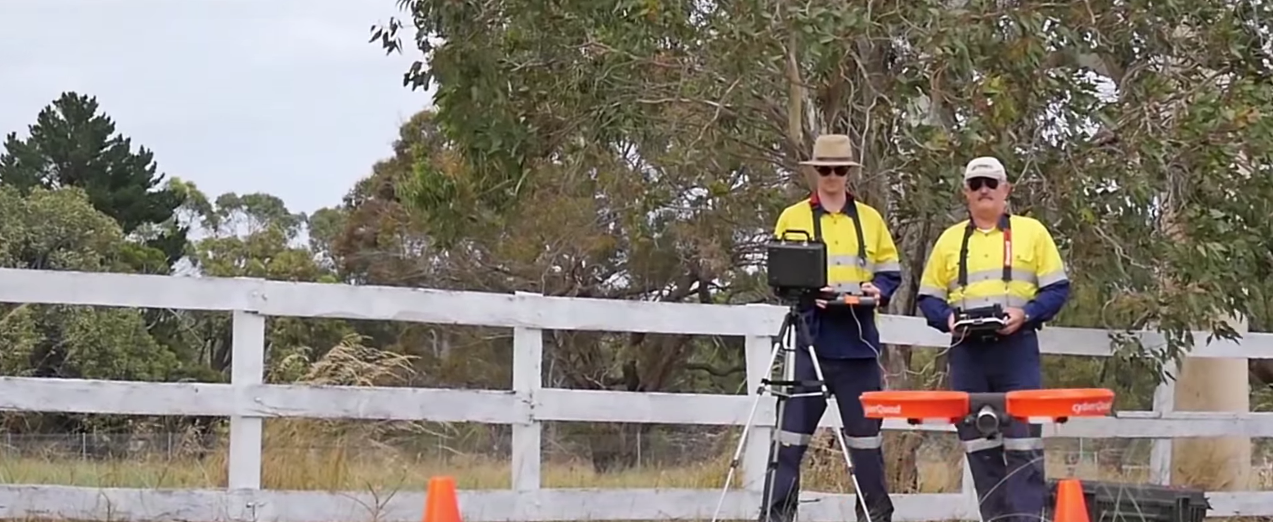
It’s easy see and understand the sort of impact UAVs can have for companies that deal with power lines, cell phone towers, oil pipelines and other utility services. Drones give these companies the ability to keep their workers out of potentially dangerous situations while also increasing the reach and scope of those professionals. Instead of sending an engineer out to a given area to assess and resolve a situation, they can use UAVs to do the same thing across multiple locations.
However, with beyond visual line-of-sight flying not feasible in the United States and questions around the implementation of such technology across an entire organization, it can be difficult to grasp the real-world ways in which drones are impacting this market. There’s no doubt they’re having an impact in multiple areas though, and the videos in this list showcase where and how that’s happening.With one hour of video being uploaded to YouTube every second, we’ve undoubtedly missed out on some great video resources, so please let us know via Twitter or email which videos can and should be included in Part 2. BP Alaska: Unmanned Aerial Vehicle (UAV) Pilot Testing – BPLike it says on screen at the beginning, this video gives the audience a look at a BP pilot testing a UAV to perform pipeline inspection in Alaska of 2012. Glen Pomeroy, Director of Pipeline Assurance at BP Alaska explains that what we’re seeing is a technology test and looks to be a validation of how they’re looking to utilize drones.Even though this video has been out there for awhile now, the info that Pomeroy and Rayjan Wilson, Lead Engineer for the UAF Geophysical Institute, talk through is still very relevant. They explain how drones can potentially enhance operations by opening up numerous opportunities with change detection and 3D mapping. As they tell us about such details we get nice looks at what the drone is seeing via the infrared and visual cameras, which offers an incredible perspective.The video was clearly made to help viewers get an understanding around the basics of why and how UAVs can be relevant in this capacity. It succeeds on all fronts in that regard as we hear and see that proof throughout. Falcon 8 Aerial Solution for Inspection and Monitoring – TopconTodayAs you can probably guess from the title of the video, this one is all about the capabilities of the Topcon Falcon 8, which might make you think the video is only of interest to people who want to know more about this particular model. However, the video showcases how the drone can provide a complete workflow for bridge, solar panel, dam and electric tower inspections, which gives us an amazing look at what it means to use a UAV in all of these environments.Some of the messages that pop up throughout the video aren’t all that insightful, but there are a few that provide genuinely useful info. Close-up shots of the dam wall while telling the audience, “Revealing the Finest Cracks and Heat Leaks” as well as the flight around power lines with messaging about “Resistant to Magnetic Interference” are great to see.We also get a look at the logistics of the setup and flight, as we see the operator pull the UAV out of a bag and what it looks like for them to actually fly it. The “Setup” and “Fly & Capture” part of the workflow are laid out in nice detail, although we really don’t see any of the “Transfer” and “Analyze” stages. Nonetheless, there’s plenty to appreciate and learn from. Pipeline surveys with drones – UAV – Global Service sncUnlike the BP video from above, this video gives us a look at the data that is gathered from the drone rather than the flight visuals. We get to see the flight plan laid out, which establishes specifically how long and far the drone needed to fly. It also gives us some excellent photogrammetry survey images along with some footage of the crew on the ground.One important thing to note here is that this project is happening in Africa, and they’re clearly flying beyond visual line-of-sight. Because of FAA restrictions, these kinds of flights are for the most part unfeasible in the United States at the moment, but this video does a great job of showing what can be done when BLOS flight is allowed.Small and virtually unnoticeable text blurbs will pop up at random places in the video, and they’re the only supplementary info we’re able to get. Without a VO we’re left to pull all of the necessary info from the visuals alone, which as I mentioned doesn’t include footage from the flight itself. The amazing photogrammetry survey images give viewers plenty to dwell on though. Aerial inspection of gas pipeline – MI HelicoptersAnother video that helpfully lays out exactly what we’re seeing, this is a look at the filming of a pipeline infrastructure with the AS355 “Twin Squirrel” and Cineflex V14HD. Unfortunately, we never see the actual drone or any footage from the ground, because the focus here is all about the visuals the drone captures.Those visuals are similar to what we see in other videos on this list, but the look at the real time GPS location and map reference is what makes this video standout. The aerial video coverage is plenty nice and offers a great perspective, but seeing the real-time tracking and latitude and longitude shifts is what makes it so different.There is no audio track at all in the video, and while it’s true that having no audio is preferable to having ill-suited music, the former option still isn’t ideal. After all, viewers can always have that same experience by hitting mute, but without any audio they’re only left with the visuals. Luckily for us, the visuals here are enough. Unity Two | UAV & Drone Power line inspections – unitytwoThis video has more of a sales pitch than I normally like to see, and even though it’s only slightly over two minutes, it’s a bit longer than it needs to be. Nonetheless, we get some great footage of a drone inspecting a power line, but also clear and concise language around why this is so significant.The star of the video does such a great job with it that I’ll quote him directly: “We’ve gone from being able to inspect 10-15 power pole tops a day to now being able to inspect 60-100 while covering an area that’s 6x times larger with the same workforce,” he says. “All while doing it more safely. We’ve taken people out of harms way and allowed them to achieve more.”That right there is everything you need to know about what kind of an impact drones can have in the power, process and utilities marketplace. The specific tools and methodologies range from one organization and country to another, but a focus on safety and increased efficiency is what’s essential. This video gives viewers a quick but formidable look at how such things are realized.Subscribe
The information you submit will be stored and used to communicate with you about your interest in Commercial UAV News. To understand more about how we use and store information, please refer to our privacy policy.
March 9, 2016
The Top Commercial Drone Power, Process and Utility Demo Videos – Part 1

Want more stories like this? Subscribe today!
.jpg.small.400x400.jpg)


Jeremiah Karpowicz is the former Editorial Director of Commercial UAV News. He has spent over a decade cultivating communities of all different types, both in-person and online. He has created articles, videos, newsletters, ebooks and plenty more for these communities as a contributor and editor. He has also shaped and defined various conference programs. Today, he is focused on defining what it means to take the engagement that happens in both the physical and digital worlds to the next level. You can get in touch with him on LinkedIn.
Featured Report
Featured Authors More Authors ›

Featured Authors


Newsletter Signup
Our Events


Our Events
September 1-3, 2026 • Las Vegas
February 23-25, 2027 • Salt Lake City
Comments