

When UAVs first started to gain traction in the commercial arena there was a lot of hype about what drones could do and the economic impact this transformative technology might have. Some touted the technology as a magic bullet that could solve just about any problem in the commercial sector, but those same people soon came to realize they’re not going to solve every problem.
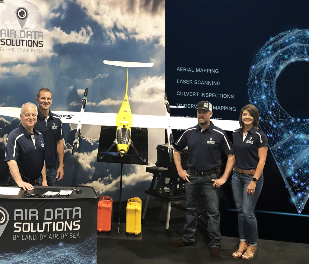
While many of the promises drones first represented are starting to become reality, companies that are focused on how to get cost-effective results are the ones finding success. Air Data Solutions is recognized as an industry leader in minimizing costs, maximizing client relationships, delivering excellent customer service, and leading the field in technical application. The Air Data Solutions team consists of industry professionals such as rated manned and unmanned aircraft pilots, a PhD in remote sensing and GIS mapping, a former army brigadier general and state secretary of transportation, and veterans of the army, Marines, and Coast Guard, all of whom are focused on understanding the client and scaling the right collection package to best serve customers nationwide.
 “A lot of that hype that was first associated with the technology is starting to subside and that’s really good to see,” said Don Cummins, President of Air Data Solutions. “It’s not really about the drone anymore. It’s about having the right team to understand clients and then get the right sensor on station to gather data. We’re basically flying sensors, so it doesn’t really matter to us what platform they’re using. It’s all about the right sensors being at the right location in order to collect the right data by the right person."
When it comes to collecting data, Air Data Solutions is always employing the latest technology and newest ways to utilize that technology to meet the needs of their clients. This requires funding and expertise that few companies in the space can claim. As a matter of fact, they believe experience is the key to their success. Experience comes from years working in the field and learning from good and bad decisions and constantly improving.
“The only way to stay at the top is to push the envelope in everything that we do.” Expertise coupled with this pioneering spirit has led the team at Air Data Solutions to develop a diverse portfolio of services including pipeline patrols nationwide, including leak detection and inspections, underwater mapping, asset inspections, city utility assessments, and rapid response to disasters. Gathering the right data can mean utilizing AI or just experienced eyes on the target. It all comes down to knowing how to provide clear imagery and data that informs decision making for clients in the public and private sectors.
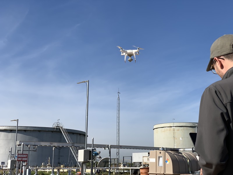
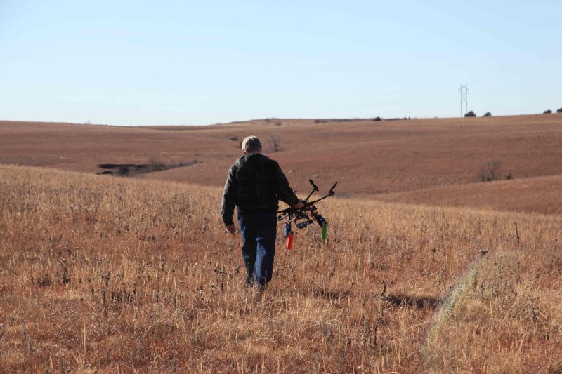
Understanding the abilities and limitations of each unmanned platform is essential. For example, although UAVs can stay in the air longer than ever before, they are not yet able to compete with manned aircraft in terms of flight times and distance. Manned aircraft, therefore, are ideal for longer flights by reducing the need to set up and break down the unmanned systems. Conversely, manned aircraft or satellites often cannot get close enough to provide the millimeter-level detail associated with drones. For some projects, maximum precision is a necessity. Air Data Solutions has a fleet of fixed wing aircraft along with an arsenal of drones to match the specifications of any mission. But more importantly, they seek out and employ the most experienced industry professionals to manage each mission. “We don’t just hire drone pilots; we hire industry experts and teach them how to use a drone to be more effective.”
Air Data Solutions has found that drones are often better suited for jobs that are shorter and/or require detailed sensor data. Those types of jobs include detecting methane leaks from underground pipelines or conducting asset inspections around difficult-to-reach infrastructure like poles, bridges, towers, and storage tanks. Additionally, it is critical to understand the client’s data needs, which is why Air Data Solutions has made finding redundancies, managing and defining scope, and streamlining data collection their top priority.
“We have industry experts on staff who have the knowledge to know what needs to be collected and what doesn’t,” Cummins told Commercial UAV News. “If you can boil it down to the essence of what a client actually needs, everyone’s time is maximized, and it will cost them a lot less money up front and in the long term because our imagery informs long term cost saving decision making. For instance, we have a job that we are working on right now where the client asked for extremely high resolution and high overlap of a large area. After analyzing their end goal, we came back and recommended a far less expensive and less extensive solution that would accomplish exactly what they needed. As a result, we were able to deliver better results for less money. The key to accomplishing this business model for all of our clients is our people. The most advanced technology is only as good as those who program it. We listen intently to our clients to learn the “why” behind the scenes, then tailor the project to meet the client’s needs. Whenever you can come back to the client and say, ‘we’ll do that quicker, cheaper, and better,’ they realize you are on their side—that goes a long way toward building a long-term relationship.”
Building a long-term relationship is an important aspect of Air Data Solution’s business model, and being able to deliver accessible, useable data is a key component of that relationship. Even when a job’s scope is streamlined and efficient, the sensor data being collected is considerably more than what can be collected manually. Some camera systems can collect up to 30–40 gigabytes of data an hour, and those capabilities are getting better by the moment. It creates a major bottleneck for companies as they aren’t able to quickly get useful information to their clients quickly. Additional issues arise when different companies use different software platforms, some of which are unable to accept GIS data.
Air Data Solutions recognizes nonstandard platforms and software systems create challenges for their customers, which is why they work closely with the client to determine the best mode of data delivery. If a client needs the data to be uploaded within their own system, Air Data Solutions can do that. If a client doesn’t have a system, then they can retrieve their data through Air Data Solutions’ custom portal that was developed specifically for the industries with which they work. Their ultimate goal is to package their data so it can be delivered into any system or handheld device in a usable and easily accessible way. The key here again are highly skilled people.
“No matter how good the tech gets, and no matter how good the sensors and the drones get, there still has to be a human behind it, making sure that it’s collecting the right data and delivering it in the right way,” Cummins explained. “Any sensor can be used the wrong way, so we hire people who are the best at what they do to figure out what’s the right choice for a given project or task, regardless of whether it’s a drone, helicopter, fixed wing aircraft, satellite or anything else. No matter how advanced and exciting the new emerging tech gets, our focus will always be on the people behind that tech and providing the most cost-efficient solutions for our clients. I hate to say that the drone doesn’t matter, but the drone really doesn’t matter. It’s all about our people and our relationships with our clients.”


Comments