

German company GerMap offers different drone solutions for different tasks. Its fixed wing drones are designed for mapping while their rotary wing drone are focused on inspections. Now, its newest addition, the G170-V offers users in both industries a whole new set of benefits.
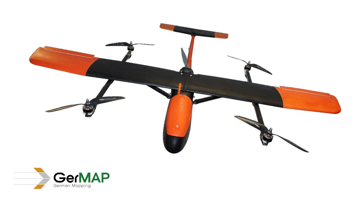
The G170-V is equipped with 4 horizontal rotors allowing it to have VTOL (Vertical Take-Off and Landing) capabilities, and operates as a regular fixed wing airplane with its 170cm wingspan, making it a Quadplane. A Quadplane is a combination of multicopter (with their VTOL feature) and fixed wing UAVs. The core component of a Quadplane is always an “autopilot” which controls the aircraft in flight and navigates it on its pre-defined waypoint flight-path. G170-V’s autopilot flight control is based on the Pixhawk open source technology. Pixhawk is an independent, open-hardware project aiming at providing high-end autopilot hardware at low costs and high availability. It is designed by the open hardware development team in collaboration with 3D Robotics and ArduPilot Group.On the ground, ArduPilot’s Mission Planner is used to control the G170-V. Mission Planner is a free, open-source, community-supported application developed by Michael Oborne for the open-source APM autopilot project. In conjunction with the G170-V, it allows you to plan your mission, control and follow the UAV in real-time, display flight parameters (battery voltage’s status, air & ground speed, artificial horizon) and returning the UAV to the launch location, as listed in the specification’s manual.With a 12 m/s cruise speed, the G170-V covers large areas while remotely sensing data, capturing stunning images with its 20Mpix RFB-camera, providing a Ground Sample Distance (GSD)* close to 4cm.With all the features mentioned above, the G170-V suits different applications including but not limited to aerial mapping, corridor mapping, forestry, agriculture, security, environmental monitoring, construction and rapid disaster response.*GSD is the distance between two consecutive pixel centers measured on the ground. A lower value means a bigger spatial resolution of the image and more visible details.

.jpg.small.400x400.jpg)


Comments