

We’ve detailed what it means to create a business structure around the data drones gather, but the challenges associated with efficiently assessing that data are ubiquitous. It’s easier than ever to gather the information needed to assemble an orthomosaic, but how is that data being managed and analyzed? Is the process to do so creating internal bottlenecks or problems with clients?
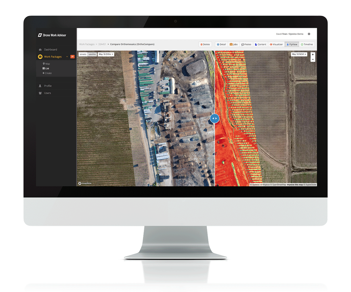
FlyView OrthoCompare from Optelos is set to resolve issues drone operators are having with managing, analyzing or sharing their data as needed. This new tool is designed to make things simple and easy for users by enabling drone operators to overlay and compare high-resolution orthomosaics from any browser. Optelos is looking to bring together workflow and AI analytics to allow commercial operators to properly handle all of the data that’s being gathered for a project.The orthomosaic datasets that professionals need to create are typically hundreds megabytes to several gigabytes in size and in a special file format, which can make the process to manage and share this information difficult. It’s something that David Tran, CEO of Optelos, has heard loud and clear from his customers, which helped guide the creation of this product.“One of their biggest challenges for operators was to easily deliver large orthomosaic files to all their clients and provide the ability to view and interrogate the data,” Tran told Commercial UAV News. “Moreover, many users wanted the ability to compare multiple orthomosaics over time to see changes and gain other insights. These challenges diminished the value of the data and overall end-user experience.”Those challenges are set to be simplified by a simple three-step process.- Upload GeoTIFF: Operators export their orthomosaics in GeoTIFF format to the Optelos Drone Work Advisor platform.
- Process: Optelos processes the GeoTIFF real-time and operators can access the results in just a matter of minutes.
- Visualize: Operators can view orthomosaics along with geo-located images, overlay multiple orthomosaics via an opacity slider, and compare orthomosaics side-by-side to quickly gather insights


Comments