
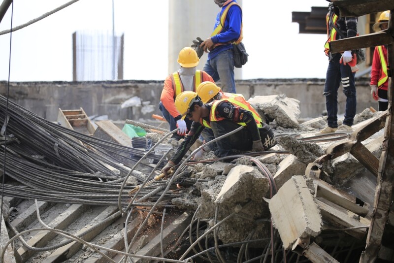
The twin earthquakes that struck Venezuela on June 24, 2026, were among the most devastating seismic events in the country’s modern history. A magnitude 7.2 foreshock and a subsequent magnitude 7.5 main shock, both shallow and centered roughly 160 kilometers west of Caracas, unleashed catastrophic damage across La Guaira, the capital region, and several coastal communities. Hundreds of aftershocks, more than 200 within the first two days, continued to shake already‑weakened structures, complicating rescue efforts and deepening the humanitarian crisis.
The human toll was staggering. Within a week, official and international estimates placed the death count between 1,400 and 1,500, with thousands more injured and tens of thousands missing. Entire neighborhoods collapsed, transportation networks were crippled, and millions faced immediate displacement. In the midst of this devastation, emergency responders from Venezuela and more than 30 countries mobilized to search for survivors, assess structural damage, and coordinate relief operations.
Among the tools increasingly visible in disaster response worldwide, and present in Venezuela’s crisis, were drones. While public reporting has not yet provided a detailed operational breakdown of every drone deployment, aerial footage from multiple news outlets confirms that drones were used extensively for situational awareness. Beyond what is confirmed, there are several critical roles drones typically play in major earthquakes, and Venezuela’s conditions made these applications not only plausible but highly likely.
The clearest documented use of drones came through aerial footage shared by international media. Drone videos published by outlets such as MSN and the New York Post showed collapsed buildings, buckled roads, destroyed industrial sites, and rescue teams navigating debris fields. These images were part of a broader effort to rapidly map the extent of destruction.
To get a more realistic picture of the use of uncrewed aviation in the aftermath of the catastrophe, Commercial UAV News reached out to Alejandro Chumaceiro, Founder and CEO of SIGIS, the leading geospatial company in Venezuela.
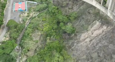
“From the moment we felt the violence of the earthquakes, we knew that our drone services would be required to play a key role in the early days of the recovery effort,” Chumaceiro said. “We were asked to immediately assess the safety of certain transportation infrastructure that was vital in the recovery effort. Three bridges built in the 1950s needed to be evaluated for damage in order to establish infrastructure soundness. Deploying unmanned aircraft equipped with advanced sensors permitted the fast creation of digital twin models for engineers to assess infrastructure status. Time is of the essence in these major crisis situations, and this particular use case for the technology proves once again that it’s the prime choice.”
In large‑scale disasters, aerial assessment is indispensable. Ground teams cannot immediately access every neighborhood, especially when roads are blocked or bridges have collapsed. Drones provide a fast, safe way to capture high‑resolution imagery of affected zones, allowing emergency managers to:
- Identify the most severely damaged areas
- Prioritize rescue operations
- Locate potential survivors based on visible signs of habitation or movement
- Assess risks to responders, such as unstable structures or fires
Given the scale of destruction in La Guaira and the surrounding region, drone‑based mapping likely played a central role in early decision‑making.
Support for Search and Rescue Coordination
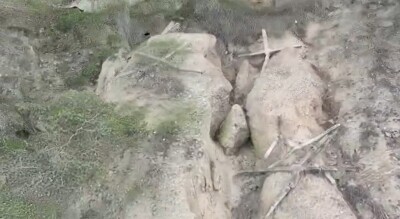
Although no public report explicitly states that drones directly located survivors, the aerial footage itself shows rescue teams working in areas where drones had just flown. This strongly suggests that drones were used to guide responders toward collapsed structures and to help them understand the safest paths through rubble.
In modern search and rescue (SAR) operations, drones equipped with zoom cameras, thermal sensors, or low‑light imaging are routinely used to detect:
- Heat signatures from trapped individuals.
- Movement under debris.
- Fire or gas leaks.
- Structural instability.
Even without confirmation of specialized sensors in Venezuela, the presence of drones in SAR zones indicates that responders were leveraging aerial perspectives to improve situational awareness.
Beyond what is publicly confirmed, the nature of the Venezuelan disaster strongly aligns with several other drone applications commonly used in major earthquakes worldwide. These uses are standard components of modern emergency response toolkits. There are confirmed reports that various Canadian, American and European companies arrived in the country with specialized drones and qualified pilots. According to the latest reports, 44 teams from 27 nations have arrived in Venezuela.
These teams and their Venezuelan counterparts from SIGIS and other local companies actually played an important role in the SAR efforts and subsequently in the assessment phases of the aftermath; we know today that drones can help in the following areas:
1. Thermal Imaging for Survivor Detection
In earthquake zones, time is the most critical factor. The first 72 hours represent the highest probability of finding survivors. Drones equipped with thermal cameras can scan large areas quickly, detecting heat signatures that may indicate trapped individuals.
Given the number of collapsed residential buildings in La Guaira, thermal drones would have been invaluable for:
- Nighttime searches
- Locating survivors in hard‑to‑reach rubble
- Guiding canine units and human rescuers
Even if not publicly documented, international rescue teams, particularly those from the U.S., Canada, and Europe, commonly deploy such equipment.
2. Delivery of Medical Supplies to Inaccessible Areas
Earthquakes often sever transportation routes. In Venezuela, roads collapsed, bridges were damaged, and the Caracas airport was temporarily closed. Drones capable of carrying small payloads could have delivered:
- First‑aid kits
- Water purification tablets
- Communication devices
- Emergency medications
This capability is especially useful in mountainous or densely urbanized regions where debris makes ground access difficult.
3. Communication Relay and Network Restoration
With natural gas shut off, power outages widespread, and cellular networks disrupted, drones can serve as temporary communication relays. Tethered drones or high‑endurance quadcopters can hover over affected zones, providing:
- Wi‑Fi hotspots
- Radio signal extension
- Emergency broadcast capability
This is particularly important for coordinating multi‑national rescue teams.
4. Structural Integrity Scanning
Some drones carry lidar or photogrammetry systems capable of generating 3D models of damaged buildings. These models help engineers determine:
- Which structures are safe to enter
- Which are at risk of imminent collapse
- How to stabilize partially damaged buildings
Given Venezuela’s extensive infrastructure damage, including schools, apartment blocks, and industrial facilities, this capability would have been highly relevant.
5. Environmental Hazard Detection
Earthquakes can trigger secondary hazards such as:
- Gas leaks
- Chemical spills
- Fires
- Landslides
Drones equipped with multispectral sensors or gas detectors can identify these threats without exposing responders to danger.
6. Crowd and Traffic Management
With millions affected and thousands displaced, drones can help monitor:
- Evacuation routes
- Crowded shelters
- Traffic bottlenecks
- Supply distribution points
This improves the efficiency of humanitarian logistics.
In short, the Venezuelan earthquakes highlight a broader trend: drones are becoming essential tools in disaster response. Their advantages are clear:
- Speed: They can cover large areas in minutes.
- Safety: They reduce risk to human responders.
- Precision: They provide detailed, actionable data.
- Cost‑effectiveness: They are far cheaper than helicopters or satellite tasking.
In Venezuela’s case, where infrastructure damage was widespread and rescue needs were immense, drones likely saved lives, whether through direct detection of survivors or by enabling faster, more informed decision‑making.
The 2026 Venezuelan earthquakes were a national tragedy of immense scale, leaving thousands dead, tens of thousands missing, and millions in need of shelter. Amid the chaos, drones emerged as quiet but powerful allies, documented in aerial footage and almost certainly deployed in multiple critical roles behind the scenes.
From mapping destruction to guiding rescue teams, from detecting hazards to restoring communication, drones represent a new frontier in humanitarian response. Their presence in Venezuela’s darkest week underscores how technology, when used responsibly and strategically, can help societies confront the unimaginable and begin the long process of recovery.







Comments