

As the 2025 hurricane season approaches, which is expected to be above average in the Atlantic, now is a good time to look at the best practices for drone use in disaster management. Speakers at XPONENTIAL 2025 who all have extensive experience in using drones to aid in all kinds of disaster situations shared how drone operations play a crucial role in preparing, responding to, and recovering from disasters.
Preparing for Disaster
Preparing your team is arguably the most important step in anticipating a disaster. Arming your team with a clear guide to who the points of contact are, internally and externally before disaster strikes is essential, ”making sure that your command staff and your partner agencies know what your capabilities are and your team knows who the point of contact is and establishing those relationships so that this is prepped months or years before that big, critical incident happens” stated Jason Burnside, Firefighter for Austin Fire Department. “We engage in regional training and focus on establishing a chain of command, knowing what our resources are so that when disaster strikes, we are ready to respond,” said Burnside.
Often, natural disasters take down cellular networks, preventing teams from using online mapping resources. Being prepared to use updated and accurate paper maps and radios for when daily communication channels are down will save a team from chaos. Being prepared with radios is especially important to maintain communication with the FAA to receive flight authorization for that particular area.
“Make sure you have a full kit with old school paper maps, CB or ham radio, because it's going to be hard to plan your mission. It's going to be hard to get orders to determine where you need to go if you need airspace authorization from the FAA,” explained Chris Todd, Executive Director of Airborne International Response Team (AIRT).
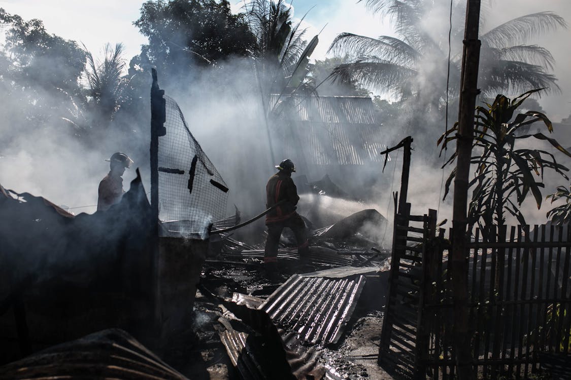
Responding to Disaster
To give the audience context of what a real search and rescue operation that utilizes drones, playing on screen was a live stream of Houston’s annual water search and rescue drill. It showed a drone flying over a lake with people in the water, waving their hands to be rescued. This drone footage is livestreamed to the helicopter team. This provides a clear location and description of the subjects to be rescued. Another frame showed a man sitting in the bank waiting to be rescued, the drone was able to capture video footage of the man which told responders exactly where he was, what he was wearing, and if he was visibly hurt.
This drill was a collaboration between manned and unmanned networks on a statewide level for disaster management. The live stream footage from the drone emphasized how much value drones bring to these scenarios. Providing detailed data on victims that need rescuing and what level of response is required that helicopters can’t get brings value to the rescue mission that responders haven’t had.
Being clear and deliberate with what kind of data the drone pilot needs to look for is essential in emergency situations. “Using DroneSense, we can drop pins on the map while we do a rapid sweep as the first search of the area. Then we mark on the map that it’s been searched by UAS, and label it as a critical rescue point if needed” Burnside explains. The drone pilots need to be informed what the rescue team is looking for in order to capture the most useful data. For example, if they are responding to a flood, the drone team needs to get a specific order to look for people on roofs that need rescuing rather than a generic task to scan the area.
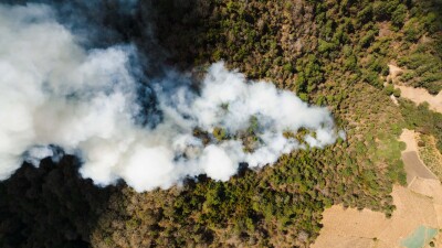
Recovering from Disaster and What’s Needed for the Future
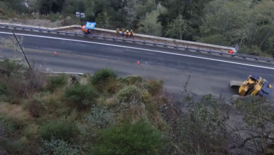
In the aftermath of a natural disaster, navigating debris-covered roads are dangerous and difficult. Roads can be closed for days or weeks depending on the severity of the disaster. When ground vehicles can’t access roads, drones are a perfect tool for surveying roadways for damage and dispatching tree crews and linemen to where they are needed. This was noticed after Hurricane Irma hit Florida in 2017.
“The only assets that were readily available in the first hours after Hurricane Irma were drones, and that was the watershed moment in Miami. We (AIRT) worked with Florida Power and Light very closely on our airborne response side to help assess damage and start to write the playbook on how we use drones for post-hurricane restoration efforts,” explained Todd.
While drones have begun to prove their value at all stages of natural disaster response and recovery, there is still work to do. Most pressing is the need for a system that can run offline to process data onsite. Burnside stated this need, “for mapping and modeling, we're principally using DroneDeploy. But that requires access to the internet and a cloud upload, and we are in an environment without internet. We are looking at investing in a robust computer that we can carry with us that would be more capable of running offline, something that has a mapping software that is localized so we can process data and render it on site”.
As with all drone operations, the hurdle of gaining public trust and integrating technologies remains. Adopting drones into crisis response plans is ultimately a move that public agencies need to buy into. The future lies in bridging gaps between technology, policy, and people, before the next disaster strikes.


Comments