

In January of this year, Pittsburgh’s 50-year-old Fern Hollow Bridge collapsed. A bus and six cars fell when the bridge gave way, and 10 people were injured. Following the incident, work quickly began to rebuild the bridge. With funding from the federal Infrastructure Investment and Jobs Act, the $25.3 million emergency reconstruction effort is slated to finish in December.
As the bridge is being rebuilt, Alessandro Fascetti, an Assistant Professor at the University of Pittsburgh’s Swanson School of Engineering, and his colleagues are engaging in a National Science Foundation-backed effort to chronicle the reconstruction. They use drones and lidar to capture data from the bridge, which is then used to create 3-d digital models. Using this information, the researchers hope to gain a deeper understanding of public infrastructure projects and develop best practices.
For Fascetti, this work builds on his years of research into how physical processes can contribute to the degradation of civil infrastructure systems. Many of his investigations have incorporated drones and sophisticated imaging processes.
“In the past, we used more traditional techniques to conduct measurements and assess the structural health of infrastructure systems,” he explained. “But I have extensive experience with drones and lidar going back to when I was a postdoc studying flood protection and mapping river levees, and I’m a licensed drone pilot. I’ve seen how these techniques enable us to capture large amounts of high-quality information and do it quickly.”
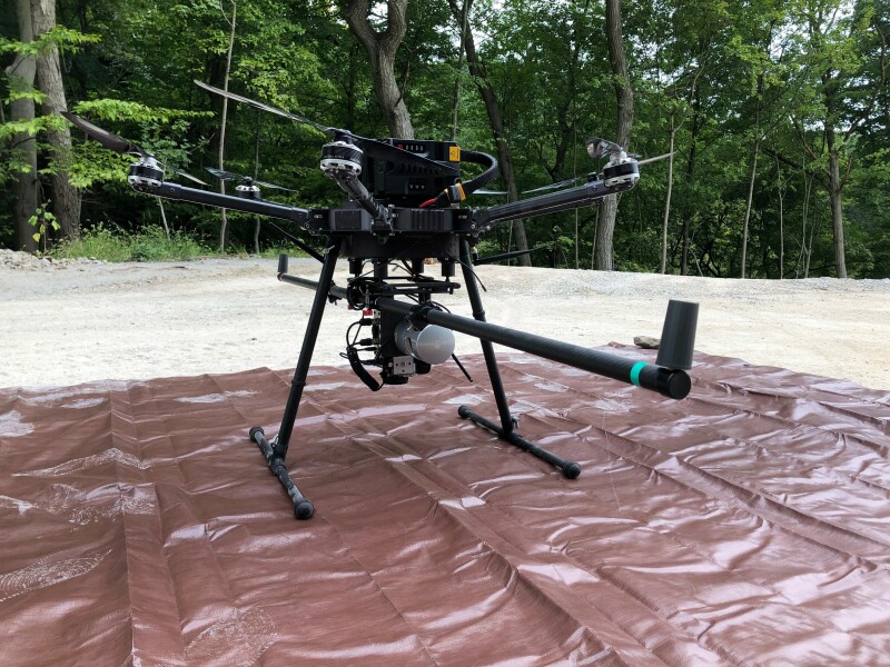
To research the Fern Hollow Bridge reconstruction, Fascetti and his team fly a hexacopter drone equipped with photo and lidar imaging systems around the site. Collecting hundreds of millions of pieces of information, the team flies only on weekends, so as not to disrupt the construction process.
“We go onsite only when no one's around, both for safety reasons and for capturing data with lowest noise possible” he reported. “Still, there are a lot of moving pieces. For example, the cranes that lift these very large reinforced concrete beams move around all the time. Every time when we go on site, it's a completely different arrangement: sometimes it's higher, it's taller, or sometimes they’re pushed back a little bit. So, the planning phase is crucial in this in this type of work.”
Adjusting to a constantly changing worksite to ensure efficient, effective flights is a challenge for Fascetti and his colleagues, but their initial planning around the use of drones and imaging systems have helped immensely.
“We have a relatively flexible system—a modular system—so we can pretty much swap and change any camera that we like as needed,” he stated. “We have multiple cameras that we can use depending on the specific application.”
Moreover, Fascetti said, his experience in collecting data on bridges has helped keep the project on track. “It's relatively standard to monitor bridges these days, so it's not something that no one's done before,” he said. “But the novelty here is that we're doing scans biweekly and pretty much following construction as much as we possibly can. This gives us many more insights and information on what happens in the bridge as it’s being built.”
Now that the bridge rebuilding project is nearly completion, Fascetti is looking to take on new research efforts. “Pittsburgh is one of the cities with most bridges in the country, so there may be more opportunities to do more of this kind of work,” he stated. “Also, we’re trying to develop new ideas around monitoring hillsides here. Pennsylvania is very hilly, and Pittsburgh has a significant number of landslides every year, especially around this time of the year. That's something I think would be very, very interesting to investigate with the techniques we have developed.”


Comments