

How do drones impact construction workflows? What kind of data can we get from them, and how much difference do they bring to the table? Last year, Commercial UAV News hosted a webinar to understand how construction stakeholders have defined this value to quantify the ROI of a drone program in five specific areas: cost, time, safety, workflow, and communication. In this webinar, CUAV was joined by Greg James from DroneUP, Cory Knittel from Skydio, Amr Raafat from Windover Construction, and Douglas Spotted Eagle from Kuker-Ranken.
Talking about that very first moment when you assess what kind of drone you might need for a job and what projects would be a good fit, how do you help people figure that out?
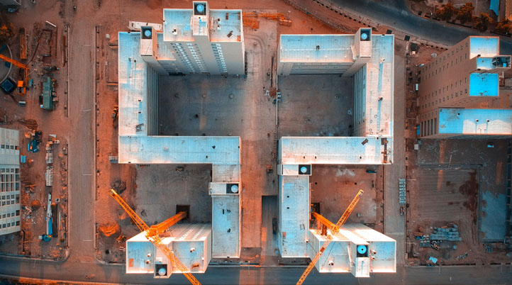
Douglas Spotted Eagle: The first question is, "What is your deliverable?" The drone is effectively meaningless; it's just a flying scanner. What kind of scan data do you need? Do you need lidar data? Do you need photogrammetry data? Those are the two primary questions since that one decision alone will determine the airframe you're going to be working with. For example, if you're looking to get involved in lidar, lidar pucks are reasonably heavy, automatically qualifying the purchaser for something that will be a little larger airframe. It might be a DJI Matrice 300 with an L1 on it if you're at an entry-level, planning on flying very low, and the environment doesn't have a lot of obstacles. Then you can step it up to larger airframes that start putting you into the price ranges of $50,000 to $60,000. If you need to be able to shoot through vegetation, you're going to end up with, again, a different type of air platform because of the payload you'll be carrying. However, suppose your organization is only looking at doing photogrammetry. In that case, whether it's going to be stitched together and put in place as a point cloud or you're looking for pretty marketing 3D models, you can get away with a very small drone.
But before you choose the aircraft, you also have to decide what your delivering platform/software will be. For example, unlike photogrammetry, lidar requires some proprietary software for most manufacturers to deliver what we call an initial point cloud. You can choose anything you want, from free to super expensive for photogrammetry. We want to look at the deliverables first, not the aircraft. Understanding what those deliverable pieces will look like will help us begin to specify what the aircraft parameters should be and what we're going to do with that particular aircraft.
Amr Raafat: What is key for us at Windover are ground control points, no matter what type of drone we are using—at least five of them to get a more accurate representation of the sites of the existing buildings. Then, we take the collected data and assemble it in Autodesk ReCap Photo and other different applications. The focus is on the ground control points because we want to increase the accuracy of the geo-referenced captured data. Lidar is more expensive to use, but it's been beneficial as well. However, it's not about the latest drone or laser scanner from the ground, but how we utilize this captured data to support job site solutions. We've been trying to complement all the data we capture with a drone from above with laser scan data from the ground to create this integrated full representation point cloud that can be embedded into the BIM workflow and support the design, QA, or QC teams during construction.
What should construction companies consider regarding overhead costs when they first begin a drone program or even outsource it to a service provider? Especially in terms of training, maintenance, and workflow integration.
Greg James: Calling out who is responsible for the program is an essential step. Overhead costs are your in-house pilots, your knowledge base to navigate your SOPs, planning, safety, security, records management, and more. All of those things need a lead, someone who sees the whole vision and tapestry of the program. The simple foundations of overhead costs come down to FAA compliance, licensing, training, etc. It's not just about using the drone but also about understanding when to fly and how to plan a flight. Often, what we see from customers is that some of this stuff is uncomfortable to learn, and there's a barrier to adoption right there. But these things need to be somewhere, whether you're running an in-house program or outsourcing it. Additionally, when investing in a drone, you've also got to pay attention to maintenance. If you make a $5,000 investment in a drone, it needs to be kept up to speed, so I think having somebody comfortable on the engineering side of things is also important.
Understanding the different software providers and what they do is also a big learning curve. There are benefits in having industry or vertical experts to understand the wide array of software you can use. But the software doesn't matter until you can integrate it into what you're using today. There must be a connection if it goes into CAD, BIM, or whatever you're doing. The program lead is analogous to thinking about insourcing versus outsourcing. If you want to take that step, you can, but recognizing the learning curve is important.
Cory Knittel: From the very beginning of when you're evaluating hardware and software to invest in, getting it right the first time is one of the biggest pieces. Suppose you're going to invest in a platform, both the hardware and the software side. In that case, you're going to train everybody to get your data flowing through and into those usable endpoints where you can make business decisions on it. However, if you don't invest the time upfront in understanding what exactly is the right fit, you wind up investing all those people's hours and money, and then you go back and say, "Oh, we actually need to change." For Skydio, as a software-focused company always improving the product and launching tools like 3D Scan, putting that investment and understanding it up first, rather than going with a different platform and realizing they're not going to change, can save a lot of money and time.
The other piece is scaling and trading. Many firms think that building out much larger programs and getting their first few high-quality pilots is easier, but once you suddenly have over 100 pilots, it can be a lot harder to scale and train. That goes back again to investing in a tool where the drone does a lot of the work for you, which is why we focus on autonomy in Skydio. If you're fully focused on scaling a program, then you have to trust the drone makes decisions for you without crashing. Otherwise, you're going to be investing incredible sums not only into training but into keeping pilots current to keep that entire team flowing well.
Figuring out how to measure that return on investment, how do you show the gains where it might not be an easy one-to-one correlation, especially on safety?
Cory Knittel: From a vendor side, I'd recommend reaching out to vendors to understand since many of them can help you make those calculations. At Skydio, we have some pretty extensive tools to take a step back and understand exactly how the process is done today. Make sure you're not just including equipment, but also the time that goes into training to capture that holistic picture, and then do that same step but for what's coming next. This way, you can understand, for example, what buying a drone and 3D scanning fully entails. How much time does that take, what hardware and software costs you, and how do you extrapolate that across whether you're just looking at one project or looking across multiple projects, rather than just getting little pieces here and there. We've seen most customers realizing savings greater than 10x of what they're investing in their drone hardware and software, so it's really exciting to see what you can accomplish.
In terms of business development, how does someone track and maintain these returns on investment?
Greg James: If you're moving from a conventional approach to something more advanced and start to use drones, I think the best way to do it is to look at the costs you've incurred that you could have avoided. We've mentioned rework, and safety, which maybe shouldn't have a number on it, but you can financially measure workers' claims. You can also think about security since construction materials being stolen off the site is a problem. If you start to measure the amount of rework you typically have on a given project and then look at it in terms of application or the typical avoidable costs you would have made, that's the best way to do it and the easiest way to quantify things. There are different technologies for different things - pretty marketing shots are hard to measure but may make things easier for your communication internally, whereas using lidar or FLIR-like sensors can impact the proper installation of materials. I would leave that to the construction companies to understand their track record and what to avoid going forward.
How do you recommend people start measuring the value and the return on investment?
Douglas Spotted Eagle: One of the easiest ways is to look at things that the aircraft can do that humans simply can't. One of the things we can also look at is that unmanned aircraft help us completely eliminate downtime. An aircraft in a typical mid-sized construction environment can save us up to about $3,500 a day in non-wasted time. One example of how that would come into play is, you got a job site that it's been taken down to bare earth, you started your grading, and now you're going to start bringing crews and inventory onto the job site. But is the job site ready for bringing those crews and inventory in? An aircraft can go through and verify that topographic data or digital elevation models (DSM), so we know whether the site is ready in advance of ever placing anything on there. $3,500 a day doesn't take a long time for that to add up. In other words, we've got so many different variables that relate to where the aircraft can save cost.
As long as we stay in this conversation of the sub $10,000 cost, forgetting about your drone program manager, the training and all these other things, we know that we can save X amount. This is a fairly good number in hard costs from the immediate onset of bringing the aircraft into the job site. Look at those places where the aircraft does things faster or with greater precision. There's been this long sense of FUD (Fear, Uncertainty, and Doubt) in our industry about what the aircraft can bring to the table in terms of precision. When we're verifying corners, boundaries, or dealing with our takeoffs, all of these kinds of things, that level of precision is something that many construction, survey, and civil engineering people are still a little bit in the dark about and understanding. We see all these different manufacturers throwing out ridiculous numbers, such as millimeter accuracy or centimeter accuracy, when, frankly, I think they don't understand it. When the surveyors and the construction personnel understand those differences, our industry, particularly the manufacturers, is doing a grave disservice because they talk about these accuracies that should save money and time at the end of the day and meet industry standard principles. All of these things come together as cost savings. But if the manufacturers are misleading the end-user with some of their claims, that does not help our industry incorporate aircraft quickly.
How have you been measuring the return on investment in your firm?
Amr Raafat: The main purpose of using laser scanning, drone mapping, or BIM is to have no surprises on the job sites and reduce rework. For example, on a vast 15 acres job site, if you have pipes that go from the ground floor and don't hit their intended location on the first floor, it causes delays of thousands of dollars. When you move a pipe in the sand, it's much easier than after you pour concrete because digging the concrete causes those delays. On one of the projects, we found almost 13 pipes that were missing walls, and the way we detect and fix that is using the drone with ground control points so we can locate where these pipes are by overlaying it with the first floor. If we didn't do this drone survey on time and communicate in real-time to our trade partners on-site and our superintendent, we would pour concrete, and the pipes would be in the wrong place. If you count the time that would take, that's about $14,000 lost. So, an hour flight, with half a day processing data, saved $14,000, which paid for the drone. That's how we can measure things. It's hard to measure things like safety, even though it's very important, but being able to measure KPIs (key performance indicators) helps us save time and provide clients with substantial cost savings.


Comments