While there is tremendous opportunity around utilizing UAVs in various industries, according to a recent report by Goldman Sachs, the market for drone jobs in the U.S. alone will be $1.3 billion for construction by 2020. Much of that will be built upon the ways in which these tools are being utilized on construction sites right now.

Dick Zhang
Dick Zhang is the Founder and CEO at
Identified Technologies, and his company is dedicated to helping construction professionals make fast informed decisions using aerial job site data gathered by automatic drones. Their Boomerang mapping drone and SiteIQ tracking software provides project managers and stakeholders with invaluable information that was previously impossible to obtain.
I wanted to get specific around what these construction opportunities will look like as well as what sort of information can now be gathered via a UAV, and Zhang was able to lay out these details and more. We discussed how the conversations he’s been having have changed, what sort of essential data drones can capture for and deliver to stakeholders, how he’s able to answer questions around ROI and plenty more.
Jeremiah Karpowicz: Before we really get into it, I just wanted to say that I attended one of the sessions you participated in at XPONENTIAL and enjoyed it quite a bit. What were your big takeaways from that discussion?Dick Zhang: The conversation confirmed to me that there really is traction in the construction industry with UAV technology across the country. John Babel’s whole background is around assessing risk for new technologies, and he was able to talk in specific detail around how he’s now able to assess that risk for drones on these construction worksites. So that was a convincing fact for me.
Secondly, Gary Bullock and William Baker have been studying drone technology from an academic perspective for years, and typically you see new technologies like this researched and studied for three to five years before seeing it in the commercial marketplace. We’re coming up on the end of that window.
And was that a factor in the questions you were answering on stage and throughout the event? Were many of those questions that much more nuanced and detailed because so many people have embraced the technology? Yes, they really were. People came to this event ready to talk about and ask specifically how drones can make a difference to them in their line of work. It’s really nice that the conversation has shifted from, “why should we care?” to “how can we get the most value from it?”. That shift has been dramatic over the past 6-8 months, so it’s been an exciting time to be in the industry.
How have you seen that shift in your role as the founder and CEO of Identified Technologies? Can you talk a little bit about the shift from “why” to “how” and what’s that meant for both your company and the industry as a whole? We can look at the question of “why”, and then that leads into the specific “how” question that the technology has provided and what sort of value users are able to extract from it.
The big picture is you can look at a construction site as a place where you’ve got a feedback loop going on at all time. Things are getting done, and then people are supposed to assess that activity. That can be broken out as “plan vs performance,” but unfortunately, it’s not always that simple for project managers and stakeholders to look at things this way because construction sites are so big and so complex, with so much going on. You’ve got a lot of moving parts and an enormous scale.
Let’s say you’re constructing a large 200 x 20 concrete pad. It’s only after building it that someone notices that they missed 30 feet in one direction on the length of the pad. Previously, what used to happen is that because no one knew the pad was too small when it was laid out, the concrete had already been poured and they had begun to lay pipe before anyone noticed this. They were 75% through that process by then. So they’d have to go back and tear apart the pad, repour the concrete and then relay the piping with the proper pad.
These sort of things have just been accepted as an inherent cost of construction projects in the past. They were considered an unavoidable part of the process, when they really don’t have to be. Corrections like that can cost the business $50,000-$100,000 coming right out of the bottom line.
So you’re looking to get into this “plan vs performance” phase much sooner and in much more direct ways by using drones.Yes. We can take a daily or weekly look at what the site looks like from a top down, aerial perspective, and then we can overlay engineering plans and determine where the utilities are supposed to come in, where the pads are supposed to go, etc.
With that overlay, we can make an assessment around performance versus plan, which means we’d have been able to notice that pad was 30 feet short. We’d have been able to fix that mistake before it cost the project what could be a critical amount of time and money.
That these costly mistakes were just accepted as unavoidable is crazy to think about, but it’s always been this way. People have come to expect it, but we’re working hard to educate the industry that they no longer have to.
What kinds efficiencies can you create with this approach?Let’s take a look at something specific like earthwork. Many people forget about this, but typically earthwork is one huge line item on a project. Twenty years ago, you had the foreman that would look at a mountain and decide where the haul roads were going to go and where they were going to back up, because there was no other way to do it. Guessing on these big excavation jobs leads to a lot of costly and time consuming mistakes.
What users are finding with our SiteIQ software is that because they’re able to track contours over, for example, every two days, they’re able to make very quick assessments. If they had the 777s over in one area the day before, SiteIQ can tell them they moved 20,000 yards, and by the numbers, they can see that was not the most efficient way to do it, so they can adjust from there.
Being able to rapidly give feedback on deployment of contractors and equipment is very powerful for these folks. So much of it is about supplying professionals with the continuous job site data that they’ve always wished they had, but was never available until now.

Identified Technologies Vertical Construction
One of the most popular examples of this type of info is the Earthwork Analysis Report. This is a report that you can run every day, every couple days or every few weeks, depending on your needs. Because we’re tracking 3D topography so accurately, we’re able to produce reports highlighting where earth is going down, and where it’s going up. To use construction terminology, that’s Cut and Fill maps. We’re able to measure that against our plan around where the earth needs to get to at the end of the project.
It’s been an extremely popular report, because previously the only way to get this info was to use a plane, which is prohibitively expensive. So the frequency of gathering the data was just once a quarter or once a year. It was so expensive to capture data before that it just wasn’t feasible to gather and analyze it regularly. We’ve been able to dramatically decrease the cost, time, and effort to acquire and analyze this data. For the first time, it’s affordable to track and forecast job site progress continuously.
Another common report is from a 2D perspective where we’re looking straight down and getting a progress report. It’s interesting to provide from a project owner standpoint, because every month they’re checking the bank account to measure progress financially, but because they’re sitting 400 miles away, there’s no way to physically see and measure progress on the site in that same way because the info they needed to do so simply wasn’t accessible. Now for the first time in history, it is.
What kind of a practical difference can all of this make to a project? By gathering accurate survey data faster and catching mistakes sooner, we’re dramatically reducing costly rework. Doing that adds days back into the schedule, and in construction, the schedule is everything.
Basically, the schedule is margin. Not only does it mean their costs are lower from fewer days of equipment rentals and labor, it also means they can earn more by completing additional projects per year. Our clients are able to cut weeks off their construction schedule and reduce costs. UAV technology empowers them to increase their profit margins and win more contracts by profitably underbidding the competition.
One of the big concerns professionals often mention centers around ROI. It’s one thing to talk about all the great things a drone can do, but project managers often don’t get specific answers around how such things can impact their bottom line. Is that something you often find yourself addressing? It’s definitely a very popular question to be asking in construction, because it is so margin and schedule based. We’ve put together a
webinar and a
case study that showcases the ROI analysis and how it can pay for itself on the first day of use.
You have to think of it in terms of the cost of every single mistake you’re going to make without these sorts of resources. Each mistake you’re preventing can represent a savings of hundreds of thousands of dollars because the scale is so enormous. Some of these pieces of equipment cost thousands of dollars an hour, and over $10,000 for a day. Even a single percentage point of efficiency makes a tremendous impact on the bottom line. The technology pays for itself almost instantly and the rest is pure ROI for our users.
Are there some market opportunities you can identify with so many construction professionals recognizing the potential in these tools?If you think about the broad adoption of anything, or in this case the specific adoption of a new piece of technology, you see the bell curve where you have the early adopters, and then you have the middle stage and then the late adopters.
If you look to where the industry is now on that adoption curve, admittedly we are on the early side. That makes it good timing for the business, because it means there’s huge opportunity here. But it means there’s a lot of education that needs to be done. Building that customer education engine has been a top priority so we can make the ROI and business case clear. Hearing that job sites that took a month to survey can now be mapped in 10 minutes sounds too good to be true so we’ve worked with third party firms to validate our accuracy independently and prove how reliable commercial UAVs have become.
What is your approach around data and deliverables? When and how should a plan or stance around these items be determined so that users aren’t drowning in data?Broadly, this is an issue for the industry because this is so new. There’s a lot going on and there’s not a lot of cohesion or standards. I think we’ll see this work itself out over the next few years, but as it pertains specifically to our company, there are three steps to the workflow. Those are #1 capturing the info from the drones, #2 processing the data, and #3 using analytics to interpret the data to make informed decisions.
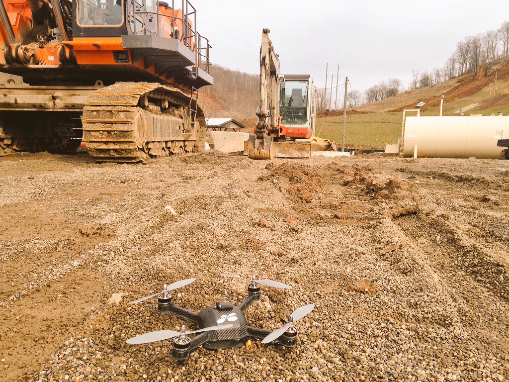
The 1st step is gathering the data legally, safely, and accurately. We take care of the front end FAA regulatory authorization, insurance, and flight planning. Our UAVs have been built specifically to capture data for construction industry professionals. Our customers needed something simple to use, light enough to map large distances on a single battery, and robust enough to stand up to bad weather and daily use on industrial sites. It’s called the Boomerang drone because you just send it out and it flies off, captures the data, and comes back by itself.

3D Volumetric
The 2nd step is processing the gathered raw photos into specific geospatial reports. We provide contour maps, orthomosaics, digital surface models, point clouds, 3D volumetric maps and more.
While gathering and processing the data into reports is useful, the greatest value to our clients comes from the 3rd step, tracking progress trends over time for accurate forecasting, team collaboration, QA, and project management decisions.
We’re able to get specific with the construction industry and provide value by providing progress forecasting, as built vs as planned comparisons and earthwork analytics to detect issues early, so projects don’t go late or over budget. That third step is the most complex, but it’s also the most important. The continuous tracking, collaborating, and forecasting is unique to Identified Technologies, and it’s what’s having the greatest impact for our clients.
What sort of opportunities have you seen drones create for construction professionals? The biggest opportunity is that we’re able to take that feedback cycle, and instead of a cycle of construct/build/assess being six months or a year, we can shrink it down to a matter of days or even hours.
The whole purpose of this sort of visibility is to close down the time between iterations on the feedback loop. You want to make a series of small steps and adjust after each step rather than deploy so much time and money on what’s essentially a guess without validating things along the way. Issues can now be detected almost instantly, instead of waiting until months of work and money have been wasted.
Based on the changes you’ve mentioned in terms of the acceptance of this technology, it sounds like we’ve reached a real turning point. What has this transition meant to and for you? We’re not at the point where UAVs are universal, but we have definitely passed the inflection point of industry skepticism and disbelief. Now we’re at the rapid adoption part of the curve, which is an exciting place to be!
Being able to talk about the specific ways that this technology can make an impact is a lot more fun than trying to educate people in the early skepticism phase. We feel very lucky to be able to use UAVs to help improve the future of construction job site management.


Comments